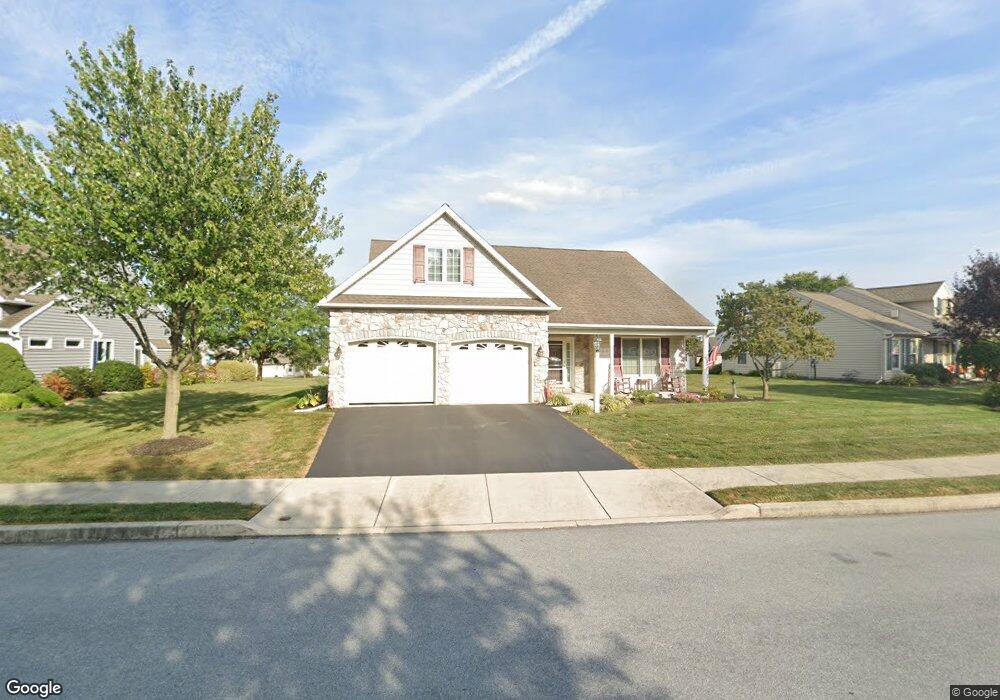
813 Cambridge Dr Unit 133 Manheim, PA 17545
Estimated Value: $398,000 - $456,000
3
Beds
3
Baths
2,266
Sq Ft
$185/Sq Ft
Est. Value
About This Home
This home is located at 813 Cambridge Dr Unit 133, Manheim, PA 17545 and is currently estimated at $420,161, approximately $185 per square foot. 813 Cambridge Dr Unit 133 is a home located in Lancaster County with nearby schools including Manheim Central Senior High School, Manheim Christian Day School, and Sporting Hill Christian School.
Ownership History
Date
Name
Owned For
Owner Type
Purchase Details
Closed on
Oct 24, 2007
Sold by
Brookshire Properties Llp
Bought by
Landis Larry G and Landis Carlene A
Current Estimated Value
Home Financials for this Owner
Home Financials are based on the most recent Mortgage that was taken out on this home.
Original Mortgage
$63,300
Interest Rate
6.39%
Mortgage Type
Purchase Money Mortgage
Create a Home Valuation Report for This Property
The Home Valuation Report is an in-depth analysis detailing your home's value as well as a comparison with similar homes in the area
Home Values in the Area
Average Home Value in this Area
Purchase History
| Date | Buyer | Sale Price | Title Company |
|---|---|---|---|
| Landis Larry G | $252,180 | First American |
Source: Public Records
Mortgage History
| Date | Status | Borrower | Loan Amount |
|---|---|---|---|
| Closed | Landis Larry G | $63,300 |
Source: Public Records
Tax History Compared to Growth
Tax History
| Year | Tax Paid | Tax Assessment Tax Assessment Total Assessment is a certain percentage of the fair market value that is determined by local assessors to be the total taxable value of land and additions on the property. | Land | Improvement |
|---|---|---|---|---|
| 2025 | $5,360 | $262,900 | -- | $262,900 |
| 2024 | $5,360 | $262,900 | -- | $262,900 |
| 2023 | $5,247 | $262,900 | $0 | $262,900 |
| 2022 | $5,112 | $262,900 | $0 | $262,900 |
| 2021 | $4,996 | $262,900 | $0 | $262,900 |
| 2020 | $4,996 | $262,900 | $0 | $262,900 |
| 2019 | $4,910 | $262,900 | $0 | $262,900 |
| 2018 | $3,652 | $262,900 | $0 | $262,900 |
| 2017 | $4,867 | $208,800 | $0 | $208,800 |
| 2016 | $4,867 | $208,800 | $0 | $208,800 |
| 2015 | $1,156 | $208,800 | $0 | $208,800 |
| 2014 | $3,467 | $208,800 | $0 | $208,800 |
Source: Public Records
Map
Nearby Homes
- 732 Heather Ridge Unit 147
- 538 Brookshire Ave
- 981 Cambridge Dr
- 554 Mallard Dr
- 609 Hamaker Rd
- 655 White Oak Rd
- 239 E High St
- 121 Mill St
- 188 N Main St
- 90 Penn Valley Village
- 8 Penn Valley Village
- 123 S Main St
- 125 S Main St
- 108 110 S Main St
- 27 Penn Valley Village
- 1505 Newport Rd
- 162 N Charlotte St
- 27 W Ferdinand St
- 33 W Ferdinand St
- 37 W Ferdinand St
- 809 Cambridge Dr Unit 132
- 821 Cambridge Dr Unit 134
- 816 Cambridge Dr Unit 76
- 820 Cambridge Dr Unit 77
- 604 Auburn Dr Unit 187
- 701 Heather Ridge Unit 135
- 824 Cambridge Dr Unit 78
- 705 Heather Ridge
- 808 Cambridge Dr
- 808 Cambridge Dr Unit 74
- 608 Auburn Dr
- 828 Cambridge Dr Unit 79
- 804 Cambridge Dr Unit 73
- 709 Heather Ridge Unit 185
- 601 Auburn Dr Unit 131
- 605 Auburn Dr Unit 203
- 832 Cambridge Dr Unit 80
- 713 Heather Ridge Unit 184
- 291 N Penryn Rd
- 700 Heather Ridge Unit 136