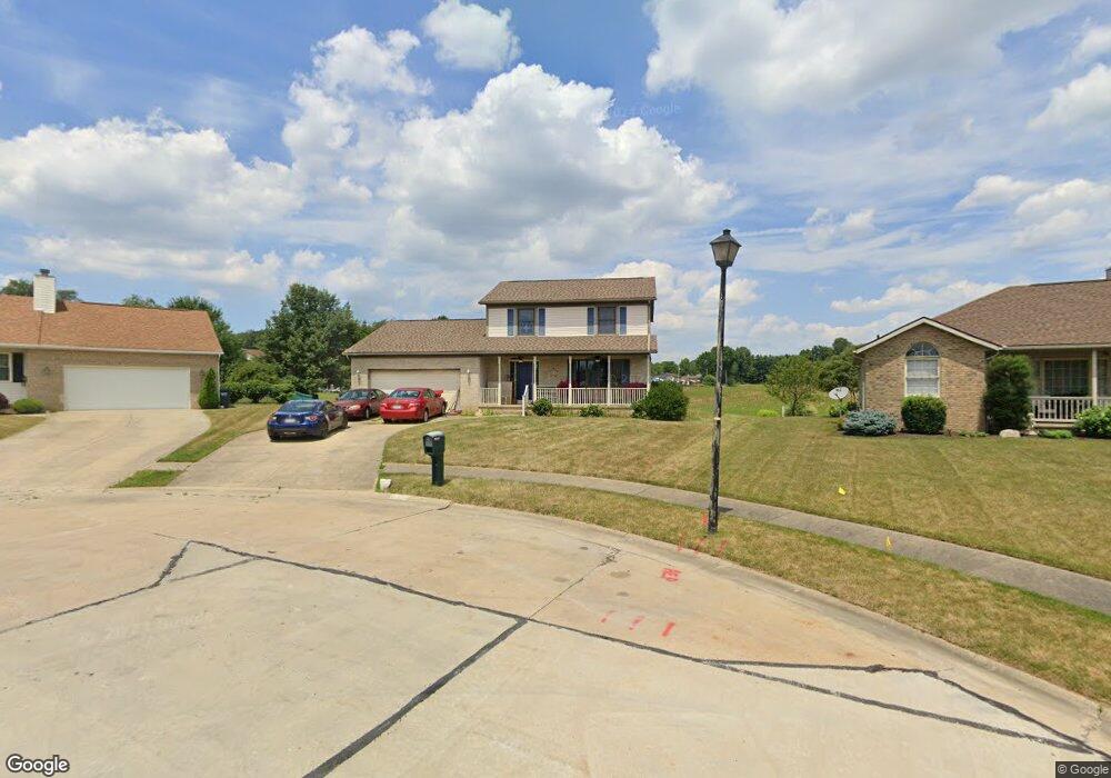
813 Joel Cir Louisville, OH 44641
Estimated Value: $235,000 - $295,000
3
Beds
3
Baths
1,832
Sq Ft
$147/Sq Ft
Est. Value
About This Home
This home is located at 813 Joel Cir, Louisville, OH 44641 and is currently estimated at $269,208, approximately $146 per square foot. 813 Joel Cir is a home located in Stark County with nearby schools including Louisville High School and St. Thomas Aquinas High School & Middle School.
Ownership History
Date
Name
Owned For
Owner Type
Purchase Details
Closed on
Jan 7, 2005
Sold by
Roberts Carl R and Roberts Joanne J
Bought by
Feliciano Jose
Current Estimated Value
Home Financials for this Owner
Home Financials are based on the most recent Mortgage that was taken out on this home.
Original Mortgage
$136,800
Outstanding Balance
$69,205
Interest Rate
5.78%
Mortgage Type
Purchase Money Mortgage
Estimated Equity
$200,003
Purchase Details
Closed on
Feb 17, 1998
Sold by
Constitution Dev
Bought by
Roberts Carl R and Roberts Jeanne J
Create a Home Valuation Report for This Property
The Home Valuation Report is an in-depth analysis detailing your home's value as well as a comparison with similar homes in the area
Home Values in the Area
Average Home Value in this Area
Purchase History
| Date | Buyer | Sale Price | Title Company |
|---|---|---|---|
| Feliciano Jose | $144,000 | -- | |
| Roberts Carl R | $23,900 | -- |
Source: Public Records
Mortgage History
| Date | Status | Borrower | Loan Amount |
|---|---|---|---|
| Open | Feliciano Jose | $136,800 |
Source: Public Records
Tax History Compared to Growth
Tax History
| Year | Tax Paid | Tax Assessment Tax Assessment Total Assessment is a certain percentage of the fair market value that is determined by local assessors to be the total taxable value of land and additions on the property. | Land | Improvement |
|---|---|---|---|---|
| 2025 | -- | $76,520 | $16,560 | $59,960 |
| 2024 | -- | $76,520 | $16,560 | $59,960 |
| 2023 | $2,559 | $58,140 | $13,690 | $44,450 |
| 2022 | $2,565 | $58,140 | $13,690 | $44,450 |
| 2021 | $2,572 | $58,140 | $13,690 | $44,450 |
| 2020 | $2,136 | $52,260 | $12,320 | $39,940 |
| 2019 | $2,147 | $51,180 | $11,240 | $39,940 |
| 2018 | $2,094 | $51,180 | $11,240 | $39,940 |
| 2017 | $1,958 | $46,170 | $9,380 | $36,790 |
| 2016 | $1,998 | $46,170 | $9,380 | $36,790 |
| 2015 | $2,004 | $46,170 | $9,380 | $36,790 |
| 2014 | $1,912 | $40,950 | $8,330 | $32,620 |
| 2013 | $960 | $40,950 | $8,330 | $32,620 |
Source: Public Records
Map
Nearby Homes
- 300 Kennedy St
- 1175 Sturbridge Dr
- 1149 Sturbridge Dr
- 614 Reno Dr
- 524 Glenbar St
- 0 Brookridge Ave
- 0 Glenbar St
- 428 Honeycrisp Dr NE
- 3047 Mcintosh Dr NE
- 432 Honeycrisp Dr NE
- 2962 Mcintosh Dr NE
- 2963 Mcintosh Dr NE
- 430 Honeycrisp Dr NE
- 2957 Mcintosh Dr NE
- 3580 Brookridge Ave Lot 15
- 5474 Ravenna Ave
- 316 E Reno Dr
- 325 Lincoln Ave
- 248 Menegay Rd
- 201 Indiana Ave