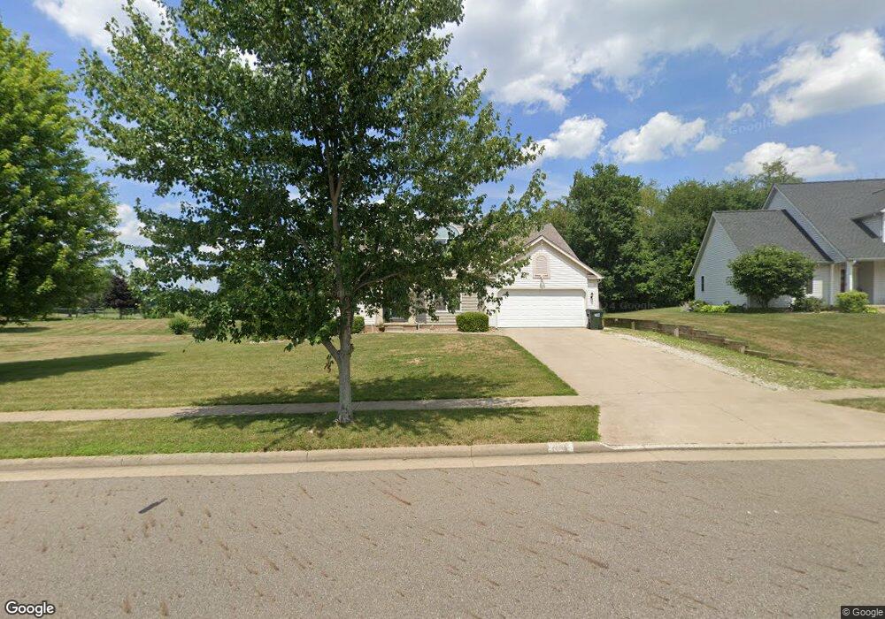
813 Reno Dr Louisville, OH 44641
Estimated Value: $328,000 - $352,000
3
Beds
3
Baths
2,002
Sq Ft
$169/Sq Ft
Est. Value
About This Home
This home is located at 813 Reno Dr, Louisville, OH 44641 and is currently estimated at $338,560, approximately $169 per square foot. 813 Reno Dr is a home located in Stark County with nearby schools including Louisville High School and St. Thomas Aquinas High School & Middle School.
Ownership History
Date
Name
Owned For
Owner Type
Purchase Details
Closed on
May 3, 2021
Sold by
Heutsche Robert G and Heutsche Christine Kay
Bought by
Jones Bryan J and Jones Robin C
Current Estimated Value
Home Financials for this Owner
Home Financials are based on the most recent Mortgage that was taken out on this home.
Original Mortgage
$203,920
Outstanding Balance
$184,514
Interest Rate
3%
Mortgage Type
New Conventional
Estimated Equity
$154,047
Purchase Details
Closed on
Oct 11, 2013
Sold by
Heutsche Robert J and Heutsche Christine Kay
Bought by
Heutsche Robert G and Heutsche Christine Kay
Home Financials for this Owner
Home Financials are based on the most recent Mortgage that was taken out on this home.
Original Mortgage
$183,834
Interest Rate
4.58%
Mortgage Type
FHA
Purchase Details
Closed on
May 25, 2007
Sold by
Heutsche Christine Kay and Fleming Christine Kay
Bought by
Heutsche Christine Kay and Heutsche Robert J
Home Financials for this Owner
Home Financials are based on the most recent Mortgage that was taken out on this home.
Original Mortgage
$160,000
Interest Rate
6.04%
Mortgage Type
Stand Alone Refi Refinance Of Original Loan
Purchase Details
Closed on
Apr 27, 2006
Sold by
Kaminski Mumford Jr Richard Sinclair and Kaminski Mumford Jacqueline M
Bought by
Fleming Christine Kay
Home Financials for this Owner
Home Financials are based on the most recent Mortgage that was taken out on this home.
Original Mortgage
$145,200
Interest Rate
6.42%
Mortgage Type
Fannie Mae Freddie Mac
Purchase Details
Closed on
May 21, 2004
Sold by
Elson J Hershberger Construction Inc
Bought by
Mumford Richard Sinclair and Kaminski Jacqueline Michele
Home Financials for this Owner
Home Financials are based on the most recent Mortgage that was taken out on this home.
Original Mortgage
$150,400
Interest Rate
5.85%
Mortgage Type
Purchase Money Mortgage
Purchase Details
Closed on
Jan 23, 2003
Sold by
Mckinley Development Co
Bought by
Elson J Hershberger Construction Inc
Home Financials for this Owner
Home Financials are based on the most recent Mortgage that was taken out on this home.
Original Mortgage
$125,160
Interest Rate
5.51%
Mortgage Type
Construction
Create a Home Valuation Report for This Property
The Home Valuation Report is an in-depth analysis detailing your home's value as well as a comparison with similar homes in the area
Home Values in the Area
Average Home Value in this Area
Purchase History
| Date | Buyer | Sale Price | Title Company |
|---|---|---|---|
| Jones Bryan J | $254,900 | Heritage Union Title Co Ltd | |
| Heutsche Robert G | -- | None Available | |
| Heutsche Christine Kay | -- | Attorney | |
| Fleming Christine Kay | $181,500 | First American Title Akron | |
| Mumford Richard Sinclair | $189,900 | -- | |
| Elson J Hershberger Construction Inc | $36,900 | Midland Commerce Group |
Source: Public Records
Mortgage History
| Date | Status | Borrower | Loan Amount |
|---|---|---|---|
| Open | Jones Bryan J | $203,920 | |
| Previous Owner | Heutsche Robert G | $183,834 | |
| Previous Owner | Heutsche Christine Kay | $160,000 | |
| Previous Owner | Fleming Christine Kay | $145,200 | |
| Previous Owner | Mumford Richard Sinclair | $150,400 | |
| Previous Owner | Elson J Hershberger Construction Inc | $125,160 |
Source: Public Records
Tax History Compared to Growth
Tax History
| Year | Tax Paid | Tax Assessment Tax Assessment Total Assessment is a certain percentage of the fair market value that is determined by local assessors to be the total taxable value of land and additions on the property. | Land | Improvement |
|---|---|---|---|---|
| 2025 | -- | $117,810 | $42,210 | $75,600 |
| 2024 | -- | $117,810 | $42,210 | $75,600 |
| 2023 | $3,849 | $89,600 | $24,990 | $64,610 |
| 2022 | $3,856 | $89,600 | $24,990 | $64,610 |
| 2021 | $3,867 | $89,600 | $24,990 | $64,610 |
| 2020 | $3,020 | $75,990 | $22,510 | $53,480 |
| 2019 | $3,032 | $78,440 | $22,510 | $55,930 |
| 2018 | $3,118 | $78,440 | $22,510 | $55,930 |
| 2017 | $2,753 | $66,820 | $17,680 | $49,140 |
| 2016 | $2,809 | $66,820 | $17,680 | $49,140 |
| 2015 | $2,759 | $65,420 | $17,680 | $47,740 |
| 2014 | $683 | $59,150 | $15,960 | $43,190 |
| 2013 | $1,345 | $59,150 | $15,960 | $43,190 |
Source: Public Records
Map
Nearby Homes
- 0 Brookridge Ave
- 0 Glenbar St
- 614 Reno Dr
- 524 Glenbar St
- 3580 Brookridge Ave Lot 15
- 300 Kennedy St
- 1175 Sturbridge Dr
- 5474 Ravenna Ave
- 1149 Sturbridge Dr
- 428 Honeycrisp Dr NE
- 3047 Mcintosh Dr NE
- 432 Honeycrisp Dr NE
- 2962 Mcintosh Dr NE
- 2963 Mcintosh Dr NE
- 430 Honeycrisp Dr NE
- 2957 Mcintosh Dr NE
- 316 E Reno Dr
- 910 Crosswyck Cir
- 1170 Winding Ridge Ave
- 325 Lincoln Ave
- 803 Reno Dr
- 1426 Brookridge Ave
- 1446 Brookridge Ave
- 3578 Brookridge Ave Lot 13 NW
- 716 Glenbar St
- 3575 Glenbar St Lot 10
- 3571 Glenbar St Lot 6
- 0 W Reno Dr
- 724 Glenbar St
- 906 Reno Dr
- 1312 Baier Ave
- 626 Glenbar St
- 1453 Brookridge Ave
- 732 Glenbar St
- 1457 Brookridge Ave
- 1304 Baier Ave
- 830 Glenbar St
- 1459 Brookridge Ave
- 614 Glenbar St
- 1268 Baier Ave