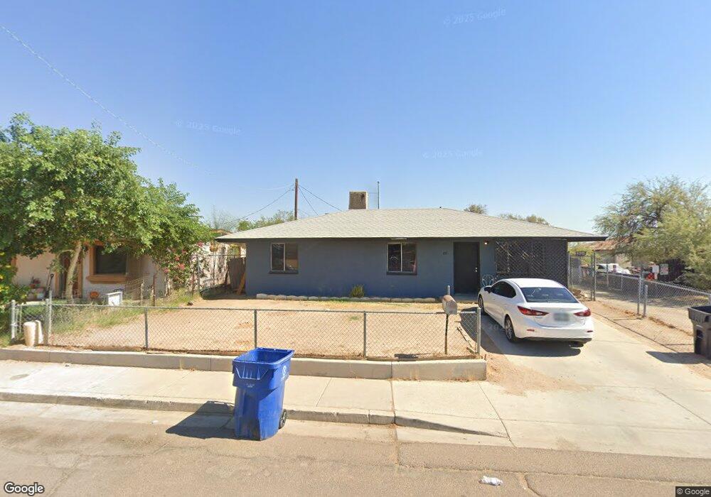
813 S 2nd St Avondale, AZ 85323
Old Town NeighborhoodEstimated Value: $195,000 - $270,000
Studio
1
Bath
816
Sq Ft
$285/Sq Ft
Est. Value
About This Home
This home is located at 813 S 2nd St, Avondale, AZ 85323 and is currently estimated at $232,498, approximately $284 per square foot. 813 S 2nd St is a home located in Maricopa County with nearby schools including Lattie Coor, Eliseo C. Felix School, and Avondale Middle School.
Ownership History
Date
Name
Owned For
Owner Type
Purchase Details
Closed on
Feb 24, 2012
Sold by
St0ne Dennis A
Bought by
Gillproperties Llc
Current Estimated Value
Purchase Details
Closed on
Jan 24, 2012
Sold by
Gill Joseph Brett
Bought by
Stone Dennis Austin
Purchase Details
Closed on
Jan 6, 2012
Sold by
Davis R Kent and Davis Charlene Mae
Bought by
Davis R Kent and Davis Charlene Mae
Purchase Details
Closed on
Jan 4, 2012
Sold by
Gill Lillian A
Bought by
Gill Lillian A and Estate Of David A Gill
Purchase Details
Closed on
Apr 28, 2004
Sold by
Molina Adelaido and Molina Ysabel
Bought by
City Of Avondale
Purchase Details
Closed on
Apr 1, 2004
Sold by
Gill David
Bought by
City Of Avondale
Purchase Details
Closed on
Nov 30, 2002
Sold by
Gill David V
Bought by
Gill David and David Vachel Gill Living Trust
Create a Home Valuation Report for This Property
The Home Valuation Report is an in-depth analysis detailing your home's value as well as a comparison with similar homes in the area
Home Values in the Area
Average Home Value in this Area
Purchase History
| Date | Buyer | Sale Price | Title Company |
|---|---|---|---|
| Gillproperties Llc | $5,000 | None Available | |
| Stone Dennis Austin | -- | None Available | |
| Davis R Kent | -- | Accommodation | |
| Gill Lillian A | -- | None Available | |
| City Of Avondale | -- | -- | |
| City Of Avondale | -- | None Available | |
| Gill David | -- | -- |
Source: Public Records
Tax History
| Year | Tax Paid | Tax Assessment Tax Assessment Total Assessment is a certain percentage of the fair market value that is determined by local assessors to be the total taxable value of land and additions on the property. | Land | Improvement |
|---|---|---|---|---|
| 2025 | $218 | $1,938 | -- | -- |
| 2024 | $201 | $1,846 | -- | -- |
| 2023 | $201 | $13,750 | $2,750 | $11,000 |
| 2022 | $193 | $9,270 | $1,850 | $7,420 |
| 2021 | $204 | $6,870 | $1,370 | $5,500 |
| 2020 | $198 | $5,520 | $1,100 | $4,420 |
| 2019 | $197 | $4,760 | $950 | $3,810 |
| 2018 | $197 | $3,850 | $770 | $3,080 |
| 2017 | $193 | $3,900 | $780 | $3,120 |
| 2016 | $196 | $2,200 | $440 | $1,760 |
Source: Public Records
Map
Nearby Homes
- 516 E Mountain View Dr
- 113 E Elm Ln
- 1108 S 5th St
- 1028 S Holben Place
- 1105 S Frost Ln
- 110 W Main St
- 300 W Lower Buckeye Rd Unit 26
- 612 E Dee St
- 127 W Main St Unit 6
- 400 E Main St Unit 23
- 501 S 9th St
- 830 S Greenleaf Ln
- 535 E Agua Fria Ln
- 1017 S 5th Ave
- 26912 E Lower Buckeye Rd
- 244 S 7th St Unit 20
- 237 S 7th St
- 823 E Agua Fria Ln
- 506 W Del Rio Ln
- 1010 S 5th St
Your Personal Tour Guide
Ask me questions while you tour the home.