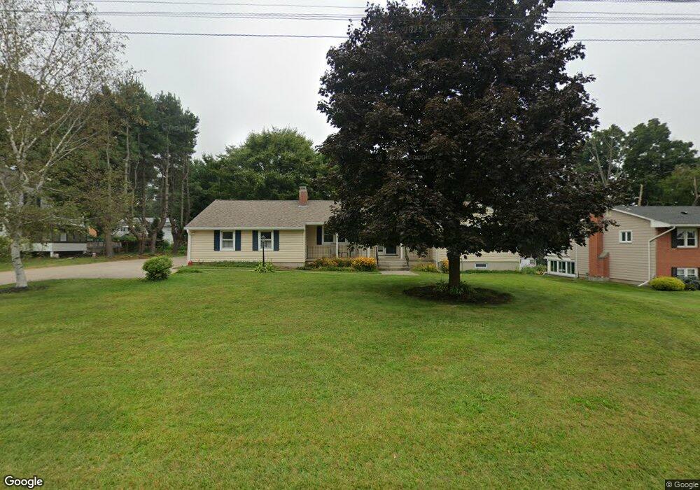
813 Wells Rd Wethersfield, CT 06109
Estimated Value: $407,000 - $446,000
3
Beds
2
Baths
1,370
Sq Ft
$312/Sq Ft
Est. Value
About This Home
This home is located at 813 Wells Rd, Wethersfield, CT 06109 and is currently estimated at $427,753, approximately $312 per square foot. 813 Wells Rd is a home located in Hartford County with nearby schools including Samuel B. Webb Elementary School, Silas Deane Middle School, and Wethersfield High School.
Ownership History
Date
Name
Owned For
Owner Type
Purchase Details
Closed on
Nov 30, 2022
Sold by
Pinard Donald L
Bought by
Pinard Children T
Current Estimated Value
Purchase Details
Closed on
Jul 27, 2022
Sold by
Pinard Children T
Bought by
Pinard Donald L
Purchase Details
Closed on
Nov 5, 2013
Sold by
Pinard Donald L and Pinard Barbara
Bought by
Pinard Children T and Payer Donna B
Purchase Details
Closed on
Sep 19, 2005
Sold by
Lund Anne K
Bought by
Pinard Donald L and Pinard Barbara
Create a Home Valuation Report for This Property
The Home Valuation Report is an in-depth analysis detailing your home's value as well as a comparison with similar homes in the area
Home Values in the Area
Average Home Value in this Area
Purchase History
| Date | Buyer | Sale Price | Title Company |
|---|---|---|---|
| Pinard Children T | -- | None Available | |
| Pinard Donald L | -- | None Available | |
| Pinard Children T | -- | -- | |
| Pinard Donald L | $250,000 | -- |
Source: Public Records
Mortgage History
| Date | Status | Borrower | Loan Amount |
|---|---|---|---|
| Previous Owner | Pinard Donald L | $181,678 |
Source: Public Records
Tax History
| Year | Tax Paid | Tax Assessment Tax Assessment Total Assessment is a certain percentage of the fair market value that is determined by local assessors to be the total taxable value of land and additions on the property. | Land | Improvement |
|---|---|---|---|---|
| 2025 | $11,673 | $283,190 | $102,900 | $180,290 |
| 2024 | $7,456 | $172,510 | $65,750 | $106,760 |
| 2023 | $7,207 | $172,510 | $65,750 | $106,760 |
| 2022 | $7,087 | $172,510 | $65,750 | $106,760 |
| 2021 | $7,016 | $172,510 | $65,750 | $106,760 |
| 2020 | $7,019 | $172,510 | $65,750 | $106,760 |
| 2019 | $7,028 | $172,510 | $65,750 | $106,760 |
| 2018 | $6,941 | $170,200 | $65,200 | $105,000 |
| 2017 | $6,769 | $170,200 | $65,200 | $105,000 |
| 2016 | $6,560 | $170,200 | $65,200 | $105,000 |
| 2015 | $6,500 | $170,200 | $65,200 | $105,000 |
| 2014 | $6,253 | $170,200 | $65,200 | $105,000 |
Source: Public Records
Map
Nearby Homes
- 20 Forest Dr
- 104 Willow St
- 7 Barrington Dr Unit C
- 273 Forest Dr
- 173 Timber Trail
- 116 Wells Farm Dr
- 274 Cedarwood Ln
- 455 Brimfield Rd
- 0 Collier Rd
- 101 Collier Rd
- 62 Harold Dr
- 137 Dale Rd
- 89 Merriman Rd
- 5 Robeth Ln
- 38 Northwood Rd
- 84 Connecticut Ave
- 97 Brussels Ave
- 38 Wheeler Rd
- 76 Luca Lane Homesite 8
- 61 Luca Ln
Your Personal Tour Guide
Ask me questions while you tour the home.