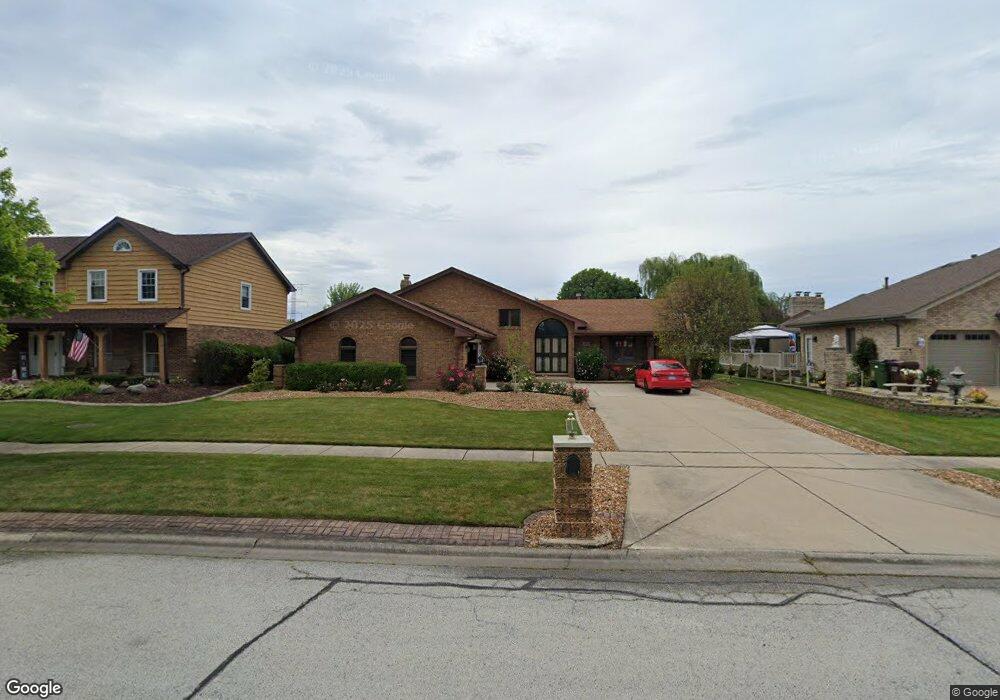
8130 Apache Trail Tinley Park, IL 60477
Central Tinley Park NeighborhoodEstimated Value: $387,502 - $522,000
4
Beds
3
Baths
1,726
Sq Ft
$257/Sq Ft
Est. Value
About This Home
This home is located at 8130 Apache Trail, Tinley Park, IL 60477 and is currently estimated at $443,626, approximately $257 per square foot. 8130 Apache Trail is a home located in Cook County with nearby schools including Millennium Elementary School, Virgil I Grissom Middle School, and Victor J Andrew High School.
Ownership History
Date
Name
Owned For
Owner Type
Purchase Details
Closed on
Nov 3, 1997
Sold by
State Bank Of Countryside
Bought by
Jolly Samuel Saji and Jolly Samuel
Current Estimated Value
Home Financials for this Owner
Home Financials are based on the most recent Mortgage that was taken out on this home.
Original Mortgage
$180,000
Outstanding Balance
$26,719
Interest Rate
7.43%
Estimated Equity
$416,907
Create a Home Valuation Report for This Property
The Home Valuation Report is an in-depth analysis detailing your home's value as well as a comparison with similar homes in the area
Home Values in the Area
Average Home Value in this Area
Purchase History
| Date | Buyer | Sale Price | Title Company |
|---|---|---|---|
| Jolly Samuel Saji | $225,000 | -- |
Source: Public Records
Mortgage History
| Date | Status | Borrower | Loan Amount |
|---|---|---|---|
| Open | Jolly Samuel Saji | $180,000 |
Source: Public Records
Tax History
| Year | Tax Paid | Tax Assessment Tax Assessment Total Assessment is a certain percentage of the fair market value that is determined by local assessors to be the total taxable value of land and additions on the property. | Land | Improvement |
|---|---|---|---|---|
| 2025 | $8,171 | $32,744 | $6,336 | $26,408 |
| 2024 | $8,171 | $32,744 | $6,336 | $26,408 |
| 2023 | $6,695 | $35,661 | $6,336 | $29,325 |
| 2022 | $6,695 | $22,200 | $5,544 | $16,656 |
| 2021 | $6,511 | $22,200 | $5,544 | $16,656 |
| 2020 | $6,418 | $22,200 | $5,544 | $16,656 |
| 2019 | $6,448 | $23,312 | $5,016 | $18,296 |
| 2018 | $6,308 | $23,312 | $5,016 | $18,296 |
| 2017 | $7,454 | $27,506 | $5,016 | $22,490 |
| 2016 | $6,308 | $21,489 | $4,488 | $17,001 |
| 2015 | $6,199 | $21,489 | $4,488 | $17,001 |
| 2014 | $6,546 | $22,663 | $4,488 | $18,175 |
| 2013 | $8,019 | $29,181 | $4,488 | $24,693 |
Source: Public Records
Map
Nearby Homes
- 7816 Marquette Dr S
- 18113 Mager Dr Unit 18113
- 8320 Heather Ln
- 8434 Kirby Dr Unit 8434
- 17618 Dunn Rd
- 7758 Marquette Dr S
- 7770 Bristol Park Dr Unit 2
- 18293 Kirby Dr Unit 2718293
- 7815 Bristol Park Dr N
- 7811 Bristol Park Dr N
- 8304 Queen Victoria Ln
- 19209 Buncrana Cir
- 7946 172nd Place
- 7946 172nd St
- 7537 175th St Unit 534
- 7517 175th St Unit 331
- 17363 Oleander Ave
- 7505 175th St Unit 122
- 7531 175th St Unit 422
- 8444 W 171st St
- 8120 Apache Trail
- 8140 Apache Trail
- 8125 Pottawattomi Trail
- 8110 Apache Trail
- 17845 Iroquois Trace
- 17835 Iroquois Trace
- 8115 Pottawattomi Trail
- 8145 Apache Trail
- 8135 Apache Trail
- 8135 Apache Trail
- 8100 Apache Trail
- 17825 Iroquois Trace
- 8130 Pottawattomi Trail
- 8155 Apache Trail
- 8105 Pottawattomi Trail
- 8115 Apache Trail
- 8050 Apache Trail
- 8065 Apache Trail
- 8155 Pottawattomi Trail
- 8120 Pottawattomi Trail
Your Personal Tour Guide
Ask me questions while you tour the home.