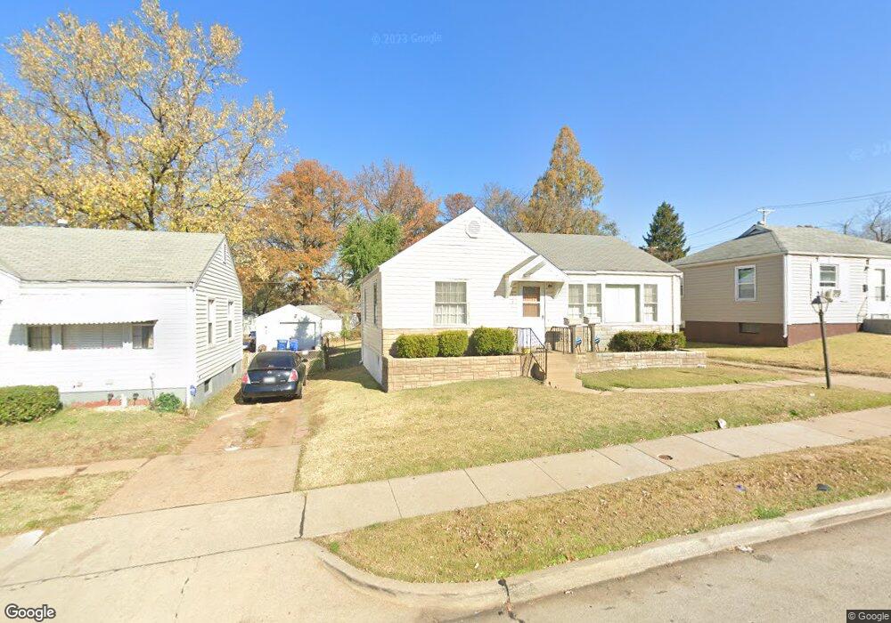
8131 Airport Rd Saint Louis, MO 63134
Estimated Value: $92,163 - $127,000
2
Beds
1
Bath
1,016
Sq Ft
$104/Sq Ft
Est. Value
About This Home
This home is located at 8131 Airport Rd, Saint Louis, MO 63134 and is currently estimated at $105,791, approximately $104 per square foot. 8131 Airport Rd is a home located in St. Louis County with nearby schools including Berkeley Elementary School, STEAM Academy at McCluer South-Berkeley High School, and Blessed Teresa of Calcutta Catholic School.
Ownership History
Date
Name
Owned For
Owner Type
Purchase Details
Closed on
Nov 19, 1998
Sold by
Bonhomme Realty Company
Bought by
Moore Marsha
Current Estimated Value
Home Financials for this Owner
Home Financials are based on the most recent Mortgage that was taken out on this home.
Original Mortgage
$40,499
Outstanding Balance
$8,739
Interest Rate
6.46%
Mortgage Type
FHA
Estimated Equity
$97,052
Purchase Details
Closed on
Jul 16, 1998
Sold by
Schaefer Dorothy A and Schaefer Edward W
Bought by
Bonhomme Realty Company
Create a Home Valuation Report for This Property
The Home Valuation Report is an in-depth analysis detailing your home's value as well as a comparison with similar homes in the area
Home Values in the Area
Average Home Value in this Area
Purchase History
| Date | Buyer | Sale Price | Title Company |
|---|---|---|---|
| Moore Marsha | $39,500 | -- | |
| Bonhomme Realty Company | -- | -- |
Source: Public Records
Mortgage History
| Date | Status | Borrower | Loan Amount |
|---|---|---|---|
| Open | Moore Marsha | $40,499 |
Source: Public Records
Tax History Compared to Growth
Tax History
| Year | Tax Paid | Tax Assessment Tax Assessment Total Assessment is a certain percentage of the fair market value that is determined by local assessors to be the total taxable value of land and additions on the property. | Land | Improvement |
|---|---|---|---|---|
| 2025 | $1,268 | $19,650 | $1,050 | $18,600 |
| 2024 | $1,268 | $16,500 | $1,390 | $15,110 |
| 2023 | $1,252 | $16,500 | $1,390 | $15,110 |
| 2022 | $730 | $8,270 | $1,050 | $7,220 |
| 2021 | $725 | $8,270 | $1,050 | $7,220 |
| 2020 | $668 | $7,070 | $1,050 | $6,020 |
| 2019 | $640 | $7,070 | $1,050 | $6,020 |
| 2018 | $692 | $6,920 | $1,050 | $5,870 |
| 2017 | $688 | $6,920 | $1,050 | $5,870 |
| 2016 | $1,038 | $10,210 | $1,390 | $8,820 |
| 2015 | $1,007 | $10,210 | $1,390 | $8,820 |
| 2014 | $971 | $9,810 | $860 | $8,950 |
Source: Public Records
Map
Nearby Homes
- 8042 Patterson Dr
- 8219 Davenport Dr
- 8027 Aline Ave
- 8306 Whitewater Dr
- 6135 Shillington Dr
- 8140 Packard Ave
- 324 Newell Dr
- 213 Henquin Dr
- 117 Henquin Dr
- 6016 Shillington Dr
- 8235 Zoe Dr
- 6005 Shillington Dr
- 116 Henquin Dr
- 6315 Washington Ave
- 6106 Jackson Ave
- 6315 Jackson Ave
- 6029 Washington Ave
- 53 N Dade Ave
- 6605 Carol Lee Dr
- 218 N Marguerite Ave
- 8135 Airport Rd
- 8127 Airport Rd
- 8139 Airport Rd
- 8123 Airport Rd
- 8204 Canyon Dr
- 8200 Canyon Dr
- 8208 Canyon Dr
- 8130 Airport Rd
- 6209 Peurifoy Ave
- 8147 Airport Rd
- 8126 Airport Rd
- 6300 Everett Dr
- 8134 Airport Rd
- 8122 Airport Rd
- 8212 Canyon Dr
- 6213 Peurifoy Ave
- 8138 Airport Rd
- 8118 Airport Rd
- 6217 Peurifoy Ave
- 8142 Airport Rd