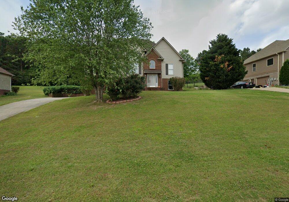
8135 Weatherstone Cir Unit 9 Bessemer, AL 35022
Estimated Value: $346,420 - $411,000
3
Beds
2
Baths
1,601
Sq Ft
$234/Sq Ft
Est. Value
About This Home
This home is located at 8135 Weatherstone Cir Unit 9, Bessemer, AL 35022 and is currently estimated at $374,105, approximately $233 per square foot. 8135 Weatherstone Cir Unit 9 is a home located in Jefferson County with nearby schools including Mcadory Middle School and Mcadory High School.
Ownership History
Date
Name
Owned For
Owner Type
Purchase Details
Closed on
Dec 19, 2017
Sold by
Cadence Bank
Bought by
Hughes Steven L
Current Estimated Value
Home Financials for this Owner
Home Financials are based on the most recent Mortgage that was taken out on this home.
Original Mortgage
$182,875
Outstanding Balance
$153,885
Interest Rate
3.92%
Mortgage Type
New Conventional
Estimated Equity
$220,220
Purchase Details
Closed on
Nov 9, 2016
Sold by
Nebraska Alliance Realty C
Bought by
Cadence Bank
Purchase Details
Closed on
Mar 29, 2011
Sold by
Askj L L C
Bought by
Canter Charles G
Home Financials for this Owner
Home Financials are based on the most recent Mortgage that was taken out on this home.
Original Mortgage
$175,275
Interest Rate
3.99%
Mortgage Type
Adjustable Rate Mortgage/ARM
Create a Home Valuation Report for This Property
The Home Valuation Report is an in-depth analysis detailing your home's value as well as a comparison with similar homes in the area
Home Values in the Area
Average Home Value in this Area
Purchase History
| Date | Buyer | Sale Price | Title Company |
|---|---|---|---|
| Hughes Steven L | $192,500 | -- | |
| Cadence Bank | $76,022 | -- | |
| Canter Charles G | -- | None Available |
Source: Public Records
Mortgage History
| Date | Status | Borrower | Loan Amount |
|---|---|---|---|
| Open | Hughes Steven L | $182,875 | |
| Previous Owner | Canter Charles G | $175,275 | |
| Previous Owner | Canter Charles G | $9,225 |
Source: Public Records
Tax History Compared to Growth
Tax History
| Year | Tax Paid | Tax Assessment Tax Assessment Total Assessment is a certain percentage of the fair market value that is determined by local assessors to be the total taxable value of land and additions on the property. | Land | Improvement |
|---|---|---|---|---|
| 2024 | $1,268 | $30,380 | -- | -- |
| 2022 | $1,311 | $27,370 | $4,700 | $22,670 |
| 2021 | $1,103 | $23,070 | $4,700 | $18,370 |
| 2020 | $1,336 | $21,250 | $4,700 | $16,550 |
| 2019 | $1,012 | $21,260 | $0 | $0 |
| 2018 | $2,240 | $44,720 | $0 | $0 |
| 2017 | $2,240 | $44,720 | $0 | $0 |
| 2016 | $2,240 | $44,720 | $0 | $0 |
| 2015 | $2,240 | $44,720 | $0 | $0 |
| 2014 | $2,209 | $44,100 | $0 | $0 |
| 2013 | $2,209 | $44,100 | $0 | $0 |
Source: Public Records
Map
Nearby Homes
- 3531 Lakefront Trail
- 3588 Lakefront Trail
- 7890 Saddlewood Dr Unit 1
- 7713 S Crest Trail
- 3623 Timber Way
- 3640 Timber Way
- 860 Highway 277
- 516 Sterling Lakes Way
- 524 Sterling Lakes Way
- 3603 Oakleaf Dr
- 669 Highway 277
- 131 Creekwater St
- 6089 Highway 13
- 513 Rock Terrace Way
- 3874 Black Hawk Dr
- 5365 S Shades Crest Rd
- 394 Rock Terrace Dr
- 386 Rock Terrace Dr
- 4110 Lee Roy Ln
- Lot 3 B Cabin Rd Unit 3B
- 8135 Weatherstone Cir
- 8139 Weatherstone Cir
- 8127 Weatherstone Cir
- 8127 Weatherstone Cir Unit 7
- 8140 Weatherstone Cir
- 8143 Weatherstone Cir
- 8136 Weatherstone Cir
- 8132 Weatherstone Cir
- 8132 Weatherstone Cir Unit 17
- 8123 Weatherstone Cir
- 8147 Weatherstone Cir
- 8128 Weatherstone Cir
- 8128 Weatherstone Cir Unit 18
- 5089 S Shades Crest Rd
- 8144 Weatherstone Cir
- 5101 S Shades Crest Rd
- 8124 Weatherstone Cir
- 8119 Weatherstone Cir
- 8151 Weatherstone Cir
- 5081 S Shades Crest Rd