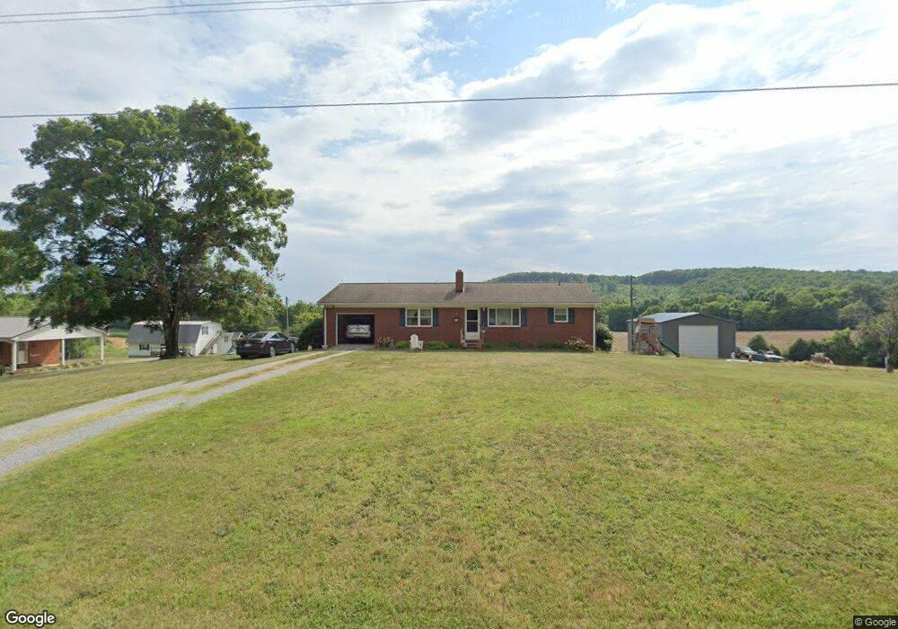
814 Crousetown Rd Lexington, NC 27292
Estimated Value: $208,377 - $365,000
3
Beds
1
Bath
3,072
Sq Ft
$95/Sq Ft
Est. Value
About This Home
This home is located at 814 Crousetown Rd, Lexington, NC 27292 and is currently estimated at $292,344, approximately $95 per square foot. 814 Crousetown Rd is a home located in Davidson County with nearby schools including Denton Elementary School and South Davidson Middle and High School.
Ownership History
Date
Name
Owned For
Owner Type
Purchase Details
Closed on
Aug 2, 2023
Sold by
Whittaker William Tyler and Whittaker Toni Marie
Bought by
William And Toni Whittaker Revocable Trust and Whittaker
Current Estimated Value
Purchase Details
Closed on
Jun 27, 2018
Sold by
Gallimore Paul J and Gallimore Sarah Lou
Bought by
Whittaker William Tyler and Whittaker Toni Marie
Home Financials for this Owner
Home Financials are based on the most recent Mortgage that was taken out on this home.
Original Mortgage
$120,000
Interest Rate
4.87%
Mortgage Type
Adjustable Rate Mortgage/ARM
Purchase Details
Closed on
May 23, 1962
Create a Home Valuation Report for This Property
The Home Valuation Report is an in-depth analysis detailing your home's value as well as a comparison with similar homes in the area
Home Values in the Area
Average Home Value in this Area
Purchase History
| Date | Buyer | Sale Price | Title Company |
|---|---|---|---|
| William And Toni Whittaker Revocable Trust | -- | None Listed On Document | |
| Whittaker William Tyler | $120,000 | None Available | |
| -- | -- | -- |
Source: Public Records
Mortgage History
| Date | Status | Borrower | Loan Amount |
|---|---|---|---|
| Previous Owner | Whittaker William Tyler | $120,000 |
Source: Public Records
Tax History
| Year | Tax Paid | Tax Assessment Tax Assessment Total Assessment is a certain percentage of the fair market value that is determined by local assessors to be the total taxable value of land and additions on the property. | Land | Improvement |
|---|---|---|---|---|
| 2025 | $1,020 | $154,520 | $0 | $0 |
| 2024 | $989 | $154,520 | $0 | $0 |
| 2023 | $764 | $119,320 | $0 | $0 |
| 2022 | $764 | $119,320 | $0 | $0 |
| 2021 | $764 | $119,320 | $0 | $0 |
| 2020 | $677 | $105,720 | $0 | $0 |
| 2019 | $687 | $105,720 | $0 | $0 |
| 2018 | $376 | $105,720 | $0 | $0 |
| 2017 | $376 | $105,720 | $0 | $0 |
| 2016 | $376 | $105,720 | $0 | $0 |
| 2015 | $376 | $105,720 | $0 | $0 |
| 2014 | $653 | $100,420 | $0 | $0 |
Source: Public Records
Map
Nearby Homes
- 301 Crouse Mountain Ln
- 308 Clara Hill Ln
- 248 Wedgewood Dr
- 367 Wedgewood Dr
- 1165 Canaan Church Rd
- 1726 Garner Rd
- 103 N Silver St
- 12274 E Old Us Highway 64
- 221 Delk Rd
- 0 Nc Highway 47
- 964 Loflin Hill Rd Unit 25
- 964 Loflin Hill Rd Unit 55
- 964 Loflin Hill Rd Unit 31
- 964 Loflin Hill Rd Unit 43
- 11043 E Old Us Highway 64
- 187 Eastside Dr
- 356 Eastside Dr
- 0 Farmer Denton Rd
- 532 N Main St
- 242 Sturdivant Rd
- 840 Crousetown Rd
- 892 Crousetown Rd
- 871 Crousetown Rd
- 691 Crousetown Rd
- 667 Crousetown Rd
- 995 Crousetown Rd
- 749 Crousetown Rd
- 577 Crousetown Rd
- 467 Crousetown Rd
- 1167 Crousetown Rd
- 428 Crousetown Rd
- 200 Dale Ridge Ln
- 155 Dale Ridge Ln
- 119 Dale Ridge Ln
- 203 Dale Ridge Ln
- 336 Crousetown Rd
- 720 Crouse Mountain Ln
- 1374 Crousetown Rd
- 304 Crousetown Rd
- 850 Crouse Mountain Ln
Your Personal Tour Guide
Ask me questions while you tour the home.