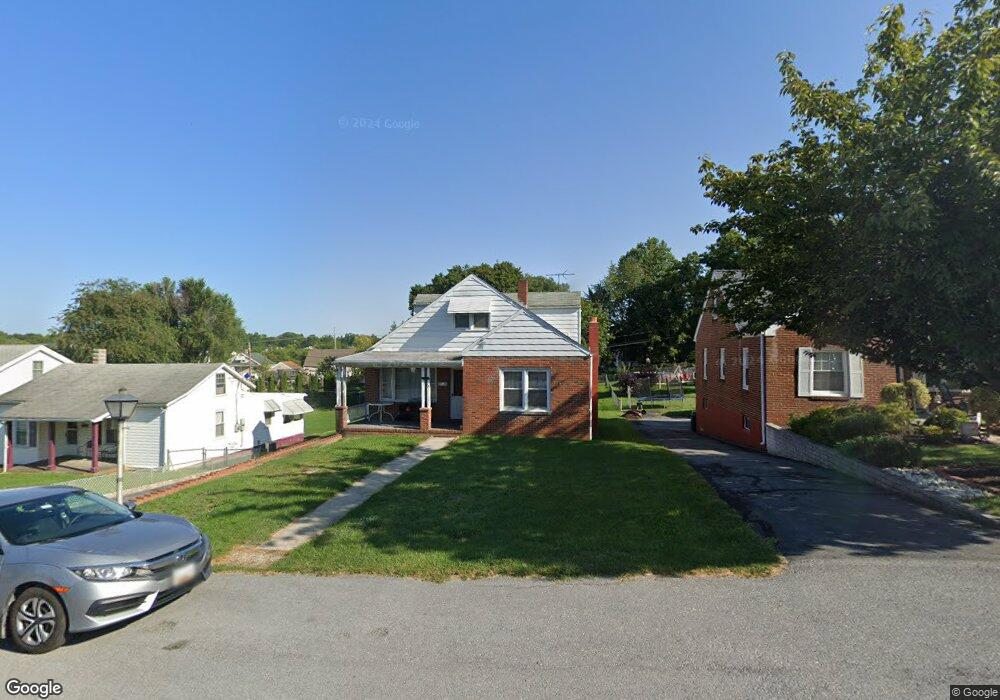
814 Park Rd Hagerstown, MD 21740
East End NeighborhoodEstimated Value: $218,945 - $298,000
--
Bed
2
Baths
1,708
Sq Ft
$156/Sq Ft
Est. Value
About This Home
This home is located at 814 Park Rd, Hagerstown, MD 21740 and is currently estimated at $266,236, approximately $155 per square foot. 814 Park Rd is a home located in Washington County with nearby schools including Pangborn Elementary School, Northern Middle School, and North Hagerstown High School.
Ownership History
Date
Name
Owned For
Owner Type
Purchase Details
Closed on
Jan 12, 1987
Sold by
Kline James L
Bought by
Long Edward S and Long Shawn L
Current Estimated Value
Home Financials for this Owner
Home Financials are based on the most recent Mortgage that was taken out on this home.
Original Mortgage
$49,600
Interest Rate
9.32%
Purchase Details
Closed on
Jul 30, 1981
Sold by
Bailey Joann H
Bought by
Kline James L
Create a Home Valuation Report for This Property
The Home Valuation Report is an in-depth analysis detailing your home's value as well as a comparison with similar homes in the area
Home Values in the Area
Average Home Value in this Area
Purchase History
| Date | Buyer | Sale Price | Title Company |
|---|---|---|---|
| Long Edward S | $62,000 | -- | |
| Kline James L | $57,000 | -- |
Source: Public Records
Mortgage History
| Date | Status | Borrower | Loan Amount |
|---|---|---|---|
| Closed | Long Edward S | $49,600 |
Source: Public Records
Tax History Compared to Growth
Tax History
| Year | Tax Paid | Tax Assessment Tax Assessment Total Assessment is a certain percentage of the fair market value that is determined by local assessors to be the total taxable value of land and additions on the property. | Land | Improvement |
|---|---|---|---|---|
| 2025 | $1,432 | $168,633 | $0 | $0 |
| 2024 | $1,432 | $138,300 | $42,500 | $95,800 |
| 2023 | $1,372 | $132,500 | $0 | $0 |
| 2022 | $1,312 | $126,700 | $0 | $0 |
| 2021 | $1,273 | $120,900 | $42,500 | $78,400 |
| 2020 | $1,273 | $120,600 | $0 | $0 |
| 2019 | $1,275 | $120,300 | $0 | $0 |
| 2018 | $1,272 | $120,000 | $42,500 | $77,500 |
| 2017 | $1,253 | $118,167 | $0 | $0 |
| 2016 | -- | $116,333 | $0 | $0 |
| 2015 | $1,454 | $114,500 | $0 | $0 |
| 2014 | $1,454 | $114,500 | $0 | $0 |
Source: Public Records
Map
Nearby Homes
- 69 Sunbrook Ln Unit 11
- 1221 1221 Security Rd
- 732 Jefferson Blvd
- 137 Sunbrook Ln Unit 182
- 761 Jefferson Blvd
- 942 Monet Dr
- 213 Sunbrook Ln Unit 69
- 562 Jefferson St
- 854 View St
- 818 View St
- 907 View St
- 528 Jefferson St
- 226 Brynwood St
- 808 Mulberry Ave
- 563 Liberty St
- 212 Brynwood St
- 823 Mulberry Ave
- 144 Fairground Ave
- 805 Mulberry Ave
- 30 Willard St