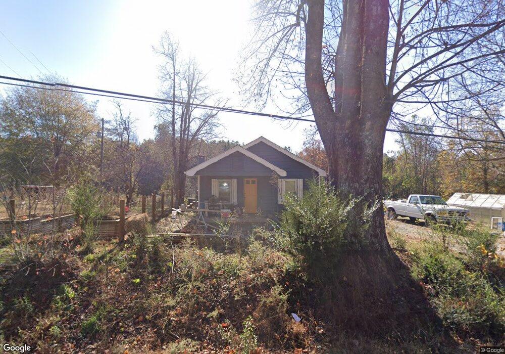
8144 Highway 108 E Mill Spring, NC 28756
Estimated Value: $207,000 - $233,000
2
Beds
1
Bath
816
Sq Ft
$267/Sq Ft
Est. Value
About This Home
This home is located at 8144 Highway 108 E, Mill Spring, NC 28756 and is currently estimated at $218,035, approximately $267 per square foot. 8144 Highway 108 E is a home located in Polk County.
Ownership History
Date
Name
Owned For
Owner Type
Purchase Details
Closed on
Jun 26, 2020
Sold by
Micek Joseph A and Micek Michelle R
Bought by
Alexander Wulfsberg Zachary Robert and Alexander Shelby
Current Estimated Value
Home Financials for this Owner
Home Financials are based on the most recent Mortgage that was taken out on this home.
Original Mortgage
$151,500
Outstanding Balance
$137,065
Interest Rate
4.37%
Mortgage Type
New Conventional
Estimated Equity
$80,970
Purchase Details
Closed on
Aug 1, 2016
Sold by
Pritchard Karen R
Bought by
Micek Joseph A and Micek Michelle R
Home Financials for this Owner
Home Financials are based on the most recent Mortgage that was taken out on this home.
Original Mortgage
$77,600
Interest Rate
3.48%
Mortgage Type
New Conventional
Create a Home Valuation Report for This Property
The Home Valuation Report is an in-depth analysis detailing your home's value as well as a comparison with similar homes in the area
Home Values in the Area
Average Home Value in this Area
Purchase History
| Date | Buyer | Sale Price | Title Company |
|---|---|---|---|
| Alexander Wulfsberg Zachary Robert | $129,500 | None Available | |
| Micek Joseph A | $80,000 | None Available |
Source: Public Records
Mortgage History
| Date | Status | Borrower | Loan Amount |
|---|---|---|---|
| Open | Alexander Wulfsberg Zachary Robert | $151,500 | |
| Previous Owner | Micek Joseph A | $77,600 |
Source: Public Records
Tax History
| Year | Tax Paid | Tax Assessment Tax Assessment Total Assessment is a certain percentage of the fair market value that is determined by local assessors to be the total taxable value of land and additions on the property. | Land | Improvement |
|---|---|---|---|---|
| 2025 | $778 | $152,383 | $54,420 | $97,963 |
| 2024 | $729 | $113,967 | $38,200 | $75,767 |
| 2023 | $729 | $113,967 | $38,200 | $75,767 |
| 2022 | $707 | $113,967 | $38,200 | $75,767 |
| 2021 | $707 | $113,967 | $38,200 | $75,767 |
| 2020 | $486 | $77,032 | $30,560 | $46,472 |
| 2019 | $486 | $77,032 | $30,560 | $46,472 |
| 2018 | $470 | $77,032 | $30,560 | $46,472 |
| 2017 | $459 | $51,320 | $27,240 | $24,080 |
| 2016 | $306 | $51,320 | $27,240 | $24,080 |
| 2015 | $299 | $0 | $0 | $0 |
Source: Public Records
Map
Nearby Homes
- 0 Big Level Rd Unit CAR4267320
- 6 Rachel Bell Rd
- TBD Pea Ridge Rd
- 0 E Nc Hwy 108 None Unit Lot 55
- TBD Shady Ln
- 00 Saddleside Dr
- Lot 20 A R Thompson Rd Unit 20
- 00 A R Thompson Rd
- 00000 A R Thompson Rd Unit 27
- Lot 20 A R Thompson Rd
- 260 Buck Branch Rd
- 1888 Pea Ridge Rd
- 10105 N Carolina 108
- 1178 Pea Ridge Rd
- 0 Mountain Pkwy Unit Lot 29
- 1564 C Rd
- LT 5 Geebees Way
- 1002 C Rd
- 99999 Pea Ridge Rd
- 99999 Abrams & Moore Rd
- 7661 N Carolina 108
- 0 Big Level Rd Unit 6 3432446
- 0 Big Level Rd Unit 4 3432438
- 0 Big Level Rd Unit 3 3432228
- 0 Big Level Rd Unit 2 3432222
- 0 Big Level Rd Unit 13396867
- 0 Big Level Rd Unit CAR4112828
- 0 Big Level Rd Unit CAR4042803
- 0 Big Level Rd Unit 3605648
- 0 Big Level Rd Unit NCM527429
- 0 Big Level Rd Unit NCM548851
- 0 Big Level Rd Unit 3131825
- 0 Big Level Rd Unit 13 3264741
- 0 Big Level Rd Unit 1340566
- 0 Big Level Rd Unit 3363481
- 00 Big Level Rd
- 0 Big Level Rd Unit 3431615
- 15 Big Level Rd
- 25 Big Level Rd
- 8221 Highway 108 E
Your Personal Tour Guide
Ask me questions while you tour the home.