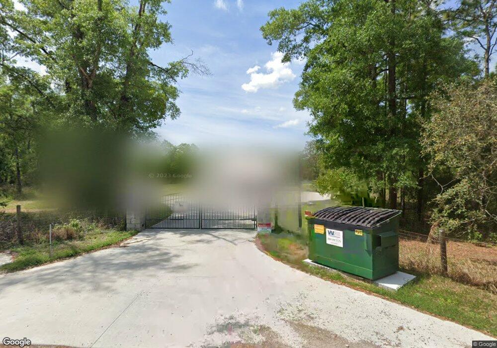
8145 B W Stevenson Rd Brooksville, FL 34613
Estimated Value: $447,000 - $648,856
3
Beds
2
Baths
1,888
Sq Ft
$269/Sq Ft
Est. Value
About This Home
This home is located at 8145 B W Stevenson Rd, Brooksville, FL 34613 and is currently estimated at $507,714, approximately $268 per square foot. 8145 B W Stevenson Rd is a home with nearby schools including Pine Grove Elementary School, Hernando High School, and West Hernando Middle School.
Ownership History
Date
Name
Owned For
Owner Type
Purchase Details
Closed on
Mar 1, 2023
Sold by
Hala Robert Thomas and Hala Danielle Nicole
Bought by
Robert Thomas Hala And Danielle Nicole Hala R
Current Estimated Value
Purchase Details
Closed on
May 17, 2020
Sold by
Hala Robert Thomas
Bought by
Hala Robert Thomas and Hala Danielle Nicole
Purchase Details
Closed on
Feb 2, 2016
Sold by
Furrow David A and Furrow Jean L
Bought by
Hala Robert Thomas
Purchase Details
Closed on
Nov 20, 2007
Sold by
Furrow David A and Furrow Lois Jean
Bought by
Furrow David A
Purchase Details
Closed on
Nov 3, 2003
Sold by
Furrow David A and Furrow Lois Jean
Bought by
Furrow David A and Furrow Lois Jean
Create a Home Valuation Report for This Property
The Home Valuation Report is an in-depth analysis detailing your home's value as well as a comparison with similar homes in the area
Home Values in the Area
Average Home Value in this Area
Purchase History
| Date | Buyer | Sale Price | Title Company |
|---|---|---|---|
| Robert Thomas Hala And Danielle Nicole Hala R | $100 | -- | |
| Hala Robert Thomas | -- | Attorney | |
| Hala Robert Thomas | $43,300 | Precision Title Suncoast Inc | |
| Furrow David A | -- | Attorney | |
| Furrow David A | -- | -- |
Source: Public Records
Tax History Compared to Growth
Tax History
| Year | Tax Paid | Tax Assessment Tax Assessment Total Assessment is a certain percentage of the fair market value that is determined by local assessors to be the total taxable value of land and additions on the property. | Land | Improvement |
|---|---|---|---|---|
| 2024 | $416 | $346,086 | -- | -- |
| 2023 | $416 | $336,006 | $0 | $0 |
| 2022 | $339 | $326,219 | $0 | $0 |
| 2021 | $339 | $316,717 | $54,880 | $261,837 |
| 2020 | $4,320 | $260,216 | $52,920 | $207,296 |
| 2019 | $4,200 | $244,696 | $48,461 | $196,235 |
| 2018 | $677 | $44,056 | $44,056 | $0 |
| 2017 | $781 | $44,056 | $44,056 | $0 |
| 2016 | $703 | $39,690 | $0 | $0 |
| 2015 | $713 | $39,690 | $0 | $0 |
| 2014 | $781 | $44,100 | $0 | $0 |
Source: Public Records
Map
Nearby Homes
- 8080 B W Stevenson Rd
- 8026 Simmons St
- 8014 Simmons St
- 0 Simmons St
- 16108 Gupton St
- 15549 Cortez Blvd Unit 266
- 8163 Winter St
- 16386 Sam C Rd
- 16254 Gupton St
- 15541 Cortez Blvd
- 8147 Cresap St
- 8270 Cresap St
- 8192 Fort Dade Ave
- 7404 Fort Dade Ave
- 8477 Foxfire Rd
- 15440 Cortez Blvd
- 7373 Fall St
- 15241 Horn Ave
- 15352 Wiscon Rd
- 000 Grove Rd
- 8024 B W Stevenson Rd
- 8137 B W Stevenson Rd
- 8148 B W Stevenson Rd
- 16208 Sam C Rd
- 15446 Wilhelm Rd
- 8140 B W Stevenson Rd
- 8144 B W Stevenson Rd
- 8100 Adrian Dr
- 8142 8142 B W Stevenson Rd
- 15402 Wilhelm Rd
- 16240 Sam C Rd
- 00 B W Stevenson Rd
- 15404 Wilhelm Rd
- 15397 Jernigan St
- 16229 Gupton St
- 8080 B W Stevenson Rd
- 8080 B W Stevenson Rd
- 16290 Sam C Rd
- 8116 Adrian Dr
- 16194 Sam C Rd
