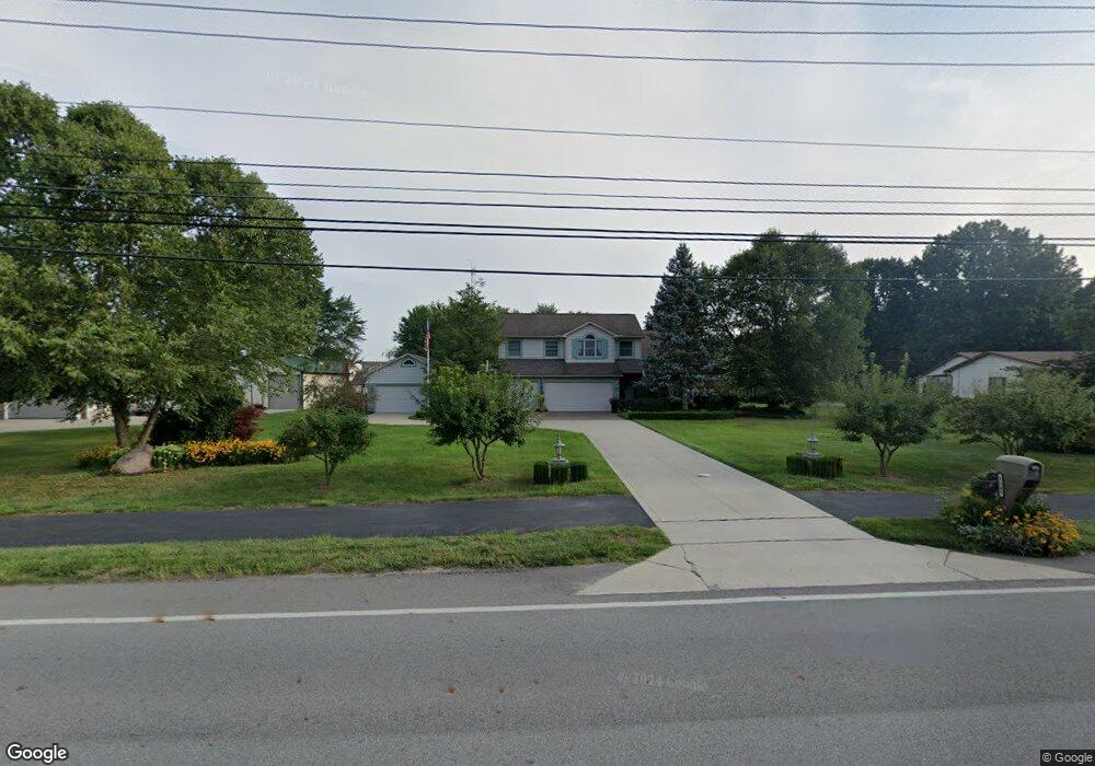
8145 Maxtown Rd Westerville, OH 43082
Genoa NeighborhoodEstimated Value: $541,172 - $593,000
3
Beds
3
Baths
2,265
Sq Ft
$249/Sq Ft
Est. Value
About This Home
This home is located at 8145 Maxtown Rd, Westerville, OH 43082 and is currently estimated at $564,793, approximately $249 per square foot. 8145 Maxtown Rd is a home located in Delaware County with nearby schools including Alcott Elementary School, Genoa Middle School, and Westerville Central High School.
Ownership History
Date
Name
Owned For
Owner Type
Purchase Details
Closed on
Sep 22, 2006
Sold by
Branson Doyal and Branson Sharon C
Bought by
Garver Robert C
Current Estimated Value
Home Financials for this Owner
Home Financials are based on the most recent Mortgage that was taken out on this home.
Original Mortgage
$100,000
Outstanding Balance
$59,759
Interest Rate
6.58%
Mortgage Type
Credit Line Revolving
Estimated Equity
$505,034
Create a Home Valuation Report for This Property
The Home Valuation Report is an in-depth analysis detailing your home's value as well as a comparison with similar homes in the area
Home Values in the Area
Average Home Value in this Area
Purchase History
| Date | Buyer | Sale Price | Title Company |
|---|---|---|---|
| Garver Robert C | $284,000 | Talon Group |
Source: Public Records
Mortgage History
| Date | Status | Borrower | Loan Amount |
|---|---|---|---|
| Open | Garver Robert C | $100,000 |
Source: Public Records
Tax History Compared to Growth
Tax History
| Year | Tax Paid | Tax Assessment Tax Assessment Total Assessment is a certain percentage of the fair market value that is determined by local assessors to be the total taxable value of land and additions on the property. | Land | Improvement |
|---|---|---|---|---|
| 2024 | $8,248 | $155,860 | $23,100 | $132,760 |
| 2023 | $8,089 | $155,860 | $23,100 | $132,760 |
| 2022 | $7,285 | $119,180 | $26,570 | $92,610 |
| 2021 | $7,358 | $119,180 | $26,570 | $92,610 |
| 2020 | $7,402 | $119,180 | $26,570 | $92,610 |
| 2019 | $6,259 | $98,390 | $23,100 | $75,290 |
| 2018 | $6,069 | $98,390 | $23,100 | $75,290 |
| 2017 | $5,944 | $96,250 | $23,100 | $73,150 |
| 2016 | $6,370 | $96,250 | $23,100 | $73,150 |
| 2015 | $6,319 | $96,250 | $23,100 | $73,150 |
| 2014 | $6,125 | $94,640 | $23,100 | $71,540 |
| 2013 | $5,720 | $89,530 | $23,100 | $66,430 |
Source: Public Records
Map
Nearby Homes
- 7568 Park Bend Ct
- 6618 Wild Rose Ln
- 1155 Ashford Ct
- 6460 Bromfield Dr
- 6611 Lake of the Woods Point
- 9119 Robinhood Cir
- 9200 Knoll Dr
- 6685 Tussic Street Rd
- 7663 Rolling Ridge Way
- 5840 Heron Ct
- 656 Olde Mill Dr
- 974 Lakeland Dr
- 5739 Mist Flower Ln
- 7268 Clancy Way
- 7581 Lanetta Ln
- 8369 Manitou Dr
- 5547 Red Bank Rd Unit Tract B
- 754 Kingsmead Rd Unit 18754
- 8818 Lindsey Ct
- 6082 Hilmar Dr
- 8191 Maxtown Rd
- 8100 Maxtown Rd
- 8156 Chateau Ln
- 8150 Chateau Ln
- 8162 Chateau Ln
- 8124 Chateau Ln
- 8060 Maxtown Rd
- 8102 Chateau Ln
- 6960 Sunbury Rd
- 8168 Chateau Ln
- 6990 Sunbury Rd
- 6930 Sunbury Rd
- 8078 Chateau Ln
- 8160 Maxtown Rd
- 8139 Chateau Ln
- 8174 Chateau Ln
- 8035 Maxtown Rd
- 8161 Chateau Ln
- 8120 Maxtown Rd
- 8194 Maxtown Rd