Estimated Value: $182,000 - $312,000
3
Beds
2
Baths
1,848
Sq Ft
$134/Sq Ft
Est. Value
About This Home
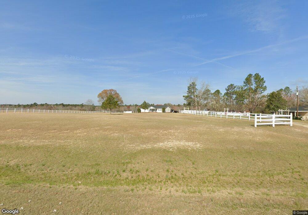
This home is located at 8146 Pinetucky Rd, Kite, GA 31049 and is currently estimated at $248,012, approximately $134 per square foot. 8146 Pinetucky Rd is a home located in Emanuel County with nearby schools including Swainsboro Primary School, Swainsboro Elementary School, and Swainsboro Middle School.
Ownership History
Date
Name
Owned For
Owner Type
Purchase Details
Closed on
Aug 29, 2023
Sold by
Lee Holly N
Bought by
Mcdaniel Mason Ashley and Grable Mason Robert
Current Estimated Value
Home Financials for this Owner
Home Financials are based on the most recent Mortgage that was taken out on this home.
Original Mortgage
$235,653
Outstanding Balance
$230,803
Interest Rate
7.12%
Mortgage Type
FHA
Estimated Equity
$17,209
Purchase Details
Closed on
Mar 22, 2001
Sold by
Hood Robert L
Bought by
Lee Timothy E and Lee Holl
Create a Home Valuation Report for This Property
The Home Valuation Report is an in-depth analysis detailing your home's value as well as a comparison with similar homes in the area
Home Values in the Area
Average Home Value in this Area
Purchase History
| Date | Buyer | Sale Price | Title Company |
|---|---|---|---|
| Mcdaniel Mason Ashley | $240,000 | -- | |
| Lee Timothy E | -- | -- |
Source: Public Records
Mortgage History
| Date | Status | Borrower | Loan Amount |
|---|---|---|---|
| Open | Mcdaniel Mason Ashley | $235,653 |
Source: Public Records
Tax History Compared to Growth
Tax History
| Year | Tax Paid | Tax Assessment Tax Assessment Total Assessment is a certain percentage of the fair market value that is determined by local assessors to be the total taxable value of land and additions on the property. | Land | Improvement |
|---|---|---|---|---|
| 2024 | $1,779 | $64,120 | $2,433 | $61,687 |
| 2023 | $1,025 | $54,680 | $1,912 | $52,769 |
| 2022 | $1,329 | $49,949 | $1,912 | $48,037 |
| 2021 | $1,272 | $46,931 | $1,738 | $45,193 |
| 2020 | $1,451 | $50,677 | $3,621 | $47,056 |
| 2019 | $1,442 | $50,677 | $3,621 | $47,056 |
| 2018 | $1,458 | $50,677 | $3,621 | $47,056 |
| 2017 | $1,413 | $49,015 | $3,621 | $45,394 |
| 2016 | $1,356 | $49,015 | $3,621 | $45,394 |
| 2015 | -- | $49,016 | $3,621 | $45,394 |
| 2014 | -- | $48,127 | $3,621 | $44,506 |
| 2013 | -- | $46,692 | $3,612 | $43,080 |
Source: Public Records
Map
Nearby Homes
- 0 Bird Flanders Rd Unit 10628445
- 0 Bird Flanders Rd Unit 25276071
- 0 Asa Lindsey Rd Unit 10595336
- 55 Hatcher St
- 2195 Montgomery St
- 22 Jl Price Rd
- 53 Averett St
- 151 Brantley Midas Rd
- 0 Cow Ford Bridge Rd Unit 10535184
- 0 Cow Ford Bridge Rd Unit 24270147
- 0 Old Wadley Rd Unit TRACT 9
- 0 Old Wadley Rd Unit TRACT 7
- 0 Old Wadley Rd Unit TRACT 10
- 1000 May Rd
- 0 Jukes Rd Unit 25298826
- 1 Hawhammock Church Rd
- 0 Shepard Rd
- 143 Atkinson Dr
- 3004 Pollett Rd
- 154 Bobby Fortner Rd
- 8142 Pinetucky Rd
- 8170 Pinetucky Rd
- 8178 Pinetucky Rd
- 8098 Pinetucky Rd
- 8212 Pinetucky Rd
- 8225 Pinetucky Rd
- 8225 Pinetucky Rd
- 8214 Pinetucky Rd
- 8050 Pinetucky Rd
- 20 Talmadge Rd
- 84 Talmadge Rd
- 84 Talmadge Rd
- 56 Talmadge Rd
- 8045 Pinetucky Rd
- 8282 Pinetucky Rd
- 8281 Pinetucky Rd
- 388 Oak Chapel Rd
- 822 Chandler Rd
- 876 Chandler Rd
- 898 Chandler Rd