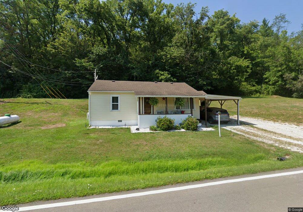
8147 State Route 775 Scottown, OH 45678
Estimated Value: $75,000 - $140,000
2
Beds
1
Bath
824
Sq Ft
$126/Sq Ft
Est. Value
About This Home
This home is located at 8147 State Route 775, Scottown, OH 45678 and is currently estimated at $104,027, approximately $126 per square foot. 8147 State Route 775 is a home located in Lawrence County with nearby schools including Symmes Valley Elementary School and Symmes Valley High School.
Ownership History
Date
Name
Owned For
Owner Type
Purchase Details
Closed on
May 18, 2017
Sold by
Christian Roger and Christian Jackie
Bought by
Jewell Melissa L
Current Estimated Value
Home Financials for this Owner
Home Financials are based on the most recent Mortgage that was taken out on this home.
Original Mortgage
$40,000
Outstanding Balance
$7,814
Interest Rate
3.97%
Mortgage Type
New Conventional
Estimated Equity
$96,213
Purchase Details
Closed on
Feb 24, 2017
Sold by
Graham Paul F and Graham Jacqueline E
Bought by
Christian Roger and Christian Jackie
Purchase Details
Closed on
Aug 25, 2003
Sold by
Smith Leona B
Bought by
Smith Leona B Life Est R
Create a Home Valuation Report for This Property
The Home Valuation Report is an in-depth analysis detailing your home's value as well as a comparison with similar homes in the area
Home Values in the Area
Average Home Value in this Area
Purchase History
| Date | Buyer | Sale Price | Title Company |
|---|---|---|---|
| Jewell Melissa L | $39,900 | None Available | |
| Christian Roger | $8,000 | None Available | |
| Smith Leona B Life Est R | $3,500 | -- |
Source: Public Records
Mortgage History
| Date | Status | Borrower | Loan Amount |
|---|---|---|---|
| Open | Jewell Melissa L | $40,000 |
Source: Public Records
Tax History Compared to Growth
Tax History
| Year | Tax Paid | Tax Assessment Tax Assessment Total Assessment is a certain percentage of the fair market value that is determined by local assessors to be the total taxable value of land and additions on the property. | Land | Improvement |
|---|---|---|---|---|
| 2024 | -- | $16,230 | $3,170 | $13,060 |
| 2023 | $472 | $16,230 | $3,170 | $13,060 |
| 2022 | $470 | $16,230 | $3,170 | $13,060 |
| 2021 | $436 | $15,240 | $3,000 | $12,240 |
| 2020 | $451 | $15,240 | $3,000 | $12,240 |
| 2019 | $474 | $15,240 | $3,000 | $12,240 |
| 2018 | $468 | $14,910 | $2,940 | $11,970 |
| 2017 | $480 | $14,910 | $2,940 | $11,970 |
| 2016 | $186 | $14,910 | $2,940 | $11,970 |
| 2015 | $126 | $12,760 | $2,930 | $9,830 |
| 2014 | $126 | $12,760 | $2,930 | $9,830 |
| 2013 | $126 | $12,760 | $2,930 | $9,830 |
Source: Public Records
Map
Nearby Homes
- 00 Ohio 217
- 0 Ohio 217
- 11904 State Route 217
- 120 County Road 408
- 4754 County Road 36
- 2255 County Road 66
- 2202 County Road 66
- 0 County Road 12
- 1334 Township Road 214th N
- 1334 McKinney Creek-Hesson Hollow Rd N
- 190 Township Rd
- 810 Township Road 141
- 477 Township Road 88
- 15 Private Dr
- 79 Private Dr
- 123 Private Dr
- 181 Private Road 3954
- 0 Township Road 1057 Unit 182524
- 1805 Long Creek Rd E
- State Route 790
- 8055 State Route 775
- 2008 Township Road 223
- 7723 State Route 775
- 548 County Road 121
- 48 Pvt Dr 701 County Road 121
- Reeves Creek Rd
- 7607 State Route 775
- 670 County Road 121
- 735 County Road 121
- 2103 Township Road 223
- 1763 County Road 171
- 1815 County Road 171
- 8931 State Route 775
- 1770 County Road 171
- 1818 County Road 171
- 1698 County Road 171
- 882 County Road 121
- 937 County Road 121
- 2255 County Road 171
- 0 County Road 121