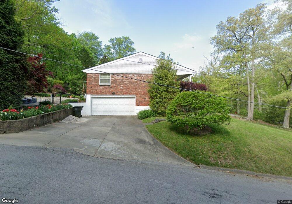
815 Captain Frank Rd New Albany, IN 47150
Estimated Value: $333,000 - $404,000
4
Beds
3
Baths
2,390
Sq Ft
$157/Sq Ft
Est. Value
About This Home
This home is located at 815 Captain Frank Rd, New Albany, IN 47150 and is currently estimated at $374,949, approximately $156 per square foot. 815 Captain Frank Rd is a home located in Floyd County with nearby schools including Green Valley Elementary School, Nathaniel Scribner Middle School, and New Albany Senior High School.
Ownership History
Date
Name
Owned For
Owner Type
Purchase Details
Closed on
Dec 22, 2010
Sold by
Stone Reid D
Bought by
Stone Reid D and Cornett Mary A
Current Estimated Value
Home Financials for this Owner
Home Financials are based on the most recent Mortgage that was taken out on this home.
Original Mortgage
$142,000
Outstanding Balance
$94,861
Interest Rate
4.44%
Mortgage Type
New Conventional
Estimated Equity
$280,088
Purchase Details
Closed on
Mar 9, 2007
Sold by
Bell Linda B
Bought by
Stone Reld D
Home Financials for this Owner
Home Financials are based on the most recent Mortgage that was taken out on this home.
Original Mortgage
$137,200
Interest Rate
6.27%
Mortgage Type
New Conventional
Create a Home Valuation Report for This Property
The Home Valuation Report is an in-depth analysis detailing your home's value as well as a comparison with similar homes in the area
Home Values in the Area
Average Home Value in this Area
Purchase History
| Date | Buyer | Sale Price | Title Company |
|---|---|---|---|
| Stone Reid D | -- | None Available | |
| Stone Reld D | -- | First American Titel Ins Co |
Source: Public Records
Mortgage History
| Date | Status | Borrower | Loan Amount |
|---|---|---|---|
| Open | Stone Reid D | $142,000 | |
| Closed | Stone Reld D | $137,200 |
Source: Public Records
Tax History Compared to Growth
Tax History
| Year | Tax Paid | Tax Assessment Tax Assessment Total Assessment is a certain percentage of the fair market value that is determined by local assessors to be the total taxable value of land and additions on the property. | Land | Improvement |
|---|---|---|---|---|
| 2024 | $1,769 | $167,700 | $21,400 | $146,300 |
| 2023 | $1,809 | $171,000 | $21,400 | $149,600 |
| 2022 | $1,835 | $172,700 | $21,400 | $151,300 |
| 2021 | $1,718 | $160,800 | $21,400 | $139,400 |
| 2020 | $1,721 | $160,800 | $21,400 | $139,400 |
| 2019 | $1,722 | $160,800 | $21,400 | $139,400 |
| 2018 | $2,173 | $200,600 | $21,400 | $179,200 |
| 2017 | $1,797 | $164,200 | $21,400 | $142,800 |
| 2016 | $1,626 | $162,600 | $21,400 | $141,200 |
| 2014 | $1,540 | $154,000 | $21,400 | $132,600 |
| 2013 | -- | $149,700 | $21,400 | $128,300 |
Source: Public Records
Map
Nearby Homes
- 810 Katie Lane (Lot 10)
- 1519 Valley View Rd
- 6 Valley View Ct
- 2318 Coyle Dr
- 929 Valley View Rd
- 917 Valley View Rd
- 911 Cherry St
- 420 Sherley St
- 201 Virginia Ct
- 1202 Naghel St
- 3608 Sunset Ridge Ct
- 3605 Sunset Ridge Ct
- 3607 Sunset Ridge Ct
- 2703 Clearstream Ct
- 1107 Griffin St
- 131 Olive Ave
- 301 Amburgey Dr
- 301 Country Club Dr
- 1414 Knob Ave
- 3632 Woodland Lakes Dr
- 831 Captain Frank Rd
- 813 Captain Frank Rd
- 901 Captain Frank Rd
- 811 Captain Frank Rd
- 914 Oakland Ct
- 905 Wildwood Ln
- 809 Captain Frank Rd
- 918 Oakland Ct
- 915 Oakland Ct
- 913 Oakland Dr
- 807 Captain Frank Rd
- 900 Wildwood Ln
- 913 Captain Frank Rd
- 902 Wildwood Ln
- 916 Oakland Dr
- 915 Oakland Dr
- 919 Oakland Ct
- 922 Oakland Ct
- 805 Captain Frank Rd
- 919 Captain Frank Rd