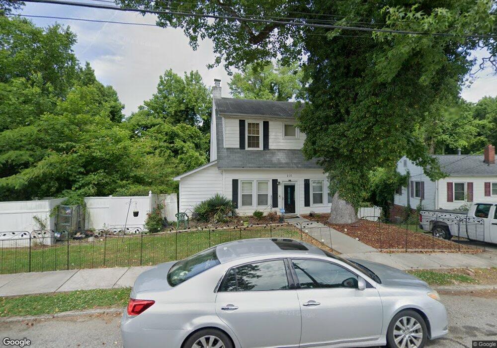
815 Circle Dr High Point, NC 27262
Greater High Point NeighborhoodEstimated Value: $160,740 - $186,000
3
Beds
1
Bath
1,408
Sq Ft
$120/Sq Ft
Est. Value
About This Home
This home is located at 815 Circle Dr, High Point, NC 27262 and is currently estimated at $168,935, approximately $119 per square foot. 815 Circle Dr is a home located in Guilford County with nearby schools including Kirkman Park Elementary School, Penn-Griffin School for the Arts, and T.W. Andrews High School.
Ownership History
Date
Name
Owned For
Owner Type
Purchase Details
Closed on
Jul 17, 1998
Sold by
City Of High Point
Bought by
Crawford Geraldine Phelps
Current Estimated Value
Home Financials for this Owner
Home Financials are based on the most recent Mortgage that was taken out on this home.
Original Mortgage
$56,400
Outstanding Balance
$11,512
Interest Rate
6.97%
Estimated Equity
$157,423
Create a Home Valuation Report for This Property
The Home Valuation Report is an in-depth analysis detailing your home's value as well as a comparison with similar homes in the area
Home Values in the Area
Average Home Value in this Area
Purchase History
| Date | Buyer | Sale Price | Title Company |
|---|---|---|---|
| Crawford Geraldine Phelps | -- | -- |
Source: Public Records
Mortgage History
| Date | Status | Borrower | Loan Amount |
|---|---|---|---|
| Open | Crawford Geraldine Phelps | $56,400 | |
| Closed | Crawford Geraldine Phelps | $10,000 |
Source: Public Records
Tax History
| Year | Tax Paid | Tax Assessment Tax Assessment Total Assessment is a certain percentage of the fair market value that is determined by local assessors to be the total taxable value of land and additions on the property. | Land | Improvement |
|---|---|---|---|---|
| 2025 | $1,167 | $84,700 | $22,000 | $62,700 |
| 2024 | $1,167 | $84,700 | $22,000 | $62,700 |
| 2023 | $1,167 | $84,700 | $22,000 | $62,700 |
| 2022 | $1,142 | $84,700 | $22,000 | $62,700 |
| 2021 | $774 | $56,200 | $10,000 | $46,200 |
| 2020 | $774 | $56,200 | $10,000 | $46,200 |
| 2019 | $774 | $56,200 | $0 | $0 |
| 2018 | $771 | $56,200 | $0 | $0 |
| 2017 | $774 | $56,200 | $0 | $0 |
| 2016 | $858 | $61,200 | $0 | $0 |
| 2015 | $863 | $61,200 | $0 | $0 |
| 2014 | $878 | $61,200 | $0 | $0 |
Source: Public Records
Map
Nearby Homes
- 828 Circle Dr
- 1012 Meadowbrook Blvd
- 1308 Boundary Ave
- 1519 Mcguinn Dr
- 1120 Carolina St
- 1508 Boundary Ave
- 1604 E Lexington Ave
- 1602 Boundary Ave
- 1604 Boundary Ave
- 1606 Boundary Ave
- 1445 Bailey Cir
- 837 Willow Place
- 844 Willow Place
- 702 E Farriss Ave
- 1509 & 1511 Wiltshire St
- 1506 East Ave
- 1504 East Ave
- 2209 Gable Way
- 501 4th St
- 916 Forrest St
Your Personal Tour Guide
Ask me questions while you tour the home.