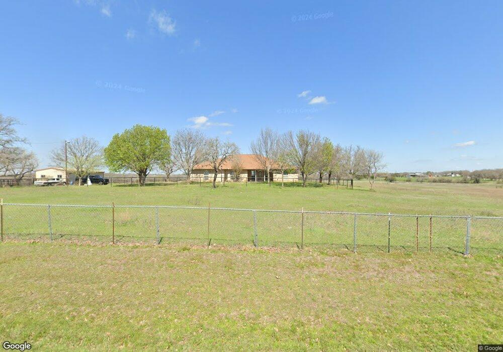
815 Dean Rd Weatherford, TX 76087
Estimated Value: $425,000 - $605,721
3
Beds
2
Baths
2,134
Sq Ft
$242/Sq Ft
Est. Value
About This Home
This home is located at 815 Dean Rd, Weatherford, TX 76087 and is currently estimated at $515,361, approximately $241 per square foot. 815 Dean Rd is a home located in Parker County with nearby schools including Wright Elementary School, Hall Middle School, and Weatherford High School.
Ownership History
Date
Name
Owned For
Owner Type
Purchase Details
Closed on
Apr 19, 2013
Sold by
Neyland Laverne M
Bought by
Zamarron Richard and Zamarron Rhonda
Current Estimated Value
Home Financials for this Owner
Home Financials are based on the most recent Mortgage that was taken out on this home.
Original Mortgage
$185,000
Outstanding Balance
$131,057
Interest Rate
3.55%
Mortgage Type
Purchase Money Mortgage
Estimated Equity
$384,304
Purchase Details
Closed on
Jun 1, 1999
Bought by
Zamarron Richard and Zamarron Rhonda
Purchase Details
Closed on
Jan 3, 1997
Bought by
Zamarron Richard and Zamarron Rhonda
Purchase Details
Closed on
Jan 1, 1901
Bought by
Zamarron Richard and Zamarron Rhonda
Create a Home Valuation Report for This Property
The Home Valuation Report is an in-depth analysis detailing your home's value as well as a comparison with similar homes in the area
Home Values in the Area
Average Home Value in this Area
Purchase History
| Date | Buyer | Sale Price | Title Company |
|---|---|---|---|
| Zamarron Richard | -- | None Available | |
| Zamarron Richard | -- | -- | |
| Zamarron Richard | -- | -- | |
| Zamarron Richard | -- | -- |
Source: Public Records
Mortgage History
| Date | Status | Borrower | Loan Amount |
|---|---|---|---|
| Open | Zamarron Richard | $185,000 |
Source: Public Records
Tax History Compared to Growth
Tax History
| Year | Tax Paid | Tax Assessment Tax Assessment Total Assessment is a certain percentage of the fair market value that is determined by local assessors to be the total taxable value of land and additions on the property. | Land | Improvement |
|---|---|---|---|---|
| 2025 | $4,278 | $314,058 | -- | -- |
| 2024 | $4,278 | $275,671 | -- | -- |
| 2023 | $4,278 | $250,610 | $0 | $0 |
| 2022 | $5,054 | $227,830 | $42,950 | $184,880 |
| 2021 | $5,471 | $227,830 | $42,950 | $184,880 |
| 2020 | $5,145 | $215,960 | $31,080 | $184,880 |
| 2019 | $4,943 | $215,960 | $31,080 | $184,880 |
| 2018 | $4,514 | $175,980 | $24,170 | $151,810 |
| 2017 | $4,630 | $175,980 | $24,170 | $151,810 |
| 2016 | $4,383 | $168,330 | $19,230 | $149,100 |
| 2015 | $3,532 | $168,330 | $19,230 | $149,100 |
| 2014 | $3,247 | $137,650 | $14,980 | $122,670 |
Source: Public Records
Map
Nearby Homes
- 1252 Kerrville Ln
- 2344 Briscoe Ranch Dr
- 2416 Waggoner Ranch Dr
- 2381 Waggoner Ranch Dr
- 2361 Waggoner Ranch Dr
- TBD Old Brock Rd
- 1036 Deer Valley Dr
- 1220 Scott Dr
- 2532 Hadley St
- 2533 Hadley St
- 206 Scarlett Rd
- 2209 Caroline Dr
- 909 Jodie Dr
- 3380 Westridge Dr Unit B
- 3380 Westridge Dr
- 3380 Westridge Dr Unit C
- 914 Randall Rd
- 3180 Old Brock Rd
- 825 Jodie Dr
- 1031 Estancia Blvd
- 131 Hansma Way
- 2633 Old Dennis Rd
- 2611 Old Dennis Rd
- 701 Dean Rd
- 701B Dean Rd
- 701A Dean Rd
- TBD (A) Dean Rd
- TBD Dean Rd
- 102 Shady Oak Dr
- 2612 Old Dennis Rd
- 200 Shady Oak Dr
- 250 Shady Oak Dr
- 197 Shady Oak Dr
- 350 Shady Oak Dr
- 2539 Old Dennis Rd
- 2532 Old Dennis Rd
- 155 Shady Oak Ct
- 0 S Dean Rd Unit 240358
- 186 Shady Oak Ct
- 2436 Old Dennis Rd