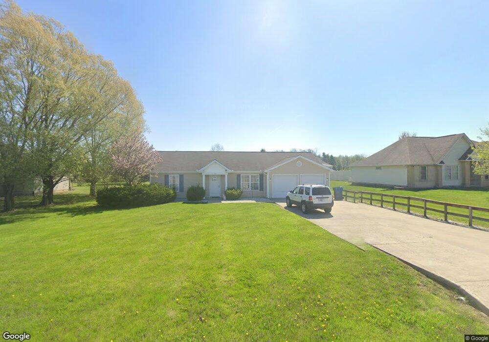
815 S Main St Sweetser, IN 46987
Estimated Value: $173,000 - $230,000
3
Beds
2
Baths
1,549
Sq Ft
$133/Sq Ft
Est. Value
About This Home
This home is located at 815 S Main St, Sweetser, IN 46987 and is currently estimated at $205,290, approximately $132 per square foot. 815 S Main St is a home with nearby schools including Converse Elementary School, Sweetser Elementary School, and Oak Hill Junior High School.
Ownership History
Date
Name
Owned For
Owner Type
Purchase Details
Closed on
Jan 16, 2024
Sold by
Hill Oxford Three Llc
Bought by
Hill Oxford Five Llc
Current Estimated Value
Home Financials for this Owner
Home Financials are based on the most recent Mortgage that was taken out on this home.
Original Mortgage
$17,102,000
Outstanding Balance
$13,748,240
Interest Rate
6.95%
Mortgage Type
New Conventional
Estimated Equity
-$13,542,950
Purchase Details
Closed on
Aug 17, 2022
Sold by
Property Development Company Four Llc
Bought by
Hill Oxford Three Llc
Purchase Details
Closed on
Mar 31, 2003
Sold by
Not Provided
Bought by
Not Provided
Create a Home Valuation Report for This Property
The Home Valuation Report is an in-depth analysis detailing your home's value as well as a comparison with similar homes in the area
Home Values in the Area
Average Home Value in this Area
Purchase History
| Date | Buyer | Sale Price | Title Company |
|---|---|---|---|
| Hill Oxford Five Llc | -- | None Listed On Document | |
| Hill Oxford Three Llc | -- | -- | |
| Not Provided | $16,500 | -- |
Source: Public Records
Mortgage History
| Date | Status | Borrower | Loan Amount |
|---|---|---|---|
| Open | Hill Oxford Five Llc | $17,102,000 |
Source: Public Records
Tax History Compared to Growth
Tax History
| Year | Tax Paid | Tax Assessment Tax Assessment Total Assessment is a certain percentage of the fair market value that is determined by local assessors to be the total taxable value of land and additions on the property. | Land | Improvement |
|---|---|---|---|---|
| 2024 | $1,382 | $144,000 | $30,200 | $113,800 |
| 2023 | $2,095 | $137,400 | $30,200 | $107,200 |
| 2022 | $2,359 | $129,400 | $24,900 | $104,500 |
| 2021 | $2,209 | $118,200 | $24,900 | $93,300 |
| 2020 | $1,968 | $112,900 | $23,500 | $89,400 |
| 2019 | $1,909 | $114,000 | $23,500 | $90,500 |
| 2018 | $1,711 | $104,700 | $19,600 | $85,100 |
| 2017 | $1,567 | $101,100 | $19,600 | $81,500 |
| 2016 | $1,527 | $102,000 | $19,600 | $82,400 |
| 2014 | $1,561 | $110,900 | $19,600 | $91,300 |
| 2013 | $1,561 | $108,000 | $19,600 | $88,400 |
Source: Public Records
Map
Nearby Homes
- 203 Eagle Dr
- 0 Pennsylvania Ave
- 110 Greenberry St
- 218 Greenberry St
- 119 Short St
- 514 Allen Dr
- 105 Peterson Dr
- 5292 W Delphi Pike
- 638 Laura Ln
- 1252 S 600 W
- 804 Alabama Ct
- 2348 W 9th St
- 2376 W Kem Rd
- 2218 Crystal Dr Unit 11
- 502 N Lenfesty Ave
- 303 S Lenfesty Ave
- 304 N Norton Ave
- 2010 W Wilno Dr
- 2200 W 2nd St
- 607 N Farlook Dr