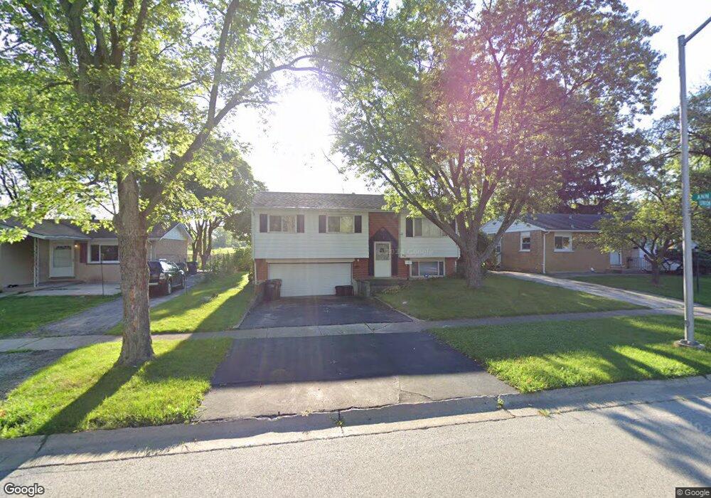
815 Union Dr University Park, IL 60484
Estimated Value: $159,298 - $222,000
--
Bed
1
Bath
1,790
Sq Ft
$113/Sq Ft
Est. Value
About This Home
This home is located at 815 Union Dr, University Park, IL 60484 and is currently estimated at $201,825, approximately $112 per square foot. 815 Union Dr is a home located in Will County with nearby schools including Crete Elementary School, Crete-Monee Middle School, and Crete-Monee High School.
Ownership History
Date
Name
Owned For
Owner Type
Purchase Details
Closed on
Nov 28, 2014
Sold by
Mithcell Helen C
Bought by
Chicago Title Land Trust Company and Trust #8002361851
Current Estimated Value
Purchase Details
Closed on
May 2, 2013
Sold by
Chicago Title Land Trust Company
Bought by
Chicago Title Land Trust Co and Trust #8002361851
Purchase Details
Closed on
Sep 10, 1996
Sold by
Hud
Bought by
Mitchell Helen C
Purchase Details
Closed on
Nov 21, 1995
Sold by
Ward Brenda B
Bought by
Hud
Create a Home Valuation Report for This Property
The Home Valuation Report is an in-depth analysis detailing your home's value as well as a comparison with similar homes in the area
Home Values in the Area
Average Home Value in this Area
Purchase History
| Date | Buyer | Sale Price | Title Company |
|---|---|---|---|
| Chicago Title Land Trust Company | -- | Chicago Title Land Trust Co | |
| Chicago Title Land Trust Co | -- | None Available | |
| Mitchell Helen C | -- | Stewart Title Company | |
| Mitchell Helen C | -- | Stewart Title Company | |
| Hud | -- | -- |
Source: Public Records
Tax History Compared to Growth
Tax History
| Year | Tax Paid | Tax Assessment Tax Assessment Total Assessment is a certain percentage of the fair market value that is determined by local assessors to be the total taxable value of land and additions on the property. | Land | Improvement |
|---|---|---|---|---|
| 2024 | $2,895 | $56,562 | $8,402 | $48,160 |
| 2023 | $2,895 | $48,760 | $7,243 | $41,517 |
| 2022 | $4,213 | $42,892 | $6,371 | $36,521 |
| 2021 | $3,844 | $39,062 | $5,852 | $33,210 |
| 2020 | $4,537 | $37,796 | $5,662 | $32,134 |
| 2019 | $4,515 | $35,842 | $5,369 | $30,473 |
| 2018 | $4,375 | $34,438 | $5,255 | $29,183 |
| 2017 | $4,213 | $32,905 | $5,138 | $27,767 |
| 2016 | $3,923 | $31,151 | $4,941 | $26,210 |
| 2015 | $2,517 | $28,470 | $4,503 | $23,967 |
| 2014 | $2,517 | $28,077 | $4,441 | $23,636 |
| 2013 | $2,517 | $29,400 | $4,650 | $24,750 |
Source: Public Records
Map
Nearby Homes
- 903 Blackhawk Dr
- 815 Blackhawk Dr
- 807 Blackhawk Dr
- 735 Union Dr
- 524 Regent Rd
- 608 Sullivan Ln
- 607 Sullivan Ln
- 1001 Blackhawk Dr
- 708 Blackhawk Dr
- 740 Mission St
- 754 Mission Dr
- 505 Barbara Ct
- 882 White Oak Ln Unit 3
- 1031 Blackhawk Dr
- 24625 S Western Ave
- 820 Sandra Dr Unit 2C
- 1109 Abbot Ln
- 1043 Ashridge Ln
- 1116 Amherst Ln
- 1061 Amherst Ln