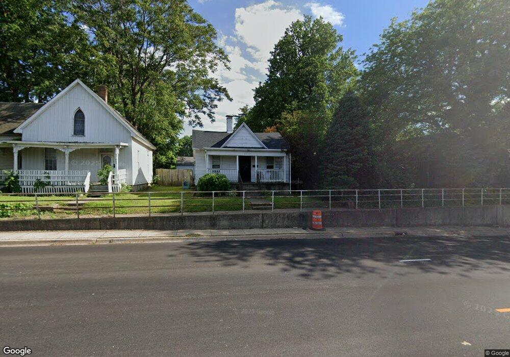
815 W Eldorado St Decatur, IL 62522
Millikin Home NeighborhoodEstimated Value: $46,347 - $56,000
--
Bed
--
Bath
1,006
Sq Ft
$51/Sq Ft
Est. Value
About This Home
This home is located at 815 W Eldorado St, Decatur, IL 62522 and is currently estimated at $50,837, approximately $50 per square foot. 815 W Eldorado St is a home located in Macon County with nearby schools including Dennis Lab School, St. Patrick School, and Teen Challenge-Home For Girls.
Ownership History
Date
Name
Owned For
Owner Type
Purchase Details
Closed on
Aug 13, 2015
Sold by
Schrishuhn Paul S
Bought by
Paul Robert L
Current Estimated Value
Home Financials for this Owner
Home Financials are based on the most recent Mortgage that was taken out on this home.
Original Mortgage
$8,800
Outstanding Balance
$6,921
Interest Rate
4.03%
Mortgage Type
Purchase Money Mortgage
Estimated Equity
$43,916
Purchase Details
Closed on
Nov 1, 1997
Create a Home Valuation Report for This Property
The Home Valuation Report is an in-depth analysis detailing your home's value as well as a comparison with similar homes in the area
Home Values in the Area
Average Home Value in this Area
Purchase History
| Date | Buyer | Sale Price | Title Company |
|---|---|---|---|
| Paul Robert L | $10,000 | None Available | |
| -- | $22,000 | -- |
Source: Public Records
Mortgage History
| Date | Status | Borrower | Loan Amount |
|---|---|---|---|
| Open | Paul Robert L | $8,800 |
Source: Public Records
Tax History Compared to Growth
Tax History
| Year | Tax Paid | Tax Assessment Tax Assessment Total Assessment is a certain percentage of the fair market value that is determined by local assessors to be the total taxable value of land and additions on the property. | Land | Improvement |
|---|---|---|---|---|
| 2024 | $757 | $13,818 | $1,783 | $12,035 |
| 2023 | $729 | $13,329 | $1,720 | $11,609 |
| 2022 | $459 | $8,310 | $1,512 | $6,798 |
| 2021 | $461 | $7,761 | $1,412 | $6,349 |
| 2020 | $477 | $7,401 | $1,347 | $6,054 |
| 2019 | $477 | $7,401 | $1,347 | $6,054 |
| 2018 | $471 | $7,425 | $1,351 | $6,074 |
| 2017 | $470 | $7,623 | $1,387 | $6,236 |
| 2016 | $474 | $7,701 | $1,401 | $6,300 |
| 2015 | $773 | $7,565 | $1,376 | $6,189 |
| 2014 | $718 | $7,490 | $1,362 | $6,128 |
| 2013 | $742 | $7,771 | $1,413 | $6,358 |
Source: Public Records
Map
Nearby Homes
- 254 N Pine St
- 958 W William St
- 609 W William St
- 875 N Monroe St
- 717 W Prairie Ave Unit 2
- 422 W William St
- 899 W Main St
- 452 W Prairie Ave
- 442 W Prairie Ave
- 1065 W Green St
- 1005 W Main St
- 233 N Edward St
- 415 W Green St
- 366 W Prairie Ave
- 330 W William St
- 657 W Wood St
- 612 W Macon St
- 844 N Edward St
- 320 W Main St
- 281 W Prairie Ave
- 809 W Eldorado St
- 831 W Eldorado St
- 807 W Eldorado St
- 803 W Eldorado St
- 801 W Eldorado St
- 865 W Eldorado St
- 834 W North St
- 842 W North St
- 830 W North St
- 824 W Eldorado St
- 755 W Eldorado St
- 448 N Pine St
- 440 N Pine St
- 745 W Eldorado St
- 430 N Pine St
- 748 W North St
- 872 W North St
- 736 W North St
- 805 W North St
- 728 W North St