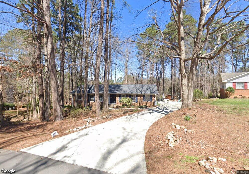
816 Duluth St Durham, NC 27705
Croasdaile NeighborhoodEstimated Value: $460,063 - $506,000
3
Beds
2
Baths
1,849
Sq Ft
$263/Sq Ft
Est. Value
About This Home
This home is located at 816 Duluth St, Durham, NC 27705 and is currently estimated at $486,016, approximately $262 per square foot. 816 Duluth St is a home located in Durham County with nearby schools including Hillandale Elementary School, George L Carrington Middle, and Riverside High School.
Ownership History
Date
Name
Owned For
Owner Type
Purchase Details
Closed on
Mar 31, 1998
Sold by
Gary Brusseau
Bought by
Hinkle Steven R and Hinkle Christi P
Current Estimated Value
Home Financials for this Owner
Home Financials are based on the most recent Mortgage that was taken out on this home.
Original Mortgage
$116,000
Outstanding Balance
$21,847
Interest Rate
7.01%
Estimated Equity
$464,169
Create a Home Valuation Report for This Property
The Home Valuation Report is an in-depth analysis detailing your home's value as well as a comparison with similar homes in the area
Home Values in the Area
Average Home Value in this Area
Purchase History
| Date | Buyer | Sale Price | Title Company |
|---|---|---|---|
| Hinkle Steven R | $145,000 | -- |
Source: Public Records
Mortgage History
| Date | Status | Borrower | Loan Amount |
|---|---|---|---|
| Open | Hinkle Steven R | $116,000 |
Source: Public Records
Tax History
| Year | Tax Paid | Tax Assessment Tax Assessment Total Assessment is a certain percentage of the fair market value that is determined by local assessors to be the total taxable value of land and additions on the property. | Land | Improvement |
|---|---|---|---|---|
| 2025 | $4,465 | $450,389 | $164,250 | $286,139 |
| 2024 | $3,438 | $246,457 | $65,610 | $180,847 |
| 2023 | $3,228 | $246,457 | $65,610 | $180,847 |
| 2022 | $3,154 | $246,457 | $65,610 | $180,847 |
| 2021 | $3,140 | $246,457 | $65,610 | $180,847 |
| 2020 | $3,066 | $246,457 | $65,610 | $180,847 |
| 2019 | $3,066 | $246,457 | $65,610 | $180,847 |
| 2018 | $3,315 | $244,404 | $43,740 | $200,664 |
| 2017 | $3,291 | $244,404 | $43,740 | $200,664 |
| 2016 | $3,180 | $244,404 | $43,740 | $200,664 |
| 2015 | $2,919 | $210,883 | $43,758 | $167,125 |
| 2014 | $2,919 | $210,883 | $43,758 | $167,125 |
Source: Public Records
Map
Nearby Homes
- 4408 Cheshire Ct
- 5 Leathers Ct
- 2708 Ferrand Dr
- 4331 Berini Dr
- 4404 Regis Ave
- 96 Sparger Springs Ln
- 208 Jefferson Dr
- 2104 Skipping Stone Dr
- 605 Blackwood Ct
- 319 Fleming Dr
- 1214 E Oak Dr
- 617 Blackwood Ct
- 621 Blackwood Ct
- 524 Soapstone Dr
- 2606 Newquay St
- 1009 Crescent Moon Ct
- 1217 Opal Ln
- 1221 Opal Ln
- 1229 Opal Ln
- 26 Quail Ridge Rd
Your Personal Tour Guide
Ask me questions while you tour the home.