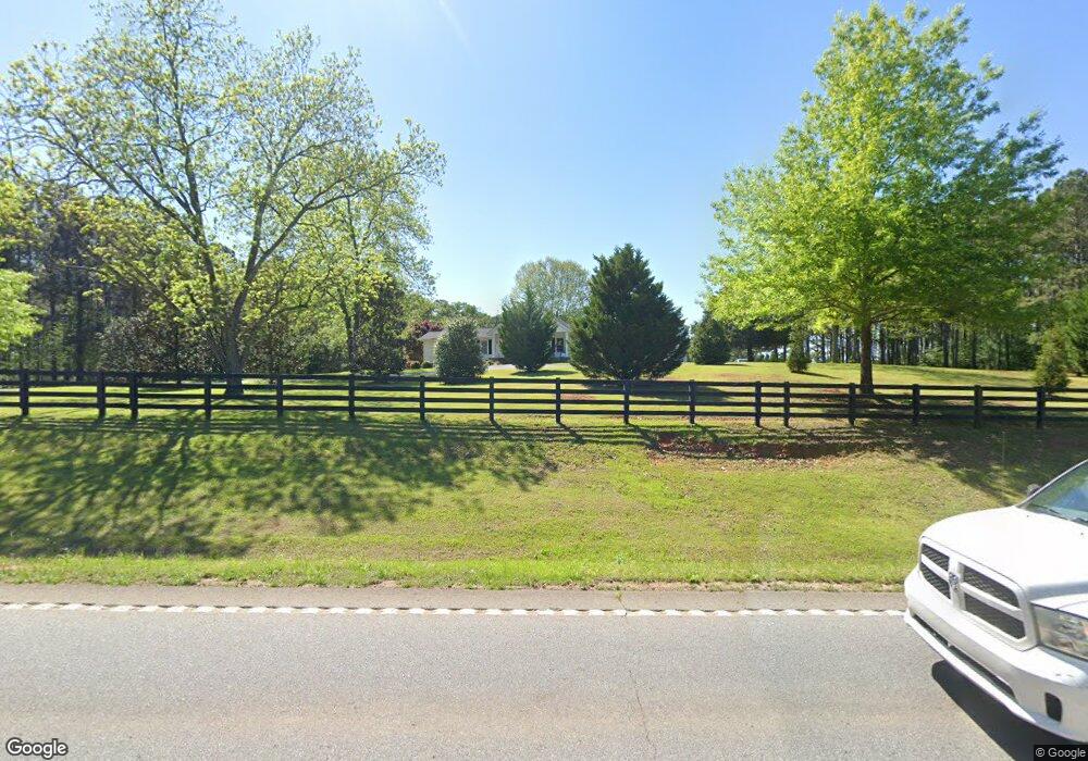
816 Highway 36 E Barnesville, GA 30204
Estimated Value: $384,000 - $572,000
3
Beds
3
Baths
2,495
Sq Ft
$177/Sq Ft
Est. Value
About This Home
This home is located at 816 Highway 36 E, Barnesville, GA 30204 and is currently estimated at $440,564, approximately $176 per square foot. 816 Highway 36 E is a home located in Lamar County with nearby schools including Lamar County Primary School, Lamar County Elementary School, and Lamar County Middle School.
Ownership History
Date
Name
Owned For
Owner Type
Purchase Details
Closed on
Aug 7, 2006
Sold by
Drake Gary T
Bought by
Drake Davis Ashley
Current Estimated Value
Purchase Details
Closed on
Apr 1, 1973
Bought by
Drake Gary T Mr and Drake Mrs
Create a Home Valuation Report for This Property
The Home Valuation Report is an in-depth analysis detailing your home's value as well as a comparison with similar homes in the area
Purchase History
| Date | Buyer | Sale Price | Title Company |
|---|---|---|---|
| Drake Davis Ashley | $119,835 | -- | |
| Drake Gary T Mr | -- | -- |
Source: Public Records
Tax History
| Year | Tax Paid | Tax Assessment Tax Assessment Total Assessment is a certain percentage of the fair market value that is determined by local assessors to be the total taxable value of land and additions on the property. | Land | Improvement |
|---|---|---|---|---|
| 2025 | $3,693 | $163,878 | $15,379 | $148,499 |
| 2024 | $3,545 | $140,418 | $15,379 | $125,039 |
| 2023 | $3,600 | $132,291 | $15,379 | $116,912 |
| 2022 | $3,292 | $121,155 | $10,543 | $110,612 |
| 2021 | $2,916 | $98,880 | $7,828 | $91,052 |
| 2020 | $2,687 | $86,781 | $7,828 | $78,953 |
| 2019 | $2,693 | $86,781 | $7,828 | $78,953 |
| 2018 | $2,586 | $86,781 | $7,828 | $78,953 |
| 2017 | $2,573 | $86,781 | $7,828 | $78,953 |
| 2016 | $2,574 | $86,781 | $7,828 | $78,953 |
| 2015 | $2,567 | $86,780 | $7,828 | $78,953 |
| 2014 | $2,488 | $86,780 | $7,828 | $78,953 |
| 2013 | -- | $86,780 | $7,827 | $78,952 |
Source: Public Records
Map
Nearby Homes
- 278 Cole Forest Blvd
- 206 Cole Forest Blvd
- 225 Cole Forest Blvd
- V L Silver Dollar Rd
- 119 Mylee Cove
- 218 City Pond Rd
- 0 Silver Dollar Rd Unit 10552561
- 0 Brinkley Rd Unit 10708515
- 0 Brinkley Rd Unit 10708713
- 0 Brinkley Rd Unit 26582523
- 0 Brinkley Rd Unit 26581581
- 233 Old 41 Hwy
- 0 Main St Unit 10711218
- 134 Belleflower Way
- 113 Heatherwood Ln
- 329 Brook Rd
- 587 Highway 41 N
- 362 Brook Rd
- 104 Savannah Way
- 0 Veterans Unit 10705095
- 103 Oak Haven Ln
- 104 Oak Haven Ln
- 111 Oak Haven Ln
- 110 Oak Haven Ln
- 117 Oak Haven Ln
- 123 Oakhaven Ln Unit 4
- 864 Highway 36 E
- 164 Oak Haven Ln
- 187 Oak Haven Ln
- 192 Oak Haven Ln
- 176 Oak Haven Ln
- 160 Oak Haven Ln
- 191 Oak Haven Ln
- 191 Oak Haven Ln Unit 14
- 784 Highway 36 E
- 131 Oakhaven Ln Unit 5
- 851 Highway 36 E
- 139 Oakhaven Ln Unit 6
- 139 Oak Haven Ln Unit 6
- 139 Oak Haven Ln
Your Personal Tour Guide
Ask me questions while you tour the home.