Estimated Value: $181,000 - $198,000
3
Beds
1
Bath
1,404
Sq Ft
$135/Sq Ft
Est. Value
About This Home
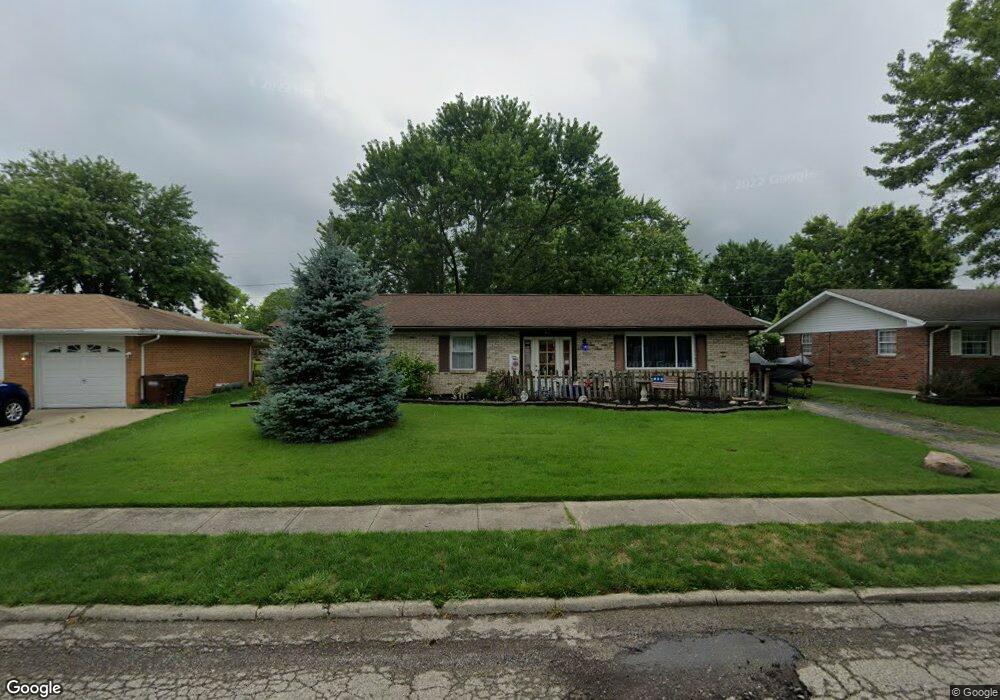
This home is located at 816 Moccasin Trail, Xenia, OH 45385 and is currently estimated at $189,456, approximately $134 per square foot. 816 Moccasin Trail is a home located in Greene County with nearby schools including Xenia High School, Summit Academy Community School for Alternative Learners - Xenia, and Legacy Christian Academy.
Ownership History
Date
Name
Owned For
Owner Type
Purchase Details
Closed on
Jul 18, 2003
Sold by
Baker Guy A and Baker Mindy J
Bought by
Vaught Jeffrey T
Current Estimated Value
Home Financials for this Owner
Home Financials are based on the most recent Mortgage that was taken out on this home.
Original Mortgage
$84,233
Outstanding Balance
$35,920
Interest Rate
5.3%
Mortgage Type
FHA
Estimated Equity
$153,536
Create a Home Valuation Report for This Property
The Home Valuation Report is an in-depth analysis detailing your home's value as well as a comparison with similar homes in the area
Home Values in the Area
Average Home Value in this Area
Purchase History
| Date | Buyer | Sale Price | Title Company |
|---|---|---|---|
| Vaught Jeffrey T | $84,900 | -- |
Source: Public Records
Mortgage History
| Date | Status | Borrower | Loan Amount |
|---|---|---|---|
| Open | Vaught Jeffrey T | $84,233 |
Source: Public Records
Tax History Compared to Growth
Tax History
| Year | Tax Paid | Tax Assessment Tax Assessment Total Assessment is a certain percentage of the fair market value that is determined by local assessors to be the total taxable value of land and additions on the property. | Land | Improvement |
|---|---|---|---|---|
| 2024 | $2,043 | $48,990 | $12,040 | $36,950 |
| 2023 | $2,043 | $48,990 | $12,040 | $36,950 |
| 2022 | $1,692 | $34,590 | $7,080 | $27,510 |
| 2021 | $1,759 | $34,590 | $7,080 | $27,510 |
| 2020 | $1,685 | $34,590 | $7,080 | $27,510 |
| 2019 | $1,744 | $33,710 | $6,880 | $26,830 |
| 2018 | $1,751 | $33,710 | $6,880 | $26,830 |
| 2017 | $1,636 | $33,710 | $6,880 | $26,830 |
| 2016 | $1,636 | $30,910 | $6,880 | $24,030 |
| 2015 | $1,641 | $30,910 | $6,880 | $24,030 |
| 2014 | $1,571 | $30,910 | $6,880 | $24,030 |
Source: Public Records
Map
Nearby Homes
- 1144 Rockwell Dr
- 1208 Bellbrook Ave
- 1272 Bellbrook Ave
- 1342 Kylemore Dr
- 1618 Navajo Dr
- 1568 Cheyenne Dr
- 1778 Arapaho Dr
- 1233 June Dr
- 1223 June Dr
- 1283 June Dr
- 1391 June Dr
- 1653 Seneca Dr
- 1769 Gayhart Dr
- 121 S Progress Dr
- 1829 Gayhart Dr
- 1866 Roxbury Dr
- 305-325 Bellbrook Ave
- 2758 Wyoming Dr
- 453 Walnut St
- 343 Sheelin Rd
- 802 Moccasin Trail
- 828 Moccasin Trail
- 821 Tomahawk Trail
- 842 Moccasin Trail
- 833 Tomahawk Trail
- 807 Tomahawk Trail
- 702 Buckskin Trail
- 690 Buckskin Trail
- 813 Moccasin Trail
- 847 Tomahawk Trail
- 678 Buckskin Trail
- 825 Moccasin Trail
- 801 Moccasin Trail
- 856 Moccasin Trail
- 839 Moccasin Trail
- 726 Buckskin Trail
- 664 Buckskin Trail
- 861 Tomahawk Trail
- 851 Moccasin Trail
- 868 Moccasin Trail