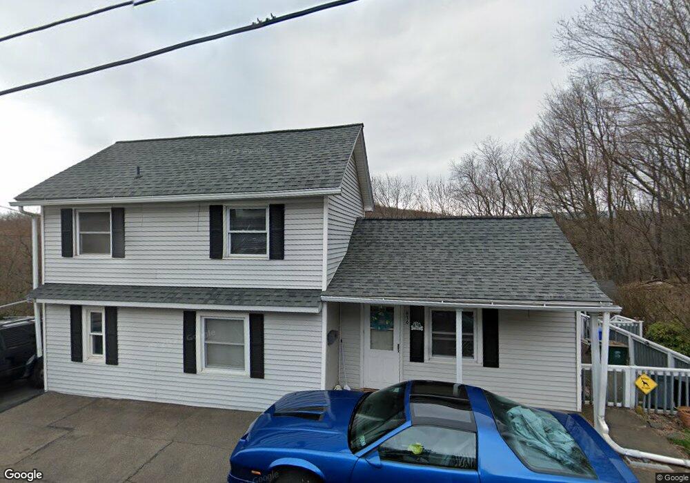
816 Rock St Archbald, PA 18403
Estimated Value: $134,000 - $161,000
5
Beds
2
Baths
1,500
Sq Ft
$97/Sq Ft
Est. Value
About This Home
This home is located at 816 Rock St, Archbald, PA 18403 and is currently estimated at $145,516, approximately $97 per square foot. 816 Rock St is a home located in Lackawanna County with nearby schools including Valley View Intermediate School, Valley View Middle School, and Valley View High School.
Ownership History
Date
Name
Owned For
Owner Type
Purchase Details
Closed on
Jul 31, 2024
Sold by
Houser Cindy
Bought by
Pachuta Alan and Williams Helen
Current Estimated Value
Home Financials for this Owner
Home Financials are based on the most recent Mortgage that was taken out on this home.
Original Mortgage
$135,500
Outstanding Balance
$133,964
Interest Rate
6.86%
Mortgage Type
FHA
Estimated Equity
$11,552
Purchase Details
Closed on
Mar 3, 2008
Sold by
Wells Fargo Bank Na
Bought by
Houser Joseph and Houser Cindy
Home Financials for this Owner
Home Financials are based on the most recent Mortgage that was taken out on this home.
Original Mortgage
$33,200
Interest Rate
5.57%
Mortgage Type
New Conventional
Purchase Details
Closed on
Apr 13, 2007
Sold by
Favola Michael A and Favola Lisa E
Bought by
Wells Fargo Bank Minnesota Na
Create a Home Valuation Report for This Property
The Home Valuation Report is an in-depth analysis detailing your home's value as well as a comparison with similar homes in the area
Home Values in the Area
Average Home Value in this Area
Purchase History
| Date | Buyer | Sale Price | Title Company |
|---|---|---|---|
| Pachuta Alan | $138,000 | None Listed On Document | |
| Houser Joseph | $41,500 | None Available | |
| Wells Fargo Bank Minnesota Na | -- | None Available |
Source: Public Records
Mortgage History
| Date | Status | Borrower | Loan Amount |
|---|---|---|---|
| Open | Pachuta Alan | $135,500 | |
| Previous Owner | Houser Joseph | $33,200 |
Source: Public Records
Tax History Compared to Growth
Tax History
| Year | Tax Paid | Tax Assessment Tax Assessment Total Assessment is a certain percentage of the fair market value that is determined by local assessors to be the total taxable value of land and additions on the property. | Land | Improvement |
|---|---|---|---|---|
| 2025 | $772 | $3,000 | $0 | $3,000 |
| 2024 | $662 | $3,000 | $0 | $3,000 |
| 2023 | $662 | $3,000 | $0 | $3,000 |
| 2022 | $641 | $3,000 | $0 | $3,000 |
| 2021 | $640 | $3,000 | $0 | $3,000 |
| 2020 | $628 | $3,000 | $0 | $3,000 |
| 2019 | $582 | $3,000 | $0 | $3,000 |
| 2018 | $572 | $3,000 | $0 | $3,000 |
| 2017 | $569 | $3,000 | $0 | $3,000 |
| 2016 | $334 | $3,000 | $0 | $0 |
| 2015 | -- | $3,000 | $0 | $0 |
| 2014 | -- | $3,000 | $0 | $0 |
Source: Public Records
Map
Nearby Homes
- 590 N Main St
- 430 Salem Rd
- 0 Forest Ln
- 112 Pine St
- 140 Cemetery St
- 217 219 Laurel St
- 00 Hickory St
- 0 Skyline Dr
- 0 Ledgewood Dr
- 818 Henry St
- 0 Joel (Lot 30) Dr
- 287 Main St Unit REAR STURGES
- 197 Columbus Dr
- 462 Delaware St
- 322 Shadow Wood Cir Unit U13
- 0 Joel (Lot 34) Dr Unit GSBSC3073
- 0 Jamie (Lot 11) Dr Unit GSBSC3086
- 0 Joel (Lot 50) Dr Unit GSBSC3078
- 0 Joel (Lot 51) Dr Unit GSBSC3079
- 192 Shadow Wood Cir