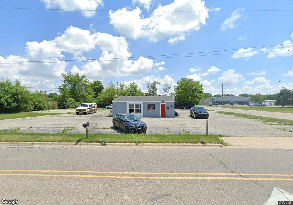
816 S Maumee St Tecumseh, MI 49286
Estimated Value: $104,915
--
Bed
--
Bath
832
Sq Ft
$126/Sq Ft
Est. Value
About This Home
This home is located at 816 S Maumee St, Tecumseh, MI 49286 and is currently estimated at $104,915, approximately $126 per square foot. 816 S Maumee St is a home located in Lenawee County with nearby schools including Tecumseh Acres Early Learning Center, Tecumseh Middle School, and Tecumseh High School.
Ownership History
Date
Name
Owned For
Owner Type
Purchase Details
Closed on
Mar 30, 2017
Sold by
Reaume Faye L and Kime Sharon L
Bought by
Hoisington Beverly M
Current Estimated Value
Home Financials for this Owner
Home Financials are based on the most recent Mortgage that was taken out on this home.
Original Mortgage
$75,015
Outstanding Balance
$62,235
Interest Rate
4.1%
Mortgage Type
Unknown
Estimated Equity
$42,680
Purchase Details
Closed on
Oct 16, 2014
Sold by
Reaume Faye L and Kime Sharon L
Bought by
Reaume Faye L and Kime Sharon L
Create a Home Valuation Report for This Property
The Home Valuation Report is an in-depth analysis detailing your home's value as well as a comparison with similar homes in the area
Home Values in the Area
Average Home Value in this Area
Purchase History
| Date | Buyer | Sale Price | Title Company |
|---|---|---|---|
| Hoisington Beverly M | $58,000 | American Title | |
| Reaume Faye L | -- | None Available |
Source: Public Records
Mortgage History
| Date | Status | Borrower | Loan Amount |
|---|---|---|---|
| Open | Hoisington Beverly M | $75,015 |
Source: Public Records
Tax History Compared to Growth
Tax History
| Year | Tax Paid | Tax Assessment Tax Assessment Total Assessment is a certain percentage of the fair market value that is determined by local assessors to be the total taxable value of land and additions on the property. | Land | Improvement |
|---|---|---|---|---|
| 2025 | $2,265 | $39,100 | $0 | $0 |
| 2024 | $2,027 | $39,600 | $0 | $0 |
| 2023 | $2,286 | $39,100 | $0 | $0 |
| 2022 | $2,302 | $39,100 | $0 | $0 |
| 2021 | $2,454 | $39,100 | $0 | $0 |
| 2020 | $2,634 | $38,900 | $0 | $0 |
| 2019 | $2,521 | $40,000 | $23,700 | $16,300 |
| 2017 | $2,333 | $42,200 | $23,700 | $18,500 |
| 2016 | $2,329 | $41,100 | $22,600 | $18,500 |
| 2014 | $1,435 | $36,500 | $18,800 | $17,700 |
Source: Public Records
Map
Nearby Homes
- 700 E Russell Rd
- 829 S Union St
- 601 S Pearl St
- 820 Waskin Dr
- 816 Waskin Dr
- 800 Waskin Dr
- 309 S Evans St
- 215 S Oneida St
- 210 S Ottawa St
- 504 Spafford St
- 102 N Maumee St
- 6988 Green Hwy
- 207 S Union St
- 799 War Bonnet Dr
- 797 War Bonnet Dr
- 6655 Gove Ct N
- 796 War Bonnet Dr
- 314 W Logan St
- 798 War Bonnet Dr
- 1006 Murray Dr
- 411 E Russell Rd
- 904 Industrial Dr
- 503 E Russell Rd
- 800 S Maumee St
- 515 E Russell Rd
- 515 E Russell Rd Unit Russell
- 209 E Russell Rd
- 514 E Russell Rd
- 905 Mill Hwy
- 803 Mill Hwy
- 909 Mill Hwy
- 915 Mill Hwy
- 919 Mill Hwy
- 906 Industrial Dr
- 923 Mill Hwy
- 3458 Green Hwy
- 927 Mill Hwy
- 404 Industrial Dr
- 805 S Evans St
- 704 Mohawk St