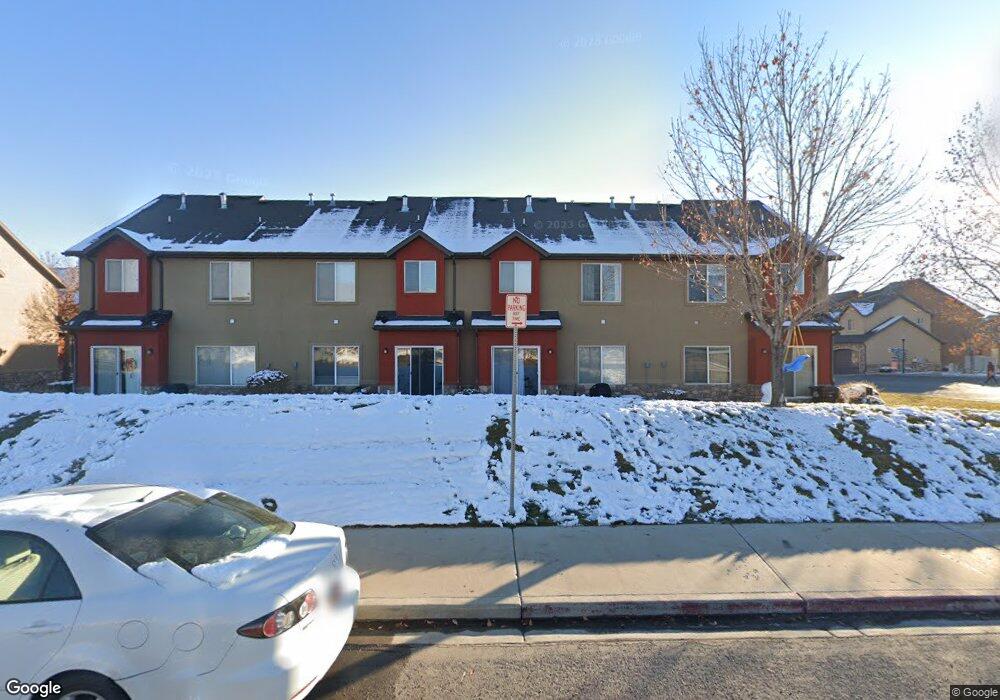
816 W 260 S Pleasant Grove, UT 84062
Estimated Value: $334,370 - $369,000
3
Beds
3
Baths
1,350
Sq Ft
$260/Sq Ft
Est. Value
About This Home
This home is located at 816 W 260 S, Pleasant Grove, UT 84062 and is currently estimated at $351,093, approximately $260 per square foot. 816 W 260 S is a home located in Utah County with nearby schools including Mount Mahogany School, Pleasant Grove Junior High School, and Pleasant Grove High School.
Ownership History
Date
Name
Owned For
Owner Type
Purchase Details
Closed on
Mar 27, 2020
Sold by
Clarke Nathan
Bought by
Lynch Devon and Lynch Maren
Current Estimated Value
Home Financials for this Owner
Home Financials are based on the most recent Mortgage that was taken out on this home.
Original Mortgage
$203,000
Outstanding Balance
$179,833
Interest Rate
3.4%
Mortgage Type
New Conventional
Estimated Equity
$171,260
Purchase Details
Closed on
May 8, 2017
Sold by
Lunt Michael Cameron and Lunt Rachel Marie
Bought by
Clarke Nathan
Home Financials for this Owner
Home Financials are based on the most recent Mortgage that was taken out on this home.
Original Mortgage
$192,060
Interest Rate
4.14%
Mortgage Type
New Conventional
Purchase Details
Closed on
Apr 28, 2009
Sold by
Pg Villas Llc
Bought by
Lunt Michael Cameron and Lunt Rachel Marie
Home Financials for this Owner
Home Financials are based on the most recent Mortgage that was taken out on this home.
Original Mortgage
$173,794
Interest Rate
4.82%
Mortgage Type
FHA
Create a Home Valuation Report for This Property
The Home Valuation Report is an in-depth analysis detailing your home's value as well as a comparison with similar homes in the area
Home Values in the Area
Average Home Value in this Area
Purchase History
| Date | Buyer | Sale Price | Title Company |
|---|---|---|---|
| Lynch Devon | -- | Us Title Insurance Agency | |
| Clarke Nathan | -- | Utah First Title Ins Ag | |
| Lunt Michael Cameron | -- | Provo Land Title Company |
Source: Public Records
Mortgage History
| Date | Status | Borrower | Loan Amount |
|---|---|---|---|
| Open | Lynch Devon | $203,000 | |
| Previous Owner | Clarke Nathan | $192,060 | |
| Previous Owner | Lunt Michael Cameron | $173,794 |
Source: Public Records
Tax History Compared to Growth
Tax History
| Year | Tax Paid | Tax Assessment Tax Assessment Total Assessment is a certain percentage of the fair market value that is determined by local assessors to be the total taxable value of land and additions on the property. | Land | Improvement |
|---|---|---|---|---|
| 2025 | $1,581 | $190,795 | $51,000 | $295,900 |
| 2024 | $1,581 | $188,485 | $0 | $0 |
| 2023 | $1,486 | $181,500 | $0 | $0 |
| 2022 | $1,558 | $189,365 | $0 | $0 |
| 2021 | $1,368 | $253,200 | $30,400 | $222,800 |
| 2020 | $1,280 | $232,300 | $27,900 | $204,400 |
| 2019 | $1,125 | $211,200 | $24,600 | $186,600 |
| 2018 | $1,043 | $185,000 | $22,200 | $162,800 |
| 2017 | $961 | $90,750 | $0 | $0 |
| 2016 | $995 | $90,750 | $0 | $0 |
| 2015 | $1,051 | $90,750 | $0 | $0 |
| 2014 | $945 | $80,850 | $0 | $0 |
Source: Public Records
Map
Nearby Homes
- 916 W 260 S
- 278 S 740 W
- 289 S 1000 W Unit 203
- 317 S 1000 W Unit 104
- 383 S 790 W
- 165 S Pleasant Blvd Unit 45
- 929 W 670 S Unit 9
- 963 W 670 S Unit 20
- 1024 W 700 S
- 123 N Romney Ln Unit 103
- 1267 W 20 S
- 1249 W Cambria Dr Unit 101
- 163 N Allenhurst St
- 169 W 200 S
- 1512 W 50 N
- 312 N 440 W
- 1559 W 50 N
- 1542 W 110 N
- 1130 W State Rd
- 1584 W 110 N