Estimated Value: $1,598,000 - $2,448,000
6
Beds
6
Baths
7,363
Sq Ft
$268/Sq Ft
Est. Value
About This Home
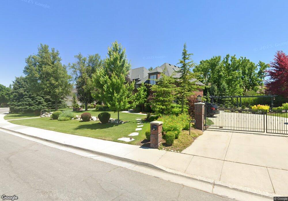
This home is located at 8161 S Farm Brook Way, Sandy, UT 84093 and is currently estimated at $1,974,629, approximately $268 per square foot. 8161 S Farm Brook Way is a home located in Salt Lake County with nearby schools including Brookwood Elementary School, Albion Middle School, and Brighton High School.
Ownership History
Date
Name
Owned For
Owner Type
Purchase Details
Closed on
Dec 31, 2024
Sold by
Derek Edwin Brown Trust and Brown Derek Edwin
Bought by
Crescendo Capital Trust and Lambert
Current Estimated Value
Purchase Details
Closed on
May 17, 2023
Sold by
Brown Derek
Bought by
Derek Edwin Brown Trust
Home Financials for this Owner
Home Financials are based on the most recent Mortgage that was taken out on this home.
Original Mortgage
$600,000
Interest Rate
6.28%
Mortgage Type
Credit Line Revolving
Purchase Details
Closed on
Apr 27, 2020
Sold by
Brown Derek and De Azevedo Emille
Bought by
Brown Derek Edwin and The Derek Edwin Brown Trust
Purchase Details
Closed on
Sep 12, 2008
Sold by
Brown Derek Edwin
Bought by
Deazevedo Emilie Colleen and Emilie Colleen De Azevedo Trust
Purchase Details
Closed on
Feb 8, 2007
Sold by
Brown Derek E and De Azevedo Emilie Colleen
Bought by
The Derek Edwin Brown Trust
Home Financials for this Owner
Home Financials are based on the most recent Mortgage that was taken out on this home.
Original Mortgage
$250,000
Interest Rate
6.17%
Mortgage Type
New Conventional
Purchase Details
Closed on
Sep 27, 2005
Sold by
Brown Derek E and Brown Emilie De Azevedo
Bought by
The Derek Edwin Brown Trust
Home Financials for this Owner
Home Financials are based on the most recent Mortgage that was taken out on this home.
Original Mortgage
$650,000
Interest Rate
5.87%
Mortgage Type
Unknown
Purchase Details
Closed on
Sep 26, 2005
Sold by
Wells Lesa M
Bought by
Brown Derek E and Brown Emilie De Azevedo
Home Financials for this Owner
Home Financials are based on the most recent Mortgage that was taken out on this home.
Original Mortgage
$650,000
Interest Rate
5.87%
Mortgage Type
Unknown
Purchase Details
Closed on
Mar 29, 1995
Sold by
Wells Brad C and Wells Lesa M
Bought by
Wells Lesa M
Purchase Details
Closed on
Nov 29, 1993
Sold by
Crosland Craig and Crosland Bonnie M
Bought by
Wells Brad C and Wells Lesa M
Home Financials for this Owner
Home Financials are based on the most recent Mortgage that was taken out on this home.
Original Mortgage
$88,200
Interest Rate
6.74%
Create a Home Valuation Report for This Property
The Home Valuation Report is an in-depth analysis detailing your home's value as well as a comparison with similar homes in the area
Home Values in the Area
Average Home Value in this Area
Purchase History
| Date | Buyer | Sale Price | Title Company |
|---|---|---|---|
| Crescendo Capital Trust | -- | None Listed On Document | |
| Crescendo Capital Trust | -- | None Listed On Document | |
| Derek Edwin Brown Trust | -- | Meridian Title Company | |
| Brown Derek | -- | Meridian Title Company | |
| Brown Derek Edwin | -- | Highland Title Agency | |
| Deazevedo Emilie Colleen | -- | None Available | |
| The Derek Edwin Brown Trust | -- | Accommodation | |
| Brown Derek E | -- | Premier Title Ins Agency | |
| The Derek Edwin Brown Trust | -- | Landmark Title | |
| Brown Derek E | -- | Landmark Title | |
| Wells Lesa M | -- | -- | |
| Wells Brad C | -- | Title One |
Source: Public Records
Mortgage History
| Date | Status | Borrower | Loan Amount |
|---|---|---|---|
| Previous Owner | Brown Derek | $600,000 | |
| Previous Owner | The Derek Edwin Brown Trust | $250,000 | |
| Previous Owner | Brown Derek E | $650,000 | |
| Previous Owner | Wells Brad C | $88,200 |
Source: Public Records
Tax History Compared to Growth
Tax History
| Year | Tax Paid | Tax Assessment Tax Assessment Total Assessment is a certain percentage of the fair market value that is determined by local assessors to be the total taxable value of land and additions on the property. | Land | Improvement |
|---|---|---|---|---|
| 2025 | $6,980 | $1,447,700 | $491,700 | $956,000 |
| 2024 | $6,980 | $1,334,300 | $452,100 | $882,200 |
| 2023 | $7,032 | $1,299,200 | $443,200 | $856,000 |
| 2022 | $6,780 | $1,227,500 | $434,500 | $793,000 |
| 2021 | $6,501 | $1,006,200 | $332,600 | $673,600 |
| 2020 | $5,800 | $846,700 | $332,600 | $514,100 |
| 2019 | $6,031 | $857,600 | $323,400 | $534,200 |
| 2018 | $5,525 | $804,200 | $323,400 | $480,800 |
| 2017 | $5,481 | $778,100 | $323,400 | $454,700 |
| 2016 | $5,420 | $747,400 | $314,100 | $433,300 |
| 2015 | $5,754 | $734,700 | $206,300 | $528,400 |
| 2014 | $5,619 | $698,400 | $200,400 | $498,000 |
Source: Public Records
Map
Nearby Homes
- 2161 E Lorita Way
- 2238 Cottonwood Cove Ln
- 2131 Gad Way
- 8483 S Terrace Dr
- 7820 Nantucket Dr
- 8571 Monitor Dr
- 1990 E Terra Vista Way
- 2614 E Tuxedo Cir
- 1924 E Viscounti Cove
- 2271 E Alta Canyon Cir
- 7970 S Grand Vista Way
- 8211 S 2660 E
- 7652 S 2325 E
- 2311 Snow Mountain Dr
- 2774 Robidoux Rd
- 8585 Mount Majestic Rd
- 8597 Mount Majestic Rd
- 2569 E Canterbury Ln
- 2619 E Sundance Dr
- 7775 S Steffensen Dr
- 2220 Pinecreek Cir
- 2220 E Pinecreek Cir
- 8127 Farm Brook Way
- 8158 S Farm Brook Way
- 8158 Farm Brook Way
- 2223 Pinecreek Cir
- 8142 Farm Brook Way
- 2223 E Pinecreek Cir
- 2230 Pinecreek Cir
- 2230 E Pinecreek Cir
- 8178 Farm Brook Way
- 8126 S Farm Brook Way
- 8126 Farm Brook Way
- 2215 E Creek Rd
- 2215 Creek Rd
- 8105 Farm Brook Way
- 2225 E Creek Rd
- 2225 Creek Rd
- 2185 E Creek Rd
- 2185 Creek Rd