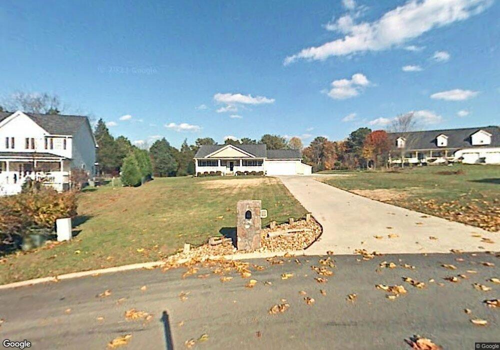
817 Brent Ln Dalton, GA 30720
Estimated Value: $315,000 - $449,000
3
Beds
2
Baths
2,013
Sq Ft
$181/Sq Ft
Est. Value
About This Home
This home is located at 817 Brent Ln, Dalton, GA 30720 and is currently estimated at $363,919, approximately $180 per square foot. 817 Brent Ln is a home located in Whitfield County with nearby schools including New Hope Elementary School, New Hope Middle School, and Northwest Whitfield County High School.
Ownership History
Date
Name
Owned For
Owner Type
Purchase Details
Closed on
Jul 25, 2025
Sold by
Stanley Trenton Robert
Bought by
Dover Jacob and Dover Amber
Current Estimated Value
Purchase Details
Closed on
Aug 2, 2005
Sold by
King David C
Bought by
Collins Frank and Collins Barbara A
Purchase Details
Closed on
Apr 30, 2003
Sold by
Chapman Norma Ann
Bought by
King David C and King Rhonda
Purchase Details
Closed on
Jan 22, 2000
Sold by
Chapman Robert L and Chapman Norma S
Bought by
Chapman Norma Ann
Purchase Details
Closed on
May 1, 1997
Bought by
Chapman Robert L and Chapman Norma S
Create a Home Valuation Report for This Property
The Home Valuation Report is an in-depth analysis detailing your home's value as well as a comparison with similar homes in the area
Home Values in the Area
Average Home Value in this Area
Purchase History
| Date | Buyer | Sale Price | Title Company |
|---|---|---|---|
| Dover Jacob | $300,000 | None Listed On Document | |
| Collins Frank | -- | -- | |
| King David C | $159,900 | -- | |
| Chapman Norma Ann | -- | -- | |
| Chapman Robert L | $19,500 | -- |
Source: Public Records
Tax History Compared to Growth
Tax History
| Year | Tax Paid | Tax Assessment Tax Assessment Total Assessment is a certain percentage of the fair market value that is determined by local assessors to be the total taxable value of land and additions on the property. | Land | Improvement |
|---|---|---|---|---|
| 2024 | $685 | $124,883 | $16,000 | $108,883 |
| 2023 | $740 | $88,924 | $10,600 | $78,324 |
| 2022 | $531 | $69,491 | $10,600 | $58,891 |
| 2021 | $532 | $69,491 | $10,600 | $58,891 |
| 2020 | $543 | $66,201 | $10,600 | $55,601 |
| 2019 | $566 | $66,201 | $10,600 | $55,601 |
| 2018 | $589 | $66,201 | $10,600 | $55,601 |
| 2017 | $638 | $69,949 | $10,600 | $59,349 |
| 2016 | $490 | $62,379 | $8,400 | $53,979 |
| 2014 | $342 | $62,379 | $8,400 | $53,979 |
| 2013 | -- | $62,378 | $8,400 | $53,978 |
Source: Public Records
Map
Nearby Homes
- 0 West R W Ridge Dr
- 466 Scarlet Dr
- 2256 Waring Rd NW
- 1626 Lagenia Ct
- 1015 S Ridge Dr
- 2215 Kerr Rd NW
- 1247 Reed Rd
- 609 Cherokee Trail NW
- 1425 Wiggs Dr
- 486 Haig Mill Rd
- 1080 Estate Dr
- 213 Grassdale Rd
- 287 Williams Rd NW
- 303 Cherokee Trail NW
- 0 Silhouette Way
- 000 Reed Rd
- 00 Waring Rd NW
- 110 Pinewood Way
- 813 Brent Ln
- 825 Brent Ln
- 810 Brent Ln
- 809 Brent Ln
- 814 Brent Ln
- 824 Henderson Dr NW
- 829 Brent Ln
- 820 Brent Ln
- 818 Henderson Dr NW
- 806 Brent Ln
- 816 Henderson Dr NW
- 805 Brent Ln
- 805 Brent Ln
- 837 Brent Ln
- 830 Brent Ln
- 178 Hardy Way
- 809 Henderson Dr NW
- 809 Henderson Dr NW
- 814 Henderson Dr NW
- 800 Brent Ln