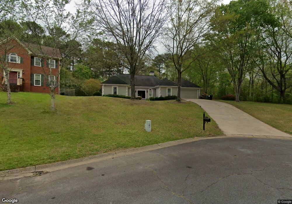
817 Commons Ct Woodstock, GA 30189
Oak Grove NeighborhoodEstimated Value: $409,000 - $418,486
3
Beds
3
Baths
2,172
Sq Ft
$190/Sq Ft
Est. Value
About This Home
This home is located at 817 Commons Ct, Woodstock, GA 30189 and is currently estimated at $413,743, approximately $190 per square foot. 817 Commons Ct is a home located in Cherokee County with nearby schools including Carmel Elementary School, Woodstock Middle School, and Woodstock High School.
Ownership History
Date
Name
Owned For
Owner Type
Purchase Details
Closed on
Sep 18, 2018
Sold by
Milton Richard D
Bought by
Milton Richard D and Milton Mary Frances
Current Estimated Value
Purchase Details
Closed on
Apr 23, 2016
Sold by
Milton Charles W
Bought by
Milton Richard D
Purchase Details
Closed on
Oct 15, 2012
Sold by
Milton Charles W
Bought by
Milton Charles W
Purchase Details
Closed on
Oct 8, 2012
Sold by
Milton Charles W
Bought by
Milton Charles W
Create a Home Valuation Report for This Property
The Home Valuation Report is an in-depth analysis detailing your home's value as well as a comparison with similar homes in the area
Home Values in the Area
Average Home Value in this Area
Purchase History
| Date | Buyer | Sale Price | Title Company |
|---|---|---|---|
| Milton Richard D | $191,900 | -- | |
| Milton Richard D | -- | -- | |
| Milton Charles W | -- | -- | |
| Milton Charles W | -- | -- |
Source: Public Records
Tax History Compared to Growth
Tax History
| Year | Tax Paid | Tax Assessment Tax Assessment Total Assessment is a certain percentage of the fair market value that is determined by local assessors to be the total taxable value of land and additions on the property. | Land | Improvement |
|---|---|---|---|---|
| 2024 | $802 | $138,972 | $32,000 | $106,972 |
| 2023 | $633 | $128,972 | $32,000 | $96,972 |
| 2022 | $732 | $106,292 | $24,000 | $82,292 |
| 2021 | $711 | $85,132 | $16,800 | $68,332 |
| 2020 | $708 | $83,732 | $16,800 | $66,932 |
| 2019 | $2,287 | $80,480 | $16,800 | $63,680 |
| 2018 | $530 | $76,760 | $16,800 | $59,960 |
| 2017 | $513 | $180,600 | $16,800 | $55,440 |
| 2016 | $513 | $162,000 | $14,400 | $50,400 |
| 2015 | $513 | $153,400 | $14,400 | $46,960 |
| 2014 | $500 | $145,500 | $14,000 | $44,200 |
Source: Public Records
Map
Nearby Homes
- 815 Commons Ct
- 813 Commons Ct
- 816 Commons Ct
- 814 Commons Ct Unit 2
- 2008 Berkshire Ct
- 812 Commons Ct
- 811 Commons Ct
- 1922 Nantucket Dr
- 2006 Berkshire Ct
- 1920 Nantucket Dr
- 1501 Lake Koinonia Dr
- 0 Commons Ct Unit 7375499
- 0 Commons Ct Unit 7036795
- 0 Commons Ct
- 810 Commons Ct
- 2010 Berkshire Ct Unit I
- 1918 Nantucket Dr
- 2004 Berkshire Ct Unit 1
- 1038 Boston Ridge
- 1034 Boston Ridge