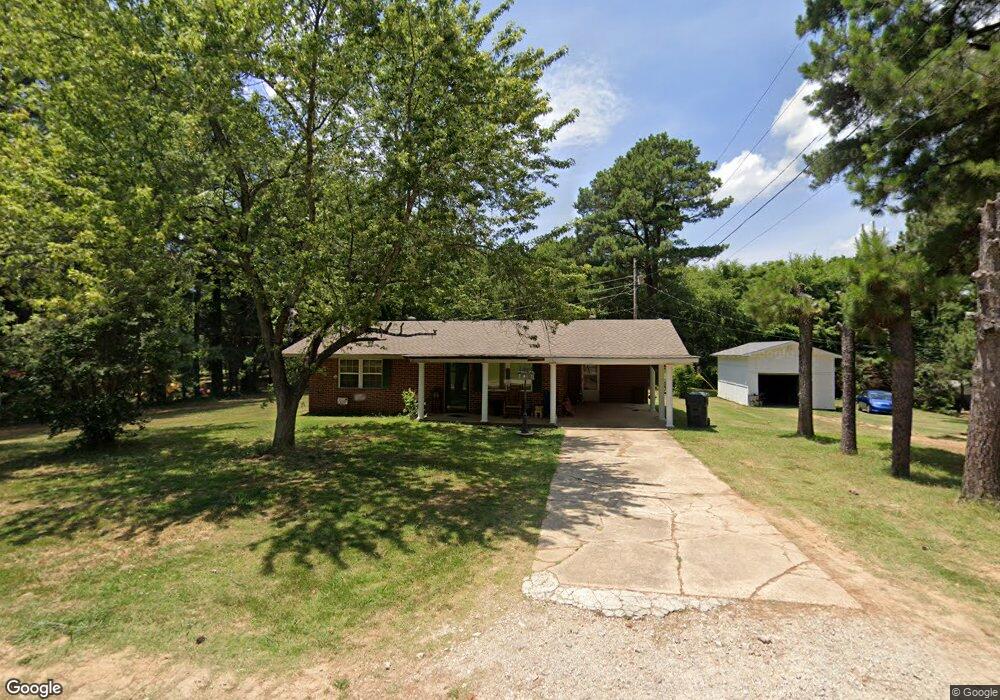
817 Kimberly Dr Jonesboro, AR 72401
Estimated Value: $94,356 - $169,000
--
Bed
1
Bath
959
Sq Ft
$149/Sq Ft
Est. Value
About This Home
This home is located at 817 Kimberly Dr, Jonesboro, AR 72401 and is currently estimated at $142,839, approximately $148 per square foot. 817 Kimberly Dr is a home located in Craighead County with nearby schools including Nettleton High School, Montessori School of Jonesboro, and Blessed Sacrament School.
Ownership History
Date
Name
Owned For
Owner Type
Purchase Details
Closed on
Nov 3, 2005
Sold by
French Vickie S
Bought by
Morgan Sandy M Wall
Current Estimated Value
Home Financials for this Owner
Home Financials are based on the most recent Mortgage that was taken out on this home.
Original Mortgage
$50,400
Outstanding Balance
$31,585
Interest Rate
8.5%
Mortgage Type
Adjustable Rate Mortgage/ARM
Estimated Equity
$111,254
Purchase Details
Closed on
Mar 8, 2002
Bought by
French
Purchase Details
Closed on
Oct 24, 1994
Bought by
Peeler
Create a Home Valuation Report for This Property
The Home Valuation Report is an in-depth analysis detailing your home's value as well as a comparison with similar homes in the area
Home Values in the Area
Average Home Value in this Area
Purchase History
| Date | Buyer | Sale Price | Title Company |
|---|---|---|---|
| Morgan Sandy M Wall | $63,000 | Professional Title Services | |
| French | $55,000 | -- | |
| Peeler | -- | -- |
Source: Public Records
Mortgage History
| Date | Status | Borrower | Loan Amount |
|---|---|---|---|
| Open | Morgan Sandy M Wall | $50,400 |
Source: Public Records
Tax History Compared to Growth
Tax History
| Year | Tax Paid | Tax Assessment Tax Assessment Total Assessment is a certain percentage of the fair market value that is determined by local assessors to be the total taxable value of land and additions on the property. | Land | Improvement |
|---|---|---|---|---|
| 2025 | $623 | $13,793 | $1,600 | $12,193 |
| 2024 | $623 | $13,793 | $1,600 | $12,193 |
| 2023 | $558 | $13,793 | $1,600 | $12,193 |
| 2022 | $512 | $13,793 | $1,600 | $12,193 |
| 2021 | $479 | $9,960 | $1,000 | $8,960 |
| 2020 | $479 | $9,960 | $1,000 | $8,960 |
| 2019 | $479 | $9,960 | $1,000 | $8,960 |
| 2018 | $479 | $9,960 | $1,000 | $8,960 |
| 2017 | $455 | $9,960 | $1,000 | $8,960 |
| 2016 | $413 | $8,600 | $1,000 | $7,600 |
| 2015 | $413 | $8,600 | $1,000 | $7,600 |
| 2014 | $413 | $8,600 | $1,000 | $7,600 |
Source: Public Records
Map
Nearby Homes
- 610 Airport Rd
- 4007 Sandra Ln
- 3502 Burdyshaw Dr
- 4064 Gabriel Ct
- 500 N Airport
- 4141 Bobcat Meadow Ln
- 4145 Bobcat Meadow Ln
- 4120 Lynx Ln
- 3708 Aggie Rd
- 4201 Lynx Ln
- 208 Lake Dr
- 1 E Johnson Ave
- 2412 E Johnson Ave
- 1008 Cypress Pointe Cove
- 3522 Bess Dr
- 4110 Tealwood Dr
- 0 Canera Unit 25018291
- 0 Canera Unit 25018279
- 20 Canera Dr
- 5 Chancery Ln
- 819 Kimberly Dr
- 3718 Hill Dr
- 3714 Hill Dr
- 820 Kimberly Dr
- 3814 Hill Dr
- 821 Kimberly Dr
- 3813 Pamela Dr
- 3813 Pamela Dr
- 3816 Hill Dr
- Lot 10 Kimberly Dr
- 10 Kimberly Dr
- 3901 Pamela Dr
- 3713 Hill Dr
- 3813 Hill Dr
- 3820 Hill Dr
- 3801 Sunset Dr
- 0 Pamela Dr
- 15 Kimberly Unit Lot 15 on Kimberly
- 15 Kimberly
- 3805 Sunset Dr