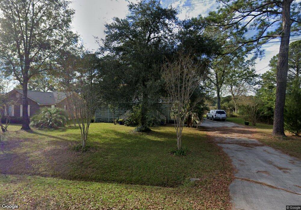
817 Longbranch Dr Charleston, SC 29414
West Ashley NeighborhoodEstimated Value: $494,000 - $635,000
3
Beds
3
Baths
2,400
Sq Ft
$237/Sq Ft
Est. Value
About This Home
This home is located at 817 Longbranch Dr, Charleston, SC 29414 and is currently estimated at $569,363, approximately $237 per square foot. 817 Longbranch Dr is a home located in Charleston County with nearby schools including Oakland Elementary School, West Ashley High School, and Carolina Voyager Charter.
Ownership History
Date
Name
Owned For
Owner Type
Purchase Details
Closed on
Feb 27, 2012
Sold by
Foxworth Edward W and Foxworth Caroline D
Bought by
Martin Gordon
Current Estimated Value
Home Financials for this Owner
Home Financials are based on the most recent Mortgage that was taken out on this home.
Original Mortgage
$207,000
Outstanding Balance
$142,330
Interest Rate
3.89%
Mortgage Type
New Conventional
Estimated Equity
$427,033
Purchase Details
Closed on
Aug 4, 2004
Sold by
Grantham Paul Hagan
Bought by
Foxworth Edward M and Foxworth Caroline D
Purchase Details
Closed on
Dec 31, 2003
Sold by
Kline Earl O and Kline Eleanor C
Bought by
Grantham Paul Hagen
Purchase Details
Closed on
Aug 19, 2000
Sold by
Koonce J Michael
Bought by
Durkee Kay Anita
Create a Home Valuation Report for This Property
The Home Valuation Report is an in-depth analysis detailing your home's value as well as a comparison with similar homes in the area
Home Values in the Area
Average Home Value in this Area
Purchase History
| Date | Buyer | Sale Price | Title Company |
|---|---|---|---|
| Martin Gordon | $230,000 | -- | |
| Foxworth Edward M | $235,000 | -- | |
| Grantham Paul Hagen | $40,000 | -- | |
| Durkee Kay Anita | -- | -- |
Source: Public Records
Mortgage History
| Date | Status | Borrower | Loan Amount |
|---|---|---|---|
| Open | Martin Gordon | $207,000 |
Source: Public Records
Tax History Compared to Growth
Tax History
| Year | Tax Paid | Tax Assessment Tax Assessment Total Assessment is a certain percentage of the fair market value that is determined by local assessors to be the total taxable value of land and additions on the property. | Land | Improvement |
|---|---|---|---|---|
| 2024 | $1,967 | $11,270 | $0 | $0 |
| 2023 | $1,967 | $11,270 | $0 | $0 |
| 2022 | $1,862 | $11,270 | $0 | $0 |
| 2021 | $1,924 | $11,270 | $0 | $0 |
| 2020 | $2,123 | $11,270 | $0 | $0 |
| 2019 | $1,845 | $10,090 | $0 | $0 |
| 2017 | $1,749 | $10,090 | $0 | $0 |
| 2016 | $1,682 | $10,090 | $0 | $0 |
| 2015 | $1,687 | $10,090 | $0 | $0 |
| 2014 | $1,538 | $0 | $0 | $0 |
| 2011 | -- | $0 | $0 | $0 |
Source: Public Records
Map
Nearby Homes
- 2538 Flamingo Dr
- 821 Longbranch Dr
- 743 Longbranch Dr Unit 9D
- 738 Olney Dr
- 738 Olney Rd
- 945 E Estates Blvd Unit D
- 2519 Longbranch Dr
- 747 Brant Rd
- 2557 Etiwan Ave
- 2494 Etiwan Ave Unit 10h
- 2494 Etiwan Ave Unit 5h
- 2494 Etiwan Ave Unit B9
- 2494 Etiwan Ave Unit 9-D
- 2619 Rutherford Way
- 899 Melrose Dr
- 2416 Kendall Dr
- 2404 Menola Ave
- 2553 Etiwan Ave
- 2555 Etiwan Ave
- 2515 Rutherford Way
- 0 Longbranch Dr Unit 2211248
- 0 Longbranch Dr Unit 2007696
- 0 Longbranch Dr Unit 1021477
- 0 Longbranch Dr Unit 18026534
- 815 Longbranch Dr
- 811 Longbranch Dr
- 827 Longbranch Dr
- 2538 Liverpool Dr
- 822 Longbranch Dr
- 807 Longbranch Dr
- 829 Longbranch Dr
- 2534 Liverpool Dr
- 2541 Liverpool Dr
- 828 Longbranch Dr
- 2535 Liverpool Dr
- 830 Longbranch Dr
- 771 Longbranch Dr
- 831 Longbranch Dr
- 823 Hemmingway Dr
- 819 Hemmingway Dr