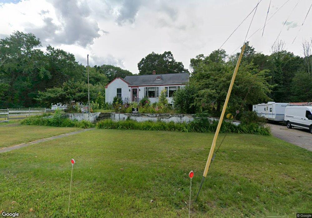
817 Old Post Rd North Attleboro, MA 02760
North Attleboro NeighborhoodEstimated Value: $523,000 - $641,000
3
Beds
2
Baths
1,794
Sq Ft
$333/Sq Ft
Est. Value
About This Home
This home is located at 817 Old Post Rd, North Attleboro, MA 02760 and is currently estimated at $597,519, approximately $333 per square foot. 817 Old Post Rd is a home located in Bristol County with nearby schools including North Attleboro High School and Dayspring Christian Academy.
Ownership History
Date
Name
Owned For
Owner Type
Purchase Details
Closed on
Nov 18, 2005
Sold by
Puccio Richard C and Puccio Barbara E
Bought by
Pothier Tim and Dulude Denise
Current Estimated Value
Home Financials for this Owner
Home Financials are based on the most recent Mortgage that was taken out on this home.
Original Mortgage
$295,200
Outstanding Balance
$162,042
Interest Rate
6.07%
Mortgage Type
Purchase Money Mortgage
Estimated Equity
$435,477
Create a Home Valuation Report for This Property
The Home Valuation Report is an in-depth analysis detailing your home's value as well as a comparison with similar homes in the area
Home Values in the Area
Average Home Value in this Area
Purchase History
| Date | Buyer | Sale Price | Title Company |
|---|---|---|---|
| Pothier Tim | $369,000 | -- |
Source: Public Records
Mortgage History
| Date | Status | Borrower | Loan Amount |
|---|---|---|---|
| Open | Pothier Tim | $295,200 |
Source: Public Records
Tax History Compared to Growth
Tax History
| Year | Tax Paid | Tax Assessment Tax Assessment Total Assessment is a certain percentage of the fair market value that is determined by local assessors to be the total taxable value of land and additions on the property. | Land | Improvement |
|---|---|---|---|---|
| 2025 | $5,397 | $457,800 | $152,000 | $305,800 |
| 2024 | $5,143 | $445,700 | $152,000 | $293,700 |
| 2023 | $5,172 | $404,400 | $152,000 | $252,400 |
| 2022 | $4,799 | $344,500 | $144,700 | $199,800 |
| 2021 | $4,969 | $348,200 | $152,000 | $196,200 |
| 2020 | $4,860 | $338,700 | $152,000 | $186,700 |
| 2019 | $4,543 | $319,000 | $132,300 | $186,700 |
| 2018 | $4,065 | $304,700 | $132,300 | $172,400 |
| 2017 | $3,711 | $280,700 | $125,700 | $155,000 |
| 2016 | $3,803 | $287,700 | $139,000 | $148,700 |
| 2015 | $3,606 | $274,400 | $146,400 | $128,000 |
| 2014 | $3,536 | $267,100 | $142,200 | $124,900 |
Source: Public Records
Map
Nearby Homes
- 338 Newport Ave
- 135 Cumberland Ave
- 23 Cumberland Ave
- 176 Read St
- 0 Middle St
- 31 Paine Rd
- 543 Newport Ave
- 15 Arline Dr
- 155 May St
- 181 Paine Rd
- 11 Howarth Ave
- 27 Killarney Way
- 59 Samuel Way
- 64 Highland Ave Unit A
- 64 Highland Ave Unit B
- 660 Thacher St Unit 1402
- 101 South Ave Unit 803
- 0 Mendon Rd
- 740 Allen Ave
- 1 Frederick a Nittel Dr
- 2 Newport Ave
- 23 Newport Ave
- 4 Newport Ave
- 10 Newport Ave
- 814 Old Post Rd Unit lot 35
- 796 Old Post Rd
- 791 Old Post Rd
- 25 Newport Ave
- 14 Newport Ave
- 788 Old Post Rd
- 785 Old Post Rd
- 32 Newport Ave
- 778 Old Post Rd
- 775 Old Post Rd
- 3 Newport Ave
- 773 Old Post Rd
- 31 Newport Ave
- 52R Newport Ave
- 52 Newport Ave
- 6 Allen Ave