Estimated Value: $511,635 - $567,000
4
Beds
2
Baths
2,838
Sq Ft
$187/Sq Ft
Est. Value
About This Home
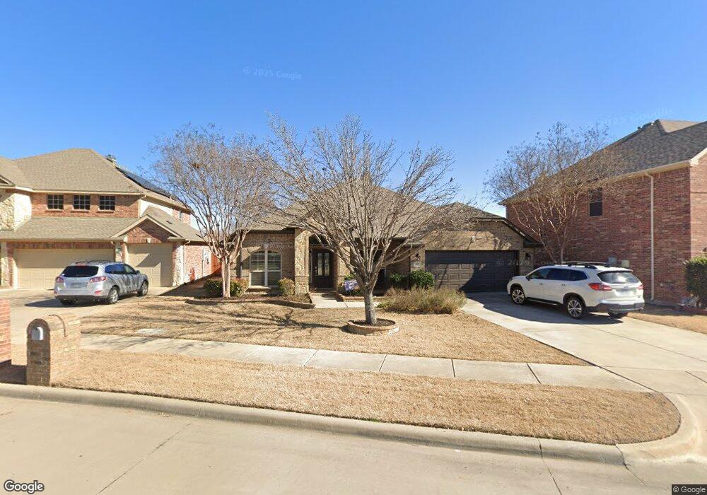
This home is located at 817 Preston Ln, Wylie, TX 75098 and is currently estimated at $530,409, approximately $186 per square foot. 817 Preston Ln is a home located in Collin County with nearby schools including R V Groves Elementary School, Dr. Al Draper Intermediate Middle School, and Raymond B Cooper J High School.
Ownership History
Date
Name
Owned For
Owner Type
Purchase Details
Closed on
Jul 13, 2019
Sold by
Qualls Michael A and Qualls Susan K
Bought by
Miller Adam J and Miller Sadie L
Current Estimated Value
Purchase Details
Closed on
Nov 30, 2009
Sold by
Ashton Dallas Residential Llc
Bought by
Qualls Michael A and Qualls Susan K
Home Financials for this Owner
Home Financials are based on the most recent Mortgage that was taken out on this home.
Original Mortgage
$181,460
Interest Rate
4.99%
Mortgage Type
New Conventional
Create a Home Valuation Report for This Property
The Home Valuation Report is an in-depth analysis detailing your home's value as well as a comparison with similar homes in the area
Home Values in the Area
Average Home Value in this Area
Purchase History
| Date | Buyer | Sale Price | Title Company |
|---|---|---|---|
| Miller Adam J | -- | None Available | |
| Qualls Michael A | -- | Stnt |
Source: Public Records
Mortgage History
| Date | Status | Borrower | Loan Amount |
|---|---|---|---|
| Previous Owner | Qualls Michael A | $181,460 |
Source: Public Records
Tax History Compared to Growth
Tax History
| Year | Tax Paid | Tax Assessment Tax Assessment Total Assessment is a certain percentage of the fair market value that is determined by local assessors to be the total taxable value of land and additions on the property. | Land | Improvement |
|---|---|---|---|---|
| 2025 | $8,202 | $524,830 | $146,250 | $378,580 |
| 2024 | $8,202 | $482,766 | $146,250 | $373,151 |
| 2023 | $8,202 | $438,878 | $128,700 | $408,977 |
| 2022 | $8,753 | $398,980 | $105,300 | $354,121 |
| 2021 | $8,567 | $364,092 | $81,900 | $282,192 |
| 2020 | $8,187 | $329,735 | $76,050 | $253,685 |
| 2019 | $8,838 | $336,306 | $84,500 | $251,806 |
| 2018 | $8,295 | $308,000 | $84,500 | $223,500 |
| 2017 | $8,341 | $315,650 | $78,000 | $237,650 |
| 2016 | $7,823 | $285,729 | $65,000 | $220,729 |
| 2015 | $6,335 | $255,965 | $58,500 | $197,465 |
Source: Public Records
Map
Nearby Homes
- 2912 Katie Cir
- 2907 Abby Ln
- 307 Wooded Creek Ave
- 2615 Gum Tree Trail
- 310 Admiral Dr
- 3014 Eastwood Dr
- 2606 Parkbridge Ct
- 3105 Admiral Dr
- Iris Plan at Wooded Creek
- Beckett II Plan at Wooded Creek
- Annabelle III Plan at Wooded Creek
- 3003 Candlebrook Dr
- 3119 Connor Ln
- 3111 Candlebrook Dr
- 3017 Eagle Mountain Dr
- 1205 Periwinkle Dr
- 206 Grassy Creek Dr
- 3103 Creekwood Dr
- 208 Lakefront Dr
- 3006 Springwell Pkwy
- 815 Preston Ln
- 819 Preston Ln
- 821 Preston Ln
- 2901 Preston Ln
- 2900 Katie Cir
- 823 Preston Ln
- 2903 Preston Ln
- 811 Preston Ln
- 2902 Katie Cir
- 2905 Preston Ln
- 2900 Preston Ln
- 2902 Preston Ln
- 809 Preston Ln
- 2904 Katie Cir
- 2901 Katie Cir
- 2904 Preston Ln
- 2907 Preston Ln
- 2903 Katie Cir
- 2906 Preston Ln
- 2906 Katie Cir