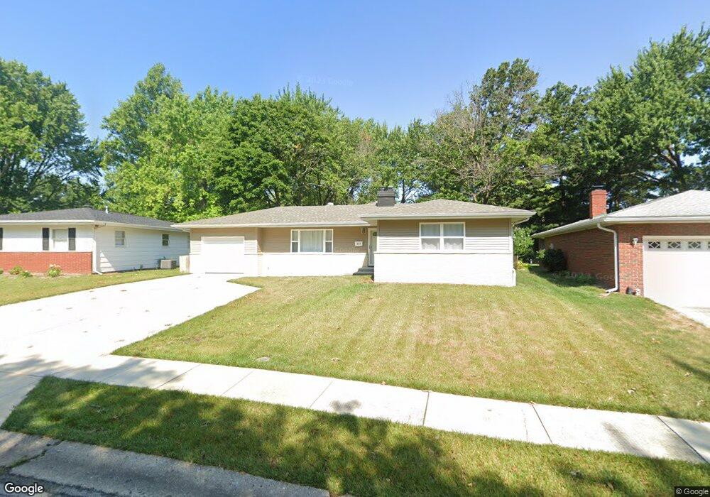
817 Roanoke Dr Springfield, IL 62702
Estimated Value: $201,094 - $236,000
4
Beds
2
Baths
1,800
Sq Ft
$120/Sq Ft
Est. Value
About This Home
This home is located at 817 Roanoke Dr, Springfield, IL 62702 and is currently estimated at $216,524, approximately $120 per square foot. 817 Roanoke Dr is a home located in Sangamon County with nearby schools including Dubois Elementary School, U.S. Grant Middle School, and Springfield High School.
Ownership History
Date
Name
Owned For
Owner Type
Purchase Details
Closed on
Aug 19, 2021
Sold by
Lee Vollintine Raymond
Bought by
Chng Pei Ni and Lee Lay Chin
Current Estimated Value
Home Financials for this Owner
Home Financials are based on the most recent Mortgage that was taken out on this home.
Original Mortgage
$128,000
Outstanding Balance
$115,635
Interest Rate
2.9%
Mortgage Type
New Conventional
Estimated Equity
$100,889
Purchase Details
Closed on
Jun 4, 2018
Sold by
Us Bank National Association
Bought by
Vollintine Raymond Lee
Home Financials for this Owner
Home Financials are based on the most recent Mortgage that was taken out on this home.
Original Mortgage
$69,700
Interest Rate
5%
Mortgage Type
New Conventional
Purchase Details
Closed on
Mar 23, 2018
Sold by
Sheriff Of Sangamon County
Bought by
Us Bank National Association
Purchase Details
Closed on
Oct 1, 2013
Purchase Details
Closed on
Dec 9, 2011
Purchase Details
Closed on
Dec 1, 2002
Create a Home Valuation Report for This Property
The Home Valuation Report is an in-depth analysis detailing your home's value as well as a comparison with similar homes in the area
Purchase History
| Date | Buyer | Sale Price | Title Company |
|---|---|---|---|
| Chng Pei Ni | $160,000 | Prairie Land Title | |
| Vollintine Raymond Lee | $80,999 | Ginali Associates Pc | |
| Us Bank National Association | -- | Codilis & Associates Pc | |
| -- | -- | -- | |
| -- | $94,500 | -- | |
| -- | -- | -- |
Source: Public Records
Mortgage History
| Date | Status | Borrower | Loan Amount |
|---|---|---|---|
| Open | Chng Pei Ni | $128,000 | |
| Previous Owner | Vollintine Raymond Lee | $69,700 |
Source: Public Records
Tax History
| Year | Tax Paid | Tax Assessment Tax Assessment Total Assessment is a certain percentage of the fair market value that is determined by local assessors to be the total taxable value of land and additions on the property. | Land | Improvement |
|---|---|---|---|---|
| 2024 | $3,832 | $51,617 | $8,661 | $42,956 |
| 2023 | $3,638 | $47,147 | $7,911 | $39,236 |
| 2022 | $2,767 | $36,876 | $7,504 | $29,372 |
| 2021 | $2,959 | $35,093 | $7,223 | $27,870 |
| 2020 | $3,096 | $35,146 | $7,234 | $27,912 |
| 2019 | $3,039 | $35,024 | $7,209 | $27,815 |
| 2018 | $2,901 | $34,331 | $7,174 | $27,157 |
| 2017 | $2,841 | $33,887 | $7,081 | $26,806 |
| 2016 | $2,785 | $33,393 | $6,978 | $26,415 |
| 2015 | $2,758 | $32,994 | $6,895 | $26,099 |
| 2014 | $2,596 | $32,780 | $6,850 | $25,930 |
| 2013 | $2,539 | $31,332 | $6,850 | $24,482 |
Source: Public Records
Map
Nearby Homes
- 812 Roanoke Dr
- 97 Mccarthy Dr
- 2510 & 2518 W Jefferson St
- 804 Fairfax Ct
- 160 S Durkin Dr Unit 4
- 6 Redwood Ln
- 107 Collier Dr
- 2011 W Jefferson St
- 36 Trailridge Ln Unit 152
- 1913 Jeanette Ln Unit 8
- 1038 N Koke Mill Rd
- 1914 Jeanette Ln Unit 6
- 2102 W Jefferson St
- 10 Royal Rd
- 27 Skyview Dr
- 3400 Briana Dr
- 3424 Bluff Rd
- 2651 W Lawrence Ave Unit 2
- 504 Brandywine Rd
- 3229 W Point Dr
- 813 Roanoke Dr
- 821 Roanoke Dr
- 825 Roanoke Dr
- 820 N Oxford Rd
- 809 Roanoke Dr
- 820 Roanoke Dr
- 824 Roanoke Dr
- 829 Roanoke Dr
- 824 N Oxford Rd
- 830 Roanoke Dr
- 805 Roanoke Dr
- 804 Roanoke Dr
- 828 N Oxford Rd
- 833 Roanoke Dr
- 834 Roanoke Dr
- 2609 Churchill Rd
- 832 N Oxford Rd
- 612 Sunny Brook Rd
- 829 N Oxford Rd
- 823 Randolph Ct
Your Personal Tour Guide
Ask me questions while you tour the home.