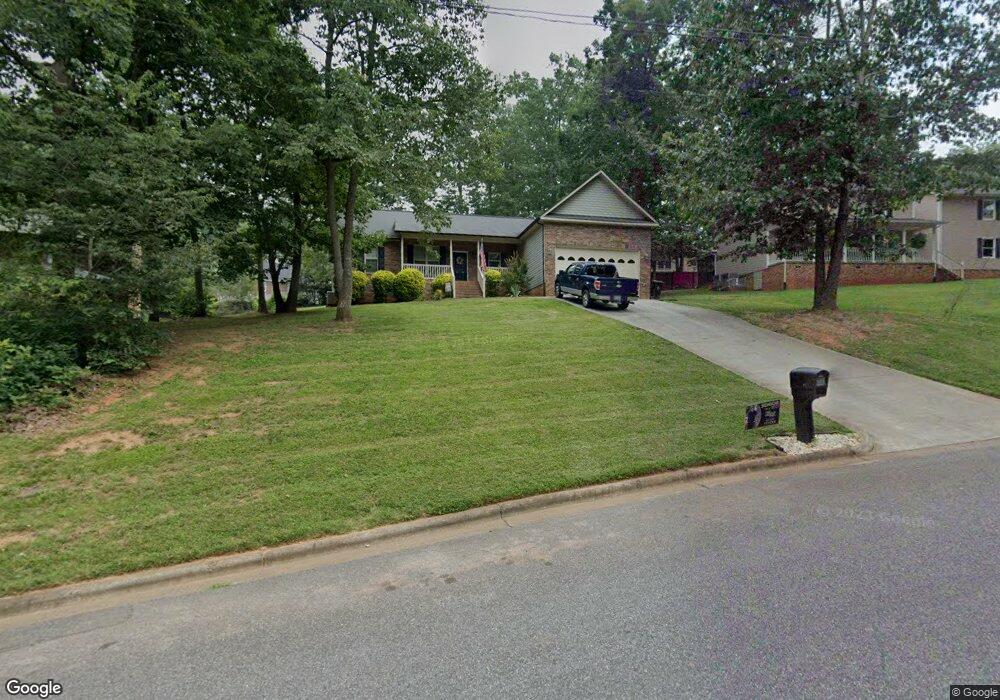
817 Southridge Dr Kings Mountain, NC 28086
Estimated Value: $323,000 - $359,000
3
Beds
2
Baths
1,680
Sq Ft
$199/Sq Ft
Est. Value
About This Home
This home is located at 817 Southridge Dr, Kings Mountain, NC 28086 and is currently estimated at $333,621, approximately $198 per square foot. 817 Southridge Dr is a home located in Cleveland County with nearby schools including West Elementary School, Kings Mountain Middle, and Kings Mountain Intermediate School.
Ownership History
Date
Name
Owned For
Owner Type
Purchase Details
Closed on
Jan 31, 2011
Sold by
K F Davis Homebuilders & Construction In
Bought by
Chumley Michael P
Current Estimated Value
Home Financials for this Owner
Home Financials are based on the most recent Mortgage that was taken out on this home.
Original Mortgage
$151,606
Outstanding Balance
$103,937
Interest Rate
4.82%
Mortgage Type
New Conventional
Estimated Equity
$229,684
Purchase Details
Closed on
May 1, 2009
Sold by
Davis Amy C and Davis Kenneth F
Bought by
K F Davis Homebuilders & Construction In
Home Financials for this Owner
Home Financials are based on the most recent Mortgage that was taken out on this home.
Original Mortgage
$132,000
Interest Rate
4.79%
Mortgage Type
Future Advance Clause Open End Mortgage
Create a Home Valuation Report for This Property
The Home Valuation Report is an in-depth analysis detailing your home's value as well as a comparison with similar homes in the area
Home Values in the Area
Average Home Value in this Area
Purchase History
| Date | Buyer | Sale Price | Title Company |
|---|---|---|---|
| Chumley Michael P | $146,000 | None Available | |
| K F Davis Homebuilders & Construction In | -- | None Available |
Source: Public Records
Mortgage History
| Date | Status | Borrower | Loan Amount |
|---|---|---|---|
| Open | Chumley Michael P | $151,606 | |
| Previous Owner | K F Davis Homebuilders & Construction In | $132,000 |
Source: Public Records
Tax History Compared to Growth
Tax History
| Year | Tax Paid | Tax Assessment Tax Assessment Total Assessment is a certain percentage of the fair market value that is determined by local assessors to be the total taxable value of land and additions on the property. | Land | Improvement |
|---|---|---|---|---|
| 2025 | $3,357 | $327,555 | $22,260 | $305,295 |
| 2024 | $2,504 | $212,371 | $18,364 | $194,007 |
| 2023 | $2,492 | $212,371 | $18,364 | $194,007 |
| 2022 | $2,386 | $212,371 | $18,364 | $194,007 |
| 2021 | $2,398 | $212,371 | $18,364 | $194,007 |
| 2020 | $2,044 | $175,794 | $18,030 | $157,764 |
| 2019 | $2,044 | $175,794 | $18,030 | $157,764 |
| 2018 | $2,042 | $175,794 | $18,030 | $157,764 |
| 2017 | $2,032 | $175,794 | $18,030 | $157,764 |
| 2016 | $2,040 | $175,794 | $18,030 | $157,764 |
| 2015 | $1,692 | $149,427 | $15,025 | $134,402 |
| 2014 | $1,692 | $149,427 | $15,025 | $134,402 |
Source: Public Records
Map
Nearby Homes
- 0 Southridge Dr Unit CAR4298120
- 804 Lee St
- 230 Paige Rd
- 245 Paige Rd
- 218 Paige Rd
- 227 Paige Rd
- 212 Paige Rd
- 149 Parker Claire Ln
- 123 Parker Claire Ln
- 219 Parker Claire Ln
- 143 Parker Claire Ln
- 137 Parker Claire Ln
- 157 Parker Claire Ln
- 104 Parker Claire Ln
- 207 Parker Claire Ln
- Belhaven Plan at Brinkley Ridge
- Freeport Plan at Brinkley Ridge
- Robie Plan at Brinkley Ridge
- Penwell Plan at Brinkley Ridge
- Aria Plan at Brinkley Ridge
- 819 Southridge Dr
- 815 Southridge Dr
- 800 Kingswood Ct
- 804 Kingswood Ct
- 820 Southridge Dr
- 321 Pinehurst Dr
- 323 Pinehurst Dr
- 317 Pinehurst Dr
- 809 Kingswood Ct
- 809 Kingswood Ct Unit 37 & 38
- 315 Amhurst Dr
- 805 Kingswood Ct
- 317 Amhurst Dr
- 403 Pinehurst Dr
- 0 Southridge Dr Unit 3124291
- 0 Southridge Dr Unit CAR4191254
- 313 Amhurst Dr
- 313 Amherst Dr
- 902 Lee St
- 405 Pinehurst Dr