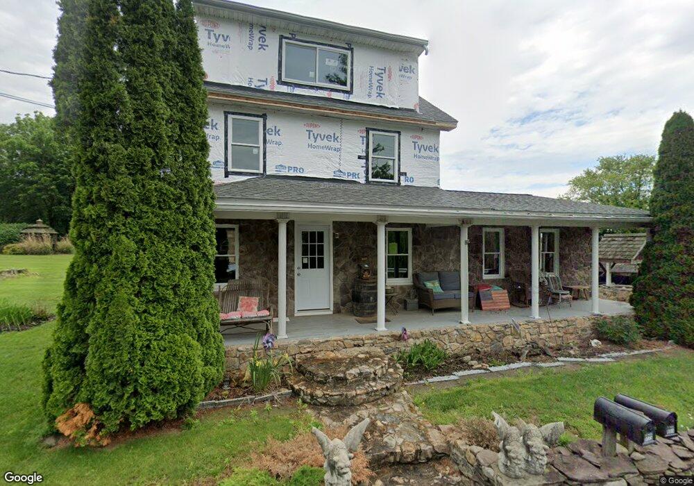
8175 Tomstown Rd Waynesboro, PA 17268
Estimated Value: $213,000 - $349,486
--
Bed
--
Bath
1,368
Sq Ft
$197/Sq Ft
Est. Value
About This Home
This home is located at 8175 Tomstown Rd, Waynesboro, PA 17268 and is currently estimated at $270,122, approximately $197 per square foot. 8175 Tomstown Rd is a home located in Franklin County with nearby schools including Waynesboro Area Senior High School.
Ownership History
Date
Name
Owned For
Owner Type
Purchase Details
Closed on
Feb 11, 2021
Sold by
Hickok Therese Lynn and Hickok Jeffrey Lee
Bought by
Hickok Theresa Lynn
Current Estimated Value
Purchase Details
Closed on
Aug 23, 2011
Sold by
Bower Lasorsa Christina Lynn
Bought by
Hickok Mitchell W
Home Financials for this Owner
Home Financials are based on the most recent Mortgage that was taken out on this home.
Original Mortgage
$180,000
Outstanding Balance
$121,268
Interest Rate
4%
Mortgage Type
New Conventional
Estimated Equity
$148,854
Create a Home Valuation Report for This Property
The Home Valuation Report is an in-depth analysis detailing your home's value as well as a comparison with similar homes in the area
Home Values in the Area
Average Home Value in this Area
Purchase History
| Date | Buyer | Sale Price | Title Company |
|---|---|---|---|
| Hickok Theresa Lynn | -- | None Available | |
| Hickok Mitchell W | $174,900 | None Available |
Source: Public Records
Mortgage History
| Date | Status | Borrower | Loan Amount |
|---|---|---|---|
| Open | Hickok Mitchell W | $180,000 |
Source: Public Records
Tax History Compared to Growth
Tax History
| Year | Tax Paid | Tax Assessment Tax Assessment Total Assessment is a certain percentage of the fair market value that is determined by local assessors to be the total taxable value of land and additions on the property. | Land | Improvement |
|---|---|---|---|---|
| 2025 | $2,288 | $15,680 | $1,750 | $13,930 |
| 2024 | $2,217 | $15,680 | $1,750 | $13,930 |
| 2023 | $2,156 | $15,680 | $1,750 | $13,930 |
| 2022 | $2,094 | $15,680 | $1,750 | $13,930 |
| 2021 | $2,031 | $15,680 | $1,750 | $13,930 |
| 2020 | $2,031 | $15,680 | $1,750 | $13,930 |
| 2019 | $1,913 | $15,120 | $1,750 | $13,370 |
| 2018 | $1,849 | $15,120 | $1,750 | $13,370 |
| 2017 | $1,807 | $15,120 | $1,750 | $13,370 |
| 2016 | $342 | $11,930 | $1,750 | $10,180 |
| 2015 | $319 | $11,930 | $1,750 | $10,180 |
| 2014 | $208 | $7,780 | $1,750 | $6,030 |
Source: Public Records
Map
Nearby Homes
- 7468 Anthony Hwy
- 8620 Monns Gap Rd
- 8652 Mormon Church Rd
- 5434 Manheim Rd
- 6159 Orphanage Rd
- 207 University Dr
- 286 Verdier St
- 111 Poplar St
- 6 S Main St
- 8655 Wayne Hwy
- 7130 St Annes Dr
- 7059 Duck Hook Ln
- 7060 Duck Hook Ln
- 7205 Fairway Dr S
- 7136 Sandwich Ln
- 6456 Wayne Hwy
- 7121 Sandwich Ln
- 6158 Merion Dr
- 6852 Lytham Ln
- 0 Unit PAFL2024598
- 8190 Tomstown Rd
- 8195 Tomstown Rd
- 8174 Tomstown Rd
- 8130 Tomstown Rd
- 8238 Tomstown Rd
- 7073 Back Ln
- 8131 Tomstown Rd
- 8113 Tomstown Rd
- 8241 Tomstown Rd
- 7102 Back Ln
- 8257 Tomstown Rd
- 8093 Tomstown Rd
- 8100 Tomstown Rd
- 8265 Tomstown Rd
- 8083 Tomstown Rd
- 8080 Tomstown Rd
- 8124 Tomstown Rd
- 7110 Back Ln
- 8275 Tomstown Rd
- 8120 Tomstown Rd