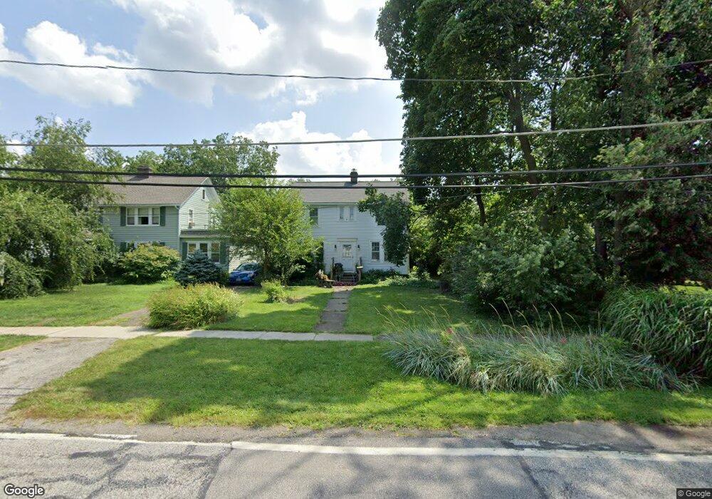
8177 Brookside Dr Olmsted Falls, OH 44138
Estimated Value: $231,809 - $328,000
3
Beds
2
Baths
1,535
Sq Ft
$176/Sq Ft
Est. Value
About This Home
This home is located at 8177 Brookside Dr, Olmsted Falls, OH 44138 and is currently estimated at $269,452, approximately $175 per square foot. 8177 Brookside Dr is a home located in Cuyahoga County with nearby schools including Falls-Lenox Primary Elementary School, Olmsted Falls Intermediate Building, and Olmsted Falls Middle School.
Ownership History
Date
Name
Owned For
Owner Type
Purchase Details
Closed on
Aug 4, 1987
Sold by
Gamertsfelder Richard E
Bought by
Herman Kathryn
Current Estimated Value
Purchase Details
Closed on
Mar 13, 1985
Sold by
Gamertsfelder Richard E
Bought by
Gamertsfelder Richard E
Purchase Details
Closed on
Jun 30, 1977
Sold by
Petlowany Wm G and Petlowany Carolyn K
Bought by
Gamertsfelder Richard E
Purchase Details
Closed on
Jan 1, 1975
Bought by
Petlowany Wm G and Petlowany Carolyn K
Create a Home Valuation Report for This Property
The Home Valuation Report is an in-depth analysis detailing your home's value as well as a comparison with similar homes in the area
Home Values in the Area
Average Home Value in this Area
Purchase History
| Date | Buyer | Sale Price | Title Company |
|---|---|---|---|
| Herman Kathryn | $78,000 | -- | |
| Gamertsfelder Richard E | -- | -- | |
| Gamertsfelder Richard E | $48,500 | -- | |
| Petlowany Wm G | -- | -- |
Source: Public Records
Tax History Compared to Growth
Tax History
| Year | Tax Paid | Tax Assessment Tax Assessment Total Assessment is a certain percentage of the fair market value that is determined by local assessors to be the total taxable value of land and additions on the property. | Land | Improvement |
|---|---|---|---|---|
| 2024 | $3,185 | $57,225 | $14,840 | $42,385 |
| 2023 | $2,788 | $42,980 | $13,860 | $29,120 |
| 2022 | $3,035 | $46,240 | $13,860 | $32,380 |
| 2021 | $3,190 | $46,240 | $13,860 | $32,380 |
| 2020 | $2,576 | $37,000 | $11,100 | $25,900 |
| 2019 | $2,286 | $105,700 | $31,700 | $74,000 |
| 2018 | $3,062 | $37,000 | $11,100 | $25,900 |
| 2017 | $3,150 | $34,030 | $10,960 | $23,070 |
| 2016 | $3,134 | $34,030 | $10,960 | $23,070 |
| 2015 | $2,990 | $34,030 | $10,960 | $23,070 |
| 2014 | $2,990 | $31,500 | $10,150 | $21,350 |
Source: Public Records
Map
Nearby Homes
- 0
- V/L Columbia Rd
- 8241 Lewis Rd
- 7593 Columbia Rd
- 281-12-024 River Rd
- 26535 Bayfair Dr
- 25725 Cook Rd
- 281-12-007 River Rd
- Anderson Plan at Smokestack Trails
- Bramante Ranch Plan at Smokestack Trails
- Hudson Plan at Smokestack Trails
- Columbia Plan at Smokestack Trails
- Lehigh Plan at Smokestack Trails
- 26685 Cranage Rd
- 27 Sycamore Dr
- 3 Dogwood Ln
- 29 Carl Ln
- 11 Concert Ct
- 5 Hawthorn Dr
- 260 Stone Ridge Way
- 8167 Brookside Dr
- 25746 Bagley Rd
- 8155 Brookside Dr
- 25774 Bagley Rd
- 25761 Mill St
- 25717 Mill St
- 25834 Bagley Rd
- 25695 Mill St
- 8170 Brookside Dr
- 8178 Brookside Dr
- 8154 Brookside Dr
- 25673 Mill St
- 8146 Brookside Dr
- 25731 Bagley Rd
- 25751 Bagley Rd
- 8138 Brookside Dr
- 25848 Bagley Rd
- 9225 Preserve Way
- 9256 Preserve Way
- 9275 Preserve Way