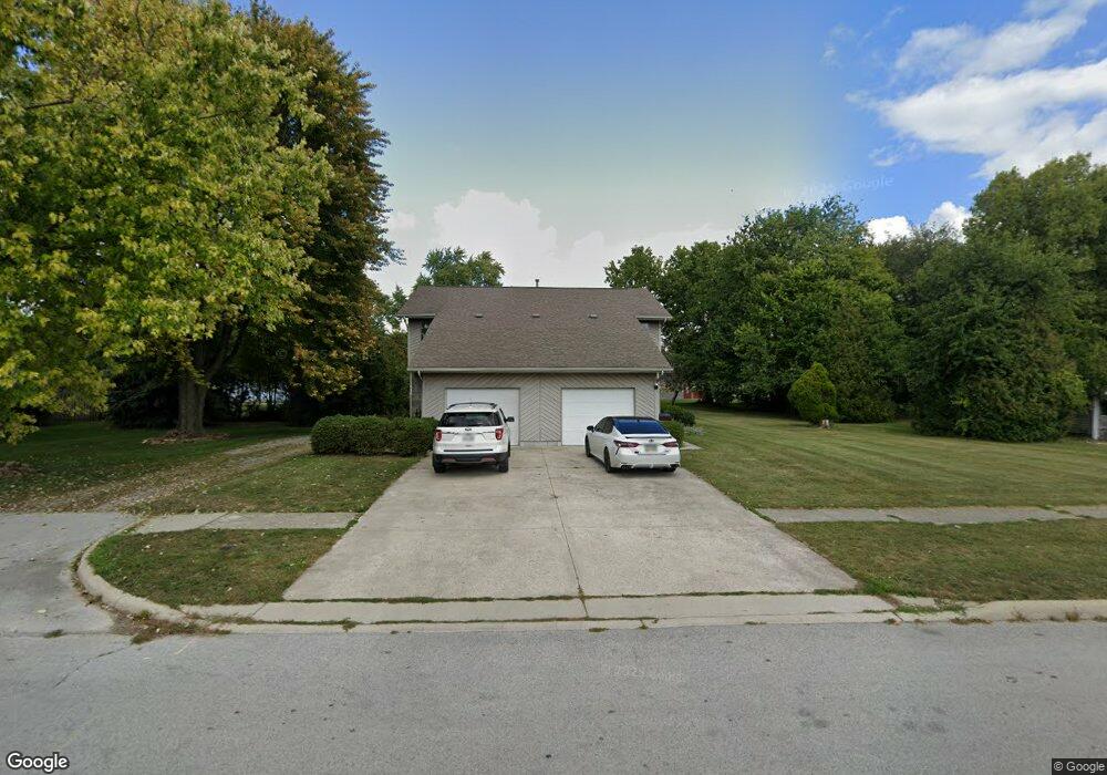
818 Bernard Ave Findlay, OH 45840
Estimated Value: $234,000 - $249,084
4
Beds
4
Baths
2,512
Sq Ft
$96/Sq Ft
Est. Value
About This Home
This home is located at 818 Bernard Ave, Findlay, OH 45840 and is currently estimated at $240,271, approximately $95 per square foot. 818 Bernard Ave is a home located in Hancock County with nearby schools including Whittier Primary School, Bigelow Hill Elementary School, and Glenwood Middle School.
Ownership History
Date
Name
Owned For
Owner Type
Purchase Details
Closed on
Nov 4, 2019
Sold by
Doudt Rolland and Doudt Veronia
Bought by
Tong Michael
Current Estimated Value
Home Financials for this Owner
Home Financials are based on the most recent Mortgage that was taken out on this home.
Original Mortgage
$135,000
Outstanding Balance
$118,883
Interest Rate
3.65%
Mortgage Type
New Conventional
Estimated Equity
$121,388
Purchase Details
Closed on
Sep 11, 1992
Bought by
Doudt Rolland D and Doudt Veronia
Create a Home Valuation Report for This Property
The Home Valuation Report is an in-depth analysis detailing your home's value as well as a comparison with similar homes in the area
Home Values in the Area
Average Home Value in this Area
Purchase History
| Date | Buyer | Sale Price | Title Company |
|---|---|---|---|
| Tong Michael | $180,000 | Assured Title Agency | |
| Doudt Rolland D | $33,000 | -- |
Source: Public Records
Mortgage History
| Date | Status | Borrower | Loan Amount |
|---|---|---|---|
| Open | Tong Michael | $135,000 |
Source: Public Records
Tax History Compared to Growth
Tax History
| Year | Tax Paid | Tax Assessment Tax Assessment Total Assessment is a certain percentage of the fair market value that is determined by local assessors to be the total taxable value of land and additions on the property. | Land | Improvement |
|---|---|---|---|---|
| 2024 | $2,393 | $65,660 | $5,020 | $60,640 |
| 2023 | $2,398 | $65,660 | $5,020 | $60,640 |
| 2022 | $2,389 | $65,660 | $5,020 | $60,640 |
| 2021 | $2,314 | $55,390 | $5,280 | $50,110 |
| 2020 | $2,313 | $55,390 | $5,280 | $50,110 |
| 2019 | $2,268 | $55,390 | $5,280 | $50,110 |
| 2018 | $2,026 | $45,400 | $4,590 | $40,810 |
| 2017 | $2,027 | $45,400 | $4,590 | $40,810 |
| 2016 | $2,002 | $45,400 | $4,590 | $40,810 |
| 2015 | $2,078 | $46,200 | $5,500 | $40,700 |
| 2014 | $2,078 | $46,200 | $5,500 | $40,700 |
| 2012 | $2,731 | $60,320 | $5,500 | $54,820 |
Source: Public Records
Map
Nearby Homes
- 1500 Crystal Ave
- 1062 Vincent St
- 716 Winfield Ave
- 0 Sheridan Ave
- 1725 Parkside Place
- 322 Midland Ave
- 1142 Concord Ct
- 1216 Concord Ct
- 600 Charles Ave
- 206 Midland Ave
- 1865 Breckenridge Rd
- 0 E Melrose Ave
- 1321 Bernard Ave
- 1125 Glen Meadow Dr
- 1928 Deer Ridge Dr
- 1928 Deer Ridge Dr Unit L-133
- 1001 Skye Dr
- 2100 Candlewick Dr
- 932 Skye Dr
- 1474 Southwood Ave
- 822 Bernard Ave
- 1013 Crystal Ave
- 1001 Crystal Ave
- 1003 Crystal Ave
- 1019 Crystal Ave
- 824 Bernard Ave
- 1025 Crystal Ave
- 826 Bernard Ave
- 929 Crystal Ave
- 817 Bernard Ave
- 821 Bernard Ave
- 823 Bernard Ave
- 828 Bernard Ave
- 825 Bernard Ave
- 925 Crystal Ave
- 1031 Crystal Ave
- 1016 Vincent St
- 803 Harmon St
- 827 Bernard Ave
- 805 Harmon St