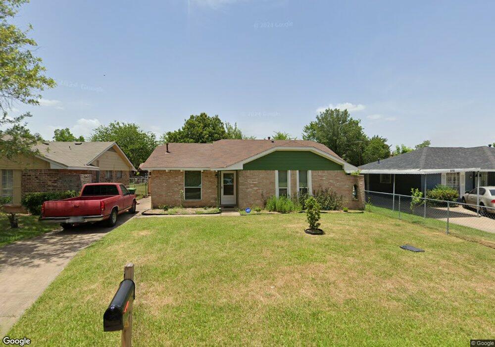
818 Marcolin St Houston, TX 77088
Acres Homes NeighborhoodEstimated Value: $159,411 - $192,000
4
Beds
2
Baths
1,062
Sq Ft
$171/Sq Ft
Est. Value
About This Home
This home is located at 818 Marcolin St, Houston, TX 77088 and is currently estimated at $181,853, approximately $171 per square foot. 818 Marcolin St is a home located in Harris County with nearby schools including Osborne Elementary School, Williams Middle, and Booker T Washington Sr High.
Ownership History
Date
Name
Owned For
Owner Type
Purchase Details
Closed on
Nov 30, 2010
Sold by
Gatlin Cheryl and Gatlin Aubrey J
Bought by
Gatlin Marilyn D
Current Estimated Value
Purchase Details
Closed on
Nov 24, 2010
Sold by
Gatlin Eitandria G
Bought by
Gatlin Marilyn D
Purchase Details
Closed on
Nov 22, 2010
Sold by
Mathews Chauntelle Gatlin
Bought by
Gatlin Marilyn D
Purchase Details
Closed on
Nov 9, 2010
Sold by
Gatlin Wesley P and Gatlin Richard E
Bought by
Gatlin Marilyn D
Create a Home Valuation Report for This Property
The Home Valuation Report is an in-depth analysis detailing your home's value as well as a comparison with similar homes in the area
Home Values in the Area
Average Home Value in this Area
Purchase History
| Date | Buyer | Sale Price | Title Company |
|---|---|---|---|
| Gatlin Marilyn D | -- | None Available | |
| Gatlin Marilyn D | -- | None Available | |
| Gatlin Marilyn D | -- | None Available | |
| Gatlin Marilyn D | -- | None Available |
Source: Public Records
Tax History Compared to Growth
Tax History
| Year | Tax Paid | Tax Assessment Tax Assessment Total Assessment is a certain percentage of the fair market value that is determined by local assessors to be the total taxable value of land and additions on the property. | Land | Improvement |
|---|---|---|---|---|
| 2025 | $2,499 | $182,314 | $59,125 | $123,189 |
| 2024 | $2,499 | $166,910 | $59,125 | $107,785 |
| 2023 | $2,499 | $135,359 | $59,125 | $76,234 |
| 2022 | $2,483 | $135,359 | $45,688 | $89,671 |
| 2021 | $2,709 | $116,238 | $26,875 | $89,363 |
| 2020 | $1,774 | $85,223 | $24,188 | $61,035 |
| 2019 | $1,685 | $79,874 | $24,188 | $55,686 |
| 2018 | $44 | $60,540 | $12,094 | $48,446 |
| 2017 | $1,411 | $60,540 | $12,094 | $48,446 |
| 2016 | $1,283 | $60,540 | $12,094 | $48,446 |
| 2015 | $42 | $57,373 | $12,094 | $45,279 |
| 2014 | $42 | $41,920 | $12,094 | $29,826 |
Source: Public Records
Map
Nearby Homes
- 0 Marjorie
- 769 Marjorie St
- 8602 De Priest St
- 854 Junell St
- 0 Marcolin St
- 8314 De Priest St
- 1314 Tarberry Rd
- 905 Ferguson Way
- 907 Ferguson Way
- 0 Grenshaw
- 8310 Williamsdell St
- 8324 Williamsdell St
- 8322 Williamsdell St
- 8320 Williamsdell St
- 958 Conklin St
- 765 Enterprise St Unit D
- 954 W Bertrand St
- 766 Fortune St
- 954A Junell St
- 934 South Ln
- 822 Marcolin St
- 814 Marcolin St
- 826 Marcolin St
- 810 Marcolin St
- 811 Grenshaw St
- 807 Grenshaw St
- 815 Grenshaw St
- 830 Marcolin St
- 823 Marcolin St
- 802 Marcolin St
- 819 Marcolin St
- 803 Grenshaw St
- 827 Marcolin St
- 819 Grenshaw St
- 815 Marcolin St
- 834 Marcolin St
- 831 Marcolin St
- 811 Marcolin St
- 823 Grenshaw St
- 835 Marcolin St