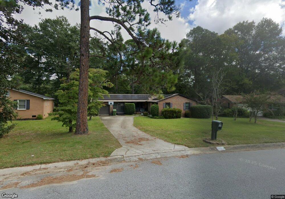
818 Rockwood Rd Columbia, SC 29209
The Hamptons NeighborhoodEstimated Value: $261,907 - $333,000
3
Beds
2
Baths
1,785
Sq Ft
$168/Sq Ft
Est. Value
About This Home
This home is located at 818 Rockwood Rd, Columbia, SC 29209 and is currently estimated at $299,227, approximately $167 per square foot. 818 Rockwood Rd is a home located in Richland County with nearby schools including Meadowfield Elementary School, Hand Middle School, and Dreher High School.
Ownership History
Date
Name
Owned For
Owner Type
Purchase Details
Closed on
Apr 24, 2021
Sold by
Hoy Terri Keller
Bought by
Hoy John Daniel
Current Estimated Value
Purchase Details
Closed on
Jun 29, 2006
Sold by
Hoy Judith D
Bought by
Hoy John D and Hoy Terri K
Home Financials for this Owner
Home Financials are based on the most recent Mortgage that was taken out on this home.
Original Mortgage
$146,000
Interest Rate
6.57%
Mortgage Type
Purchase Money Mortgage
Create a Home Valuation Report for This Property
The Home Valuation Report is an in-depth analysis detailing your home's value as well as a comparison with similar homes in the area
Home Values in the Area
Average Home Value in this Area
Purchase History
| Date | Buyer | Sale Price | Title Company |
|---|---|---|---|
| Hoy John Daniel | -- | None Available | |
| Hoy John D | $165,000 | None Available |
Source: Public Records
Mortgage History
| Date | Status | Borrower | Loan Amount |
|---|---|---|---|
| Previous Owner | Hoy John D | $146,000 |
Source: Public Records
Tax History Compared to Growth
Tax History
| Year | Tax Paid | Tax Assessment Tax Assessment Total Assessment is a certain percentage of the fair market value that is determined by local assessors to be the total taxable value of land and additions on the property. | Land | Improvement |
|---|---|---|---|---|
| 2024 | $1,577 | $189,000 | $0 | $0 |
| 2023 | $1,577 | $6,572 | $0 | $0 |
| 2022 | $1,431 | $164,300 | $23,000 | $141,300 |
| 2021 | $0 | $6,570 | $0 | $0 |
| 2020 | $1,461 | $6,570 | $0 | $0 |
| 2019 | $1,439 | $6,570 | $0 | $0 |
| 2018 | $1,324 | $5,980 | $0 | $0 |
| 2017 | $1,294 | $5,980 | $0 | $0 |
| 2016 | $1,289 | $5,980 | $0 | $0 |
| 2015 | $1,253 | $5,980 | $0 | $0 |
| 2014 | $1,214 | $149,500 | $0 | $0 |
| 2013 | -- | $5,980 | $0 | $0 |
Source: Public Records
Map
Nearby Homes
- 811 Rockwood Rd
- 755 Burnside Dr
- 509 Burnside Dr
- 206 Hampton Forest Dr
- 821 Walters Ln
- 404 Hampton Forest Dr
- 513 Knollwood Dr
- 1040 Coatesdale Rd
- 411 Hampton Forest Dr
- 444 Cami Forest Ln
- 1284 Rockwood Rd
- 6627 Christie Rd
- 6603 Christie Rd
- 497 Galway Ln
- 148 Cottage Lake Way
- 174 Preston Green Dr
- 813 Greenlawn Dr
- 225 E Lake Trail
- 911 Fairwood Dr
- 109 Rosebank Dr
- 900 Rockwood Rd
- 814 Rockwood Rd
- 736 Malibu Dr
- 810 Rockwood Rd
- 817 Rockwood Rd
- 908 Rockwood Rd
- 901 Rockwood Rd
- 763 Burnside Dr
- 905 Rockwood Rd
- 759 Burnside Dr
- 912 Rockwood Rd
- 805 Burnside Dr
- 801 Burnside Dr
- 812 Malibu Dr
- 809 Burnside Dr
- 731 Malibu Dr
- 737 Malibu Dr
- 12 Malibu Ct
- 741 Malibu Dr
- 819 Burnside Dr