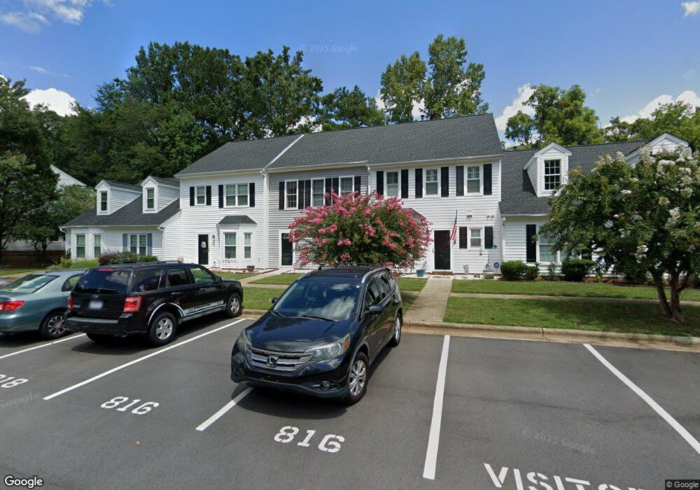
818 St Catherines Dr Wake Forest, NC 27587
Estimated Value: $260,000 - $286,000
2
Beds
3
Baths
1,474
Sq Ft
$184/Sq Ft
Est. Value
About This Home
This home is located at 818 St Catherines Dr, Wake Forest, NC 27587 and is currently estimated at $270,975, approximately $183 per square foot. 818 St Catherines Dr is a home located in Wake County with nearby schools including Richland Creek Elementary School, Wake Forest-Rolesville Middle School, and Wake Forest High School.
Ownership History
Date
Name
Owned For
Owner Type
Purchase Details
Closed on
Jun 15, 2015
Sold by
Hixon Kathleen A
Bought by
4610 Central Ave Llc
Current Estimated Value
Purchase Details
Closed on
Nov 29, 2010
Sold by
Hampton Leslie
Bought by
Hixon Kathleen A
Purchase Details
Closed on
Dec 19, 2007
Sold by
Lindstrom Kirt and Lindstrom Cindy
Bought by
Hampton Leslie
Home Financials for this Owner
Home Financials are based on the most recent Mortgage that was taken out on this home.
Original Mortgage
$130,350
Interest Rate
6.22%
Mortgage Type
Unknown
Purchase Details
Closed on
Sep 28, 2006
Sold by
Slivko William and Slivko Lorna
Bought by
Lindstrom Kirt and Lindstrom Cindy
Home Financials for this Owner
Home Financials are based on the most recent Mortgage that was taken out on this home.
Original Mortgage
$92,000
Interest Rate
6.48%
Mortgage Type
Unknown
Create a Home Valuation Report for This Property
The Home Valuation Report is an in-depth analysis detailing your home's value as well as a comparison with similar homes in the area
Home Values in the Area
Average Home Value in this Area
Purchase History
| Date | Buyer | Sale Price | Title Company |
|---|---|---|---|
| 4610 Central Ave Llc | $117,500 | Attorney | |
| Hixon Kathleen A | $100,000 | None Available | |
| Hampton Leslie | $130,500 | None Available | |
| Lindstrom Kirt | $115,000 | None Available |
Source: Public Records
Mortgage History
| Date | Status | Borrower | Loan Amount |
|---|---|---|---|
| Previous Owner | Hampton Leslie | $130,350 | |
| Previous Owner | Lindstrom Kirt | $92,000 |
Source: Public Records
Tax History Compared to Growth
Tax History
| Year | Tax Paid | Tax Assessment Tax Assessment Total Assessment is a certain percentage of the fair market value that is determined by local assessors to be the total taxable value of land and additions on the property. | Land | Improvement |
|---|---|---|---|---|
| 2025 | $2,666 | $277,700 | $40,000 | $237,700 |
| 2024 | $2,656 | $277,700 | $40,000 | $237,700 |
| 2023 | $2,002 | $170,543 | $26,000 | $144,543 |
| 2022 | $1,921 | $170,543 | $26,000 | $144,543 |
| 2021 | $1,887 | $170,543 | $26,000 | $144,543 |
| 2020 | $1,887 | $170,543 | $26,000 | $144,543 |
| 2019 | $1,507 | $119,847 | $16,000 | $103,847 |
| 2018 | $1,427 | $119,847 | $16,000 | $103,847 |
| 2017 | $1,380 | $119,847 | $16,000 | $103,847 |
| 2016 | $1,363 | $119,847 | $16,000 | $103,847 |
| 2015 | $1,384 | $120,235 | $24,000 | $96,235 |
| 2014 | -- | $120,235 | $24,000 | $96,235 |
Source: Public Records
Map
Nearby Homes
- 719 Saint Catherines Dr
- 713 Saint Catherines Dr
- 647 Guinness Place
- 930 Saint Catherines Dr
- 321 Glencoe Dr Unit B
- 333 Natsam Woods Way
- 335 Spaight Acres Way
- 361 Natsam Woods Way
- 404 Shannonford Ct
- 372 Natsam Woods Way
- 995 Saint Catherines Dr
- 738 Cormiche Ln
- 317 Devon Dr
- 317 Devon Cliffs Dr
- 321 Devon Cliffs Dr
- 601 Gimari Dr
- 777 Cormiche Ln
- 781 Cormiche Ln
- 521 Brushford Ln
- 411 W Oak Ave
- 818 Saint Catherines Dr
- 820 Saint Catherines Dr
- 820 St Catherines Dr
- 816 Saint Catherines Dr
- 822 Saint Catherines Dr
- 822 St Catherines Dr
- 814 St Catherines Dr
- 814 Saint Catherines Dr
- 828 Saint Catherines Dr
- 828 St Catherines Dr
- 830 Saint Catherines Dr
- 810 Saint Catherines Dr
- 808 St Catherines Dr
- 832 Saint Catherines Dr
- 808 Saint Catherines Dr
- 806 St Catherines Dr
- 834 Saint Catherines Dr
- 806 Saint Catherines Dr
- 834 St Catherines Dr
- 804 St Catherines Dr