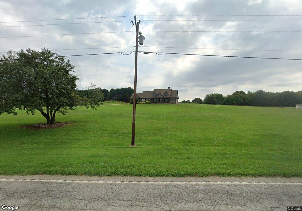
8189 Parris Bridge Rd Chesnee, SC 29323
Estimated Value: $410,000 - $509,797
3
Beds
3
Baths
2,468
Sq Ft
$193/Sq Ft
Est. Value
About This Home
This home is located at 8189 Parris Bridge Rd, Chesnee, SC 29323 and is currently estimated at $475,266, approximately $192 per square foot. 8189 Parris Bridge Rd is a home with nearby schools including Chesnee Elementary School, Chesnee Middle School, and Chesnee High School.
Ownership History
Date
Name
Owned For
Owner Type
Purchase Details
Closed on
Aug 25, 2015
Sold by
Harris Megan N and Hines Mark R
Bought by
Hines Mark R and Harris Megan N
Current Estimated Value
Home Financials for this Owner
Home Financials are based on the most recent Mortgage that was taken out on this home.
Original Mortgage
$246,000
Outstanding Balance
$194,328
Interest Rate
4.16%
Mortgage Type
New Conventional
Estimated Equity
$280,938
Purchase Details
Closed on
Oct 3, 2014
Sold by
Harris Thomas E
Bought by
Harris Megan Nicole
Purchase Details
Closed on
Jul 9, 2007
Sold by
Hines Lynn
Bought by
Hines Mark Ross
Create a Home Valuation Report for This Property
The Home Valuation Report is an in-depth analysis detailing your home's value as well as a comparison with similar homes in the area
Home Values in the Area
Average Home Value in this Area
Purchase History
| Date | Buyer | Sale Price | Title Company |
|---|---|---|---|
| Hines Mark R | -- | -- | |
| Harris Megan Nicole | -- | -- | |
| Hines Mark Ross | -- | Attorney |
Source: Public Records
Mortgage History
| Date | Status | Borrower | Loan Amount |
|---|---|---|---|
| Open | Hines Mark R | $246,000 |
Source: Public Records
Tax History Compared to Growth
Tax History
| Year | Tax Paid | Tax Assessment Tax Assessment Total Assessment is a certain percentage of the fair market value that is determined by local assessors to be the total taxable value of land and additions on the property. | Land | Improvement |
|---|---|---|---|---|
| 2025 | $1,975 | $12,696 | $1,284 | $11,412 |
| 2024 | $1,975 | $12,696 | $1,284 | $11,412 |
| 2023 | $1,975 | $12,696 | $1,284 | $11,412 |
| 2022 | $1,794 | $11,040 | $1,079 | $9,961 |
| 2021 | $1,794 | $11,040 | $1,079 | $9,961 |
| 2020 | $1,765 | $11,040 | $1,079 | $9,961 |
| 2019 | $1,765 | $11,040 | $1,079 | $9,961 |
| 2018 | $1,721 | $11,040 | $1,079 | $9,961 |
| 2017 | $5,087 | $14,400 | $1,662 | $12,738 |
| 2016 | $580 | $1,662 | $1,662 | $0 |
| 2015 | $580 | $1,206 | $1,206 | $0 |
| 2014 | $360 | $1,032 | $1,032 | $0 |
Source: Public Records
Map
Nearby Homes
- 202 Arrowood Branch Rd
- 291 Robbins Rd
- 0 Cantrell Dr
- 0 State Road S-42-1879
- 537 State Road S-42-1879
- 550 Harris Rd
- 545 State Road S-42-1879
- 553 State Road S-42-1879
- 557 State Road S-42-1879
- 561 State Road S-42-1879
- 565 State Road S-42-1879
- 569 State Road S-42-1879
- 107 Brooklyn Church Rd
- 140 Manor House Ln
- 1543 Highway 11 W
- 351 Smith Wall Rd
- 333 Mcswain Rd
- 268 Margate Cir
- 73 Pond View Ln Unit 66
- 73 Pond View Ln
- 8193 Parris Bridge Rd
- 108 Cooley Ridge Dr
- 114 Cooley Ridge Dr
- 244 Arrowood Branch Rd
- 8195 Parris Bridge Rd
- 240 Arrowood Branch Rd
- 111 Cooley Ridge Dr
- 107 Cooley Ridge Dr
- 0 Robbins Rd
- 236 Arrowood Branch Rd
- 8221 Parris Bridge Rd
- 232 Arrowood Branch Rd
- 8227 Parris Bridge Rd
- 8164 Parris Bridge Rd
- 228 Arrowood Branch Rd
- 126 Cooley Ridge Dr
- 123 Cooley Ridge Dr
- 333 Jeremiah Rd
- 451 Arrowood Branch Rd
- 8116 Parris Bridge Rd