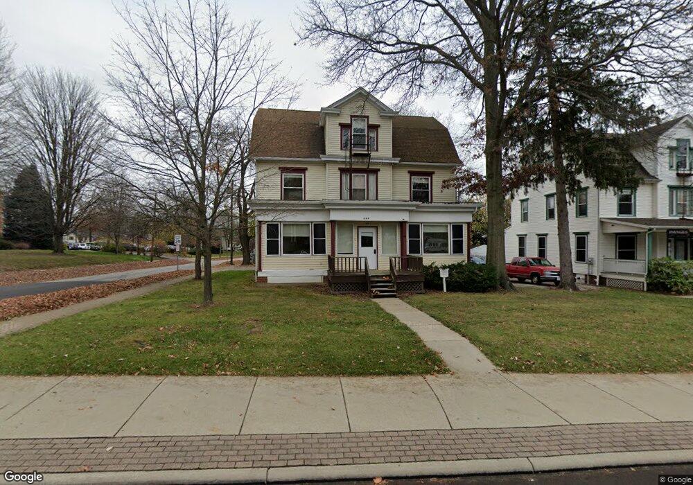
819 Beall Ave Wooster, OH 44691
Estimated Value: $745,668
6
Beds
3
Baths
3,253
Sq Ft
$229/Sq Ft
Est. Value
About This Home
This home is located at 819 Beall Ave, Wooster, OH 44691 and is currently estimated at $745,668, approximately $229 per square foot. 819 Beall Ave is a home located in Wayne County with nearby schools including Cornerstone Elementary School, Edgewood Middle School, and Wooster High School.
Ownership History
Date
Name
Owned For
Owner Type
Purchase Details
Closed on
Jul 10, 2001
Sold by
Swartz Mark E
Bought by
College Of Wooster
Current Estimated Value
Purchase Details
Closed on
Dec 29, 1995
Sold by
Mantsch Michael E
Bought by
Charles and Mann Lela M
Home Financials for this Owner
Home Financials are based on the most recent Mortgage that was taken out on this home.
Original Mortgage
$82,500
Interest Rate
7.42%
Mortgage Type
New Conventional
Purchase Details
Closed on
Nov 1, 1994
Sold by
Wheeler Municipal Corp
Bought by
Mantsch Michael E and Mantsch Elizabeth A
Home Financials for this Owner
Home Financials are based on the most recent Mortgage that was taken out on this home.
Original Mortgage
$78,000
Interest Rate
9.75%
Mortgage Type
New Conventional
Purchase Details
Closed on
Jun 20, 1991
Sold by
Smith Delbert R and Smith Helen M
Bought by
Wheeler Municipal Corpora
Create a Home Valuation Report for This Property
The Home Valuation Report is an in-depth analysis detailing your home's value as well as a comparison with similar homes in the area
Home Values in the Area
Average Home Value in this Area
Purchase History
| Date | Buyer | Sale Price | Title Company |
|---|---|---|---|
| College Of Wooster | $335,000 | -- | |
| Charles | $110,000 | -- | |
| Mantsch Michael E | $69,000 | -- | |
| Wheeler Municipal Corpora | $40,000 | -- |
Source: Public Records
Mortgage History
| Date | Status | Borrower | Loan Amount |
|---|---|---|---|
| Previous Owner | Charles | $82,500 | |
| Previous Owner | Mantsch Michael E | $78,000 |
Source: Public Records
Tax History Compared to Growth
Tax History
| Year | Tax Paid | Tax Assessment Tax Assessment Total Assessment is a certain percentage of the fair market value that is determined by local assessors to be the total taxable value of land and additions on the property. | Land | Improvement |
|---|---|---|---|---|
| 2024 | $3 | $47,910 | $10,050 | $37,860 |
| 2023 | $2 | $47,910 | $10,050 | $37,860 |
| 2022 | $6 | $47,910 | $10,050 | $37,860 |
| 2021 | $6 | $47,910 | $10,050 | $37,860 |
| 2020 | $6 | $47,910 | $10,050 | $37,860 |
| 2019 | $6 | $39,460 | $9,630 | $29,830 |
| 2018 | $6 | $39,460 | $9,630 | $29,830 |
| 2017 | $6 | $39,460 | $9,630 | $29,830 |
| 2016 | $6 | $39,460 | $9,630 | $29,830 |
| 2015 | $6 | $39,460 | $9,630 | $29,830 |
| 2014 | $6 | $39,460 | $9,630 | $29,830 |
| 2013 | $12 | $47,730 | $10,470 | $37,260 |
Source: Public Records
Map
Nearby Homes
- 548 Spring St
- 733 Spink St
- 804 Belmont Ave
- 336 Spring St
- 652 Gasche St
- 657 N Bever St
- 708 N Bever St
- 329 E Bowman St
- 554 Nold Ave
- 1117 Quinby Ave
- 900 Quinby Ave
- 1123 Quinby Ave
- 1029 E University St
- 534 N Buckeye St
- 638 High St
- 143 Park Ave
- 1132 E University St
- 423 N Market St
- 537 N Grant St
- 406 N Walnut St