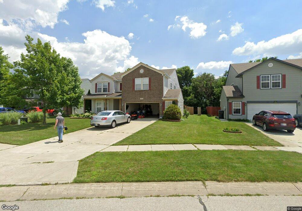
819 Bough St Whiteland, IN 46184
Estimated Value: $357,000 - $385,000
5
Beds
4
Baths
3,622
Sq Ft
$102/Sq Ft
Est. Value
About This Home
This home is located at 819 Bough St, Whiteland, IN 46184 and is currently estimated at $369,877, approximately $102 per square foot. 819 Bough St is a home located in Johnson County with nearby schools including Pleasant Crossing Elementary School, Clark-Pleasant Middle School, and Whiteland Community High School.
Ownership History
Date
Name
Owned For
Owner Type
Purchase Details
Closed on
Apr 12, 2011
Sold by
Deutsche Bank Trust Compnay Americas
Bought by
Slatter Ian and Slatter Alison
Current Estimated Value
Purchase Details
Closed on
Apr 11, 2011
Sold by
Colonial Savings F A
Bought by
Deutsche Bank Trust Company Americas
Purchase Details
Closed on
Nov 18, 2010
Sold by
Raggi Pardeep S
Bought by
Colonial Savings F A
Purchase Details
Closed on
Jul 7, 2006
Sold by
C P Morgan Communities L P
Bought by
Raggi Pardeep S
Home Financials for this Owner
Home Financials are based on the most recent Mortgage that was taken out on this home.
Original Mortgage
$152,300
Interest Rate
6.73%
Create a Home Valuation Report for This Property
The Home Valuation Report is an in-depth analysis detailing your home's value as well as a comparison with similar homes in the area
Home Values in the Area
Average Home Value in this Area
Purchase History
| Date | Buyer | Sale Price | Title Company |
|---|---|---|---|
| Slatter Ian | -- | Investors Titlecorp | |
| Deutsche Bank Trust Company Americas | -- | Investors Titlecorp | |
| Colonial Savings F A | $135,000 | None Available | |
| Raggi Pardeep S | -- | None Available |
Source: Public Records
Mortgage History
| Date | Status | Borrower | Loan Amount |
|---|---|---|---|
| Previous Owner | Raggi Pardeep S | $152,300 |
Source: Public Records
Tax History Compared to Growth
Tax History
| Year | Tax Paid | Tax Assessment Tax Assessment Total Assessment is a certain percentage of the fair market value that is determined by local assessors to be the total taxable value of land and additions on the property. | Land | Improvement |
|---|---|---|---|---|
| 2025 | $3,569 | $345,100 | $56,000 | $289,100 |
| 2024 | $3,569 | $340,700 | $56,000 | $284,700 |
| 2023 | $1,973 | $190,000 | $56,000 | $134,000 |
| 2022 | $1,973 | $190,000 | $29,900 | $160,100 |
| 2021 | $1,981 | $190,000 | $29,900 | $160,100 |
| 2020 | $1,994 | $190,000 | $29,900 | $160,100 |
| 2019 | $1,962 | $197,900 | $29,900 | $168,000 |
| 2018 | $1,609 | $153,900 | $21,300 | $132,600 |
| 2017 | $1,549 | $153,900 | $21,300 | $132,600 |
| 2016 | $1,539 | $153,900 | $21,300 | $132,600 |
| 2014 | $1,539 | $153,900 | $26,100 | $127,800 |
| 2013 | $1,539 | $153,900 | $26,100 | $127,800 |
Source: Public Records
Map
Nearby Homes
- 3196 Underwood Dr
- 2916 Lodgepole Dr
- 577 Stobus Dr
- 731 W 600 N
- 2545 Wildflower Ln
- 698 Pine Lake Dr
- 2489 Wildflower Ln
- 2400 Grand Fir Dr
- 767 Mountain Pine Dr
- 2357 Grand Fir Dr
- 700 Mountain Pine Dr
- 2418 Ashton Ln
- 2284 Blossom Dr
- 2277 Maple Stone Ln
- 648 Bluestem Cir
- 647 Bluestem Cir
- 1137 Chateaugay Ct
- 1119 Chateaugay Ct
- 389 Springfield Cir
- Liberty Plan at Crossroads at Southport