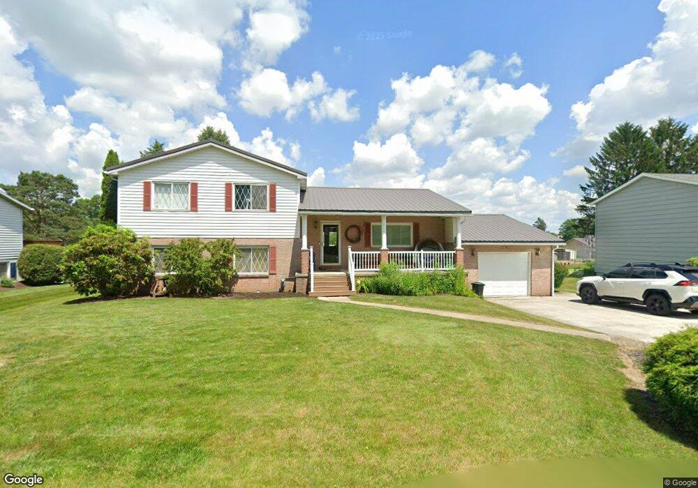
819 Lansberry Ct Somerset, PA 15501
Estimated Value: $224,117 - $244,000
3
Beds
2
Baths
2,064
Sq Ft
$115/Sq Ft
Est. Value
About This Home
This home is located at 819 Lansberry Ct, Somerset, PA 15501 and is currently estimated at $236,529, approximately $114 per square foot. 819 Lansberry Ct is a home located in Somerset County with nearby schools including Maple Ridge Elementary School, Eagle View Elementary School, and Somerset Area Junior/Senior High School.
Ownership History
Date
Name
Owned For
Owner Type
Purchase Details
Closed on
Oct 19, 2006
Sold by
Griffith Donald E and Griffith Debra K
Bought by
Truscott Jeffrey L and Hautz Barbara R
Current Estimated Value
Home Financials for this Owner
Home Financials are based on the most recent Mortgage that was taken out on this home.
Original Mortgage
$132,000
Outstanding Balance
$78,811
Interest Rate
6.47%
Mortgage Type
New Conventional
Estimated Equity
$157,718
Purchase Details
Closed on
Sep 26, 2006
Sold by
Hochard Thelma L
Bought by
Griffith Donald E and Griffith Debra K
Home Financials for this Owner
Home Financials are based on the most recent Mortgage that was taken out on this home.
Original Mortgage
$132,000
Outstanding Balance
$78,811
Interest Rate
6.47%
Mortgage Type
New Conventional
Estimated Equity
$157,718
Purchase Details
Closed on
Feb 24, 2006
Sold by
Lyzbicki Edward A and Lyzbicki Angie L
Bought by
Griffith Donald E and Griffith Debra K
Create a Home Valuation Report for This Property
The Home Valuation Report is an in-depth analysis detailing your home's value as well as a comparison with similar homes in the area
Home Values in the Area
Average Home Value in this Area
Purchase History
| Date | Buyer | Sale Price | Title Company |
|---|---|---|---|
| Truscott Jeffrey L | $165,000 | None Available | |
| Griffith Donald E | -- | None Available | |
| Griffith Donald E | $140,000 | None Available |
Source: Public Records
Mortgage History
| Date | Status | Borrower | Loan Amount |
|---|---|---|---|
| Open | Truscott Jeffrey L | $132,000 |
Source: Public Records
Tax History Compared to Growth
Tax History
| Year | Tax Paid | Tax Assessment Tax Assessment Total Assessment is a certain percentage of the fair market value that is determined by local assessors to be the total taxable value of land and additions on the property. | Land | Improvement |
|---|---|---|---|---|
| 2025 | $3,959 | $49,760 | $0 | $0 |
| 2024 | $3,959 | $49,760 | $0 | $0 |
| 2023 | $3,872 | $49,760 | $0 | $0 |
| 2022 | $3,682 | $49,760 | $0 | $0 |
| 2021 | $3,606 | $49,760 | $0 | $0 |
| 2020 | $3,556 | $49,760 | $0 | $0 |
| 2019 | $3,556 | $49,760 | $0 | $0 |
| 2018 | $3,505 | $49,760 | $8,760 | $41,000 |
| 2017 | $3,481 | $49,760 | $8,760 | $41,000 |
| 2016 | -- | $49,760 | $8,760 | $41,000 |
| 2015 | -- | $49,750 | $8,755 | $40,995 |
| 2014 | -- | $49,750 | $8,755 | $40,995 |
Source: Public Records
Map
Nearby Homes
- 840 Lansberry Ct
- 0 Overlook Dr Unit 2 96025858
- Lot 2 Overlook Dr
- 742 S Edgewood Ave (Rear)
- 878 Tayman Ave
- 549 W Race St
- 870 Deer Path Ln
- 1275 Greenhill Ln
- 678 W Main St
- 506 Tayman Ave
- 203 Colby Ave
- 344 W Garrett St
- 336 W Sanner St
- 0 Patton St
- 1402 Brierwood Dr
- 1303 Brierwood Dr
- 908 S Park Ave
- 324 W Patriot St
- 827 Lansberry Ct
- 809 Lansberry Ct
- 837 Lansberry Ct
- 820 Lansberry Ct
- 808 Lansberry Ct
- 847 Lansberry Ct
- 921 Lindberg Way
- 850 Lansberry Ct
- 865 Lansberry Ct
- 842 Harrington Ln
- 860 Lansberry Ct
- 850 Harrington Ln
- 839 Delaware Ave
- 852 Harrington Ln
- 873 Lansberry Ct
- 620 Dott Ave
- 856 Harrington Ln
- 858 Harrington Ln
- 870 Lansberry Ct
- 879 Lansberry Ct