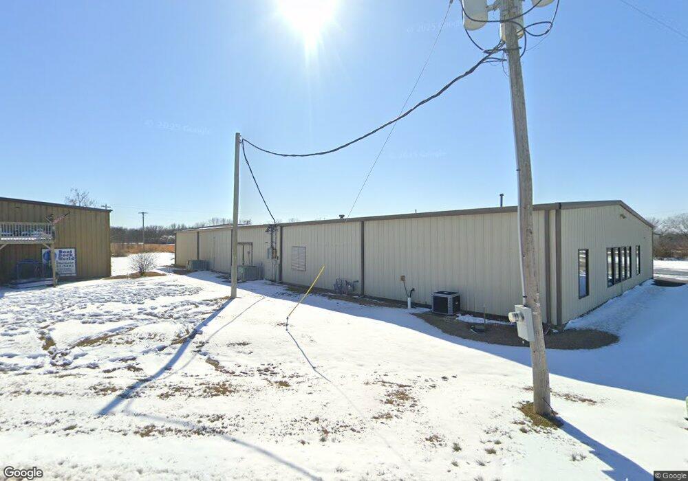
819 Lester Ln Rogers, AR 72756
Estimated Value: $540,119
Studio
--
Bath
7,500
Sq Ft
$72/Sq Ft
Est. Value
About This Home
This home is located at 819 Lester Ln, Rogers, AR 72756 and is currently estimated at $540,119, approximately $72 per square foot. 819 Lester Ln is a home located in Benton County with nearby schools including Northside Elementary School, Lingle Middle School, and Rogers Heritage High School.
Ownership History
Date
Name
Owned For
Owner Type
Purchase Details
Closed on
Jun 28, 2019
Sold by
Shaw Michael and Shaw Pam
Bought by
Big Green Properties Llc
Current Estimated Value
Home Financials for this Owner
Home Financials are based on the most recent Mortgage that was taken out on this home.
Original Mortgage
$280,000
Outstanding Balance
$245,689
Interest Rate
4%
Mortgage Type
Future Advance Clause Open End Mortgage
Estimated Equity
$294,430
Purchase Details
Closed on
May 10, 2012
Sold by
Latham Steven Ross
Bought by
Shaw Michael and Shaw Pam
Purchase Details
Closed on
Nov 11, 2010
Bought by
Latham Rev Trust
Purchase Details
Closed on
Apr 20, 1992
Bought by
Fulton Sanitation Services
Purchase Details
Closed on
Aug 29, 1991
Bought by
Sutter Supply Inc
Purchase Details
Closed on
Sep 20, 1988
Bought by
Taylor
Create a Home Valuation Report for This Property
The Home Valuation Report is an in-depth analysis detailing your home's value as well as a comparison with similar homes in the area
Home Values in the Area
Average Home Value in this Area
Purchase History
| Date | Buyer | Sale Price | Title Company |
|---|---|---|---|
| Big Green Properties Llc | $280,000 | City Title & Closing | |
| Shaw Michael | $136,000 | None Available | |
| Latham Rev Trust | -- | -- | |
| Fulton Sanitation Services | $18,000 | -- | |
| Sutter Supply Inc | $16,000 | -- | |
| Taylor | $7,000 | -- |
Source: Public Records
Mortgage History
| Date | Status | Borrower | Loan Amount |
|---|---|---|---|
| Open | Big Green Properties Llc | $280,000 |
Source: Public Records
Tax History
| Year | Tax Paid | Tax Assessment Tax Assessment Total Assessment is a certain percentage of the fair market value that is determined by local assessors to be the total taxable value of land and additions on the property. | Land | Improvement |
|---|---|---|---|---|
| 2025 | $3,678 | $86,017 | $11,408 | $74,609 |
| 2024 | $3,225 | $86,017 | $11,408 | $74,609 |
| 2023 | $2,932 | $55,590 | $8,100 | $47,490 |
| 2022 | $2,939 | $55,590 | $8,100 | $47,490 |
| 2021 | $2,692 | $55,590 | $8,100 | $47,490 |
| 2020 | $2,453 | $42,460 | $8,100 | $34,360 |
| 2019 | $2,453 | $42,460 | $8,100 | $34,360 |
| 2018 | $2,453 | $42,460 | $8,100 | $34,360 |
| 2017 | $2,305 | $42,460 | $8,100 | $34,360 |
| 2016 | $2,305 | $42,460 | $8,100 | $34,360 |
| 2015 | $2,114 | $39,820 | $8,100 | $31,720 |
| 2014 | $2,164 | $39,820 | $8,100 | $31,720 |
Source: Public Records
Map
Nearby Homes
- 329 Rader Rd
- 949 Red Cedar Place
- 0 Rader Rd Unit 1290308
- 989 Red Cedar Place
- 11010 Meadowlark Rd
- 12620 Lindy Ln
- 11010 Meadow Lark Rd
- 150 N Highway 62
- 11680 Amy Ave
- 353 E Rose St
- 10635 Prairie Creek Rd N
- 12437 Wildwood Dr
- 12424 Wildwood Dr
- 13113 Scenic Dr
- 12412 Wildwood Dr
- 5116 Joe Ln
- 4006 NE Hudson Rd
- 84 N Briarwood Rd
- 13585 Andy Jack Rd
- 12885 Scenic Dr
- 839 Lester Ln
- 839 Lester Ln
- 705 Lester Ln
- 707 Lester Ln
- 817 Lester Ln
- 849 Lester Ln Unit 1
- 810 Lester Ln Unit 1
- 810 Lester Ln
- 839 Lester Ln
- 816 Lester Ln
- 11789 S Highway 62
- 849 Old Wire Rd
- 0 Hwy 62 Unit 350083
- 0 Hwy 62 Unit 338432
- 0 Hwy 62 Unit 277753
- 0 Hwy 62 Unit 351416
- 0 Hwy 62 Unit 1292936
- 0 Hwy 62 Unit 452852
- 0 Hwy 62 Unit 452856
- 0 Hwy 62 Unit 458084
Your Personal Tour Guide
Ask me questions while you tour the home.