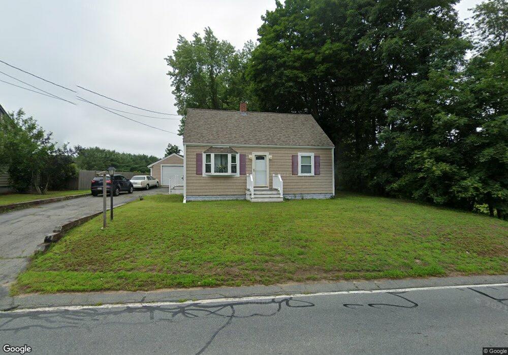
819 Main St Acushnet, MA 02743
Upper Acushnet NeighborhoodEstimated Value: $471,114 - $587,000
3
Beds
1
Bath
1,599
Sq Ft
$335/Sq Ft
Est. Value
About This Home
This home is located at 819 Main St, Acushnet, MA 02743 and is currently estimated at $535,779, approximately $335 per square foot. 819 Main St is a home located in Bristol County with nearby schools including Acushnet Elementary School, Albert F Ford Middle School, and Alma Del Mar Charter School.
Create a Home Valuation Report for This Property
The Home Valuation Report is an in-depth analysis detailing your home's value as well as a comparison with similar homes in the area
Home Values in the Area
Average Home Value in this Area
Tax History
| Year | Tax Paid | Tax Assessment Tax Assessment Total Assessment is a certain percentage of the fair market value that is determined by local assessors to be the total taxable value of land and additions on the property. | Land | Improvement |
|---|---|---|---|---|
| 2025 | $4,051 | $375,400 | $119,100 | $256,300 |
| 2024 | $3,876 | $339,700 | $112,900 | $226,800 |
| 2023 | $3,902 | $325,200 | $102,400 | $222,800 |
| 2022 | $3,851 | $290,200 | $96,100 | $194,100 |
| 2021 | $2,973 | $258,800 | $96,100 | $162,700 |
| 2020 | $3,521 | $252,600 | $89,900 | $162,700 |
| 2019 | $3,344 | $235,800 | $85,700 | $150,100 |
| 2018 | $3,216 | $221,800 | $85,700 | $136,100 |
| 2017 | $3,087 | $213,800 | $85,700 | $128,100 |
| 2016 | $3,111 | $214,100 | $85,700 | $128,400 |
| 2015 | $2,853 | $199,800 | $85,700 | $114,100 |
Source: Public Records
Map
Nearby Homes
- 0 Land Way Unit 73479153
- 489 Main St
- 363 Main St
- 0 Keene Rd Unit 73459818
- 329 Middle Rd
- 25 Pershing Ave
- 23 Oliveira Ave
- 134 Nyes Ln
- 191 Hathaway Rd
- 7 Hamlin St
- 199 Quaker Ln
- 168 Keene Rd
- 0 Hathaway Rd Unit 73469544
- 12 White St
- 1015 Forbes St
- 23 Coury Dr
- 40 Foley Dr
- SS Charbonneau Ln
- ES Acushnet Ave
- 11 Boylston St
Your Personal Tour Guide
Ask me questions while you tour the home.