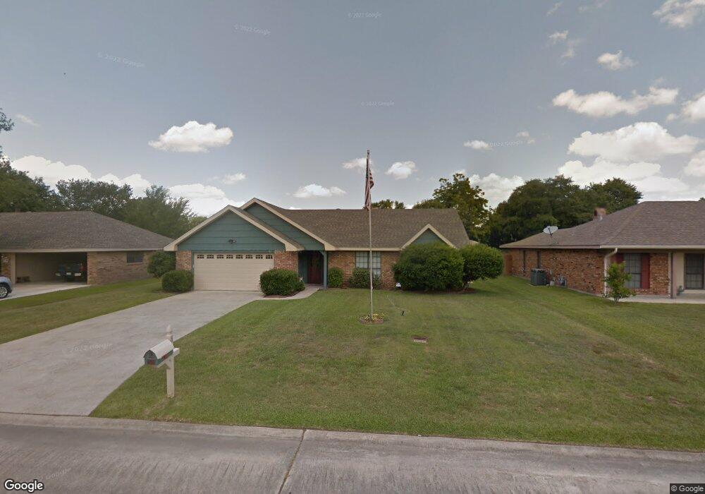
819 Rampart St Lake Charles, LA 70607
Estimated Value: $193,000 - $233,000
3
Beds
2
Baths
1,762
Sq Ft
$119/Sq Ft
Est. Value
About This Home
This home is located at 819 Rampart St, Lake Charles, LA 70607 and is currently estimated at $210,336, approximately $119 per square foot. 819 Rampart St is a home located in Calcasieu Parish with nearby schools including Dolby Elementary School, F.K. White Middle School, and LaGrange High School.
Ownership History
Date
Name
Owned For
Owner Type
Purchase Details
Closed on
Nov 6, 2014
Sold by
Legros James Ray and Legros Barbar Sue
Bought by
Lampson Thomas Anthony
Current Estimated Value
Home Financials for this Owner
Home Financials are based on the most recent Mortgage that was taken out on this home.
Original Mortgage
$65,000
Outstanding Balance
$49,552
Interest Rate
3.87%
Mortgage Type
Unknown
Estimated Equity
$160,784
Create a Home Valuation Report for This Property
The Home Valuation Report is an in-depth analysis detailing your home's value as well as a comparison with similar homes in the area
Home Values in the Area
Average Home Value in this Area
Purchase History
| Date | Buyer | Sale Price | Title Company |
|---|---|---|---|
| Lampson Thomas Anthony | $175,000 | None Available |
Source: Public Records
Mortgage History
| Date | Status | Borrower | Loan Amount |
|---|---|---|---|
| Open | Lampson Thomas Anthony | $65,000 |
Source: Public Records
Tax History Compared to Growth
Tax History
| Year | Tax Paid | Tax Assessment Tax Assessment Total Assessment is a certain percentage of the fair market value that is determined by local assessors to be the total taxable value of land and additions on the property. | Land | Improvement |
|---|---|---|---|---|
| 2024 | $986 | $16,510 | $2,700 | $13,810 |
| 2023 | $986 | $16,510 | $2,700 | $13,810 |
| 2022 | $1,020 | $16,510 | $2,700 | $13,810 |
| 2021 | $792 | $16,510 | $2,700 | $13,810 |
| 2020 | $1,542 | $15,020 | $2,590 | $12,430 |
| 2019 | $1,709 | $16,310 | $2,500 | $13,810 |
| 2018 | $1,048 | $16,310 | $2,500 | $13,810 |
| 2017 | $1,723 | $16,310 | $2,500 | $13,810 |
| 2016 | $1,031 | $16,310 | $2,500 | $13,810 |
| 2015 | $1,031 | $16,680 | $3,840 | $12,840 |
Source: Public Records
Map
Nearby Homes
- 829 Rampart St
- 730 Rampart St
- 856 Desoto St
- 832 Desoto St
- 714 Rampart St
- 4823 Gentilly St
- 805 Royal St
- 720 Royal St
- 0 Petro Point Dr
- 645 Esplanade St
- 0 Link Rd Unit SWL24005611
- 4701 Desoto St
- 878 Link Rd
- 620 Bienville St Unit 2
- 0 Tallow Rd Unit SWL24005610
- 1750 Park Place Dr
- 0 Common St Unit SWL25101034
- 0 Common St Unit SWL23007421
- 0 Common St Unit SWL24003400
- 208 Dolby St
- 817 Rampart St
- 821 Rampart St
- 813 Rampart St
- 814 Esplanade St
- 820 Esplanade St
- 825 Rampart St
- 820 Rampart St
- 816 Rampart St
- 824 Rampart St
- 809 Rampart St
- 812 Rampart St
- 1000 Esplanade St
- 808 Esplanade St
- 830 Rampart St
- 808 Rampart St
- 805 Rampart St
- 823 Esplanade St
- 819 Esplanade St
- 804 Esplanade St
- 834 Rampart St