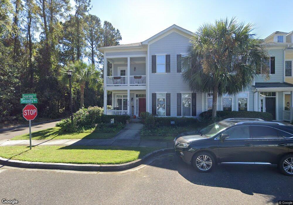
819 Soaring Ln Charleston, SC 29412
James Island NeighborhoodEstimated Value: $562,000 - $726,000
3
Beds
3
Baths
2,300
Sq Ft
$283/Sq Ft
Est. Value
About This Home
This home is located at 819 Soaring Ln, Charleston, SC 29412 and is currently estimated at $650,062, approximately $282 per square foot. 819 Soaring Ln is a home located in Charleston County with nearby schools including Stiles Point Elementary School, Camp Road Middle, and James Island Charter High School.
Ownership History
Date
Name
Owned For
Owner Type
Purchase Details
Closed on
May 17, 2013
Sold by
Gilbert Richard and Gilbert Shirley
Bought by
Volousky Edward J and Volousky Deborah H
Current Estimated Value
Home Financials for this Owner
Home Financials are based on the most recent Mortgage that was taken out on this home.
Original Mortgage
$35,000
Outstanding Balance
$7,320
Interest Rate
2.75%
Mortgage Type
Construction
Estimated Equity
$642,742
Purchase Details
Closed on
Aug 11, 2006
Sold by
James Island Associates
Bought by
Gilbert Richard and Gilbert Shirley
Create a Home Valuation Report for This Property
The Home Valuation Report is an in-depth analysis detailing your home's value as well as a comparison with similar homes in the area
Home Values in the Area
Average Home Value in this Area
Purchase History
| Date | Buyer | Sale Price | Title Company |
|---|---|---|---|
| Volousky Edward J | $297,000 | -- | |
| Gilbert Richard | $345,641 | None Available |
Source: Public Records
Mortgage History
| Date | Status | Borrower | Loan Amount |
|---|---|---|---|
| Open | Volousky Edward J | $35,000 | |
| Closed | Volousky Edward J | $50,000 |
Source: Public Records
Tax History
| Year | Tax Paid | Tax Assessment Tax Assessment Total Assessment is a certain percentage of the fair market value that is determined by local assessors to be the total taxable value of land and additions on the property. | Land | Improvement |
|---|---|---|---|---|
| 2024 | $1,853 | $11,660 | $0 | $0 |
| 2023 | $1,589 | $11,660 | $0 | $0 |
| 2022 | $1,465 | $11,660 | $0 | $0 |
| 2021 | $1,535 | $11,660 | $0 | $0 |
| 2020 | $1,590 | $11,660 | $0 | $0 |
| 2019 | $1,385 | $9,880 | $0 | $0 |
| 2017 | $1,338 | $11,880 | $0 | $0 |
| 2016 | $1,284 | $11,880 | $0 | $0 |
| 2015 | $1,326 | $11,880 | $0 | $0 |
| 2014 | $1,054 | $0 | $0 | $0 |
| 2011 | -- | $0 | $0 | $0 |
Source: Public Records
Map
Nearby Homes
- 1250 Wide Water Ct
- 1313 Salt Marsh Cove
- 1144 Tidal View Ln
- 1055 Grand Concourse St
- 808 Waxwood Ln
- 1032 Greenhill Rd Unit A
- 957 Regatta Rd
- 939 Mikell Dr
- 1138 Oxbow Dr
- 1138 Cottage Rd
- 1050 Ben Rd
- 902 Mikell Dr
- 1120 Seaside Ln
- 1174 Fort Johnson Rd
- 1076 Williams Rd
- 3006 Allison Cove Dr
- 1139 Greenhill Rd
- 1344 Teal Ave
- 1333 Teal Ave
- 1129 Camp Rd
- 817 Soaring Ln
- 815 Soaring Ln
- 813 Soaring Ln
- 811 Soaring Ln
- 914 Vista Perch Ln
- 1014 Freedom Peak Ln
- 912 Vista Perch Ln
- 809 Soaring Ln
- 910 Vista Perch Ln
- 807 Soaring Ln
- 1155 Brigantine Dr
- 1010 Freedom Peak Ln
- 908 Vista Perch Ln
- 805 Soaring Ln
- 906 Vista Perch Ln
- 803 Soaring Ln
- 1149 Brigantine Dr
- 817 Brigantine Dr
- 904 Vista Perch Ln
- 1102 Hidden Fields Way